Enable Location

We need your location to show you interesting places around you

Discover nearby places

Find interesting locations and hidden gems around you

Precise directions

Get accurate directions and distances to places

Your location is never shared with other users. It's only used when you tap the location button.

Madison County

Log in to your account

Start exploring — it's free

Trusted by 61,535 travelers worldwide

Continue with Google
Continue with Apple
or

We will send you a code to connect

By continuing, you accept our Terms and Conditions and our Privacy Policy

Check your inbox

We've sent a pincode in your inbox. Please enter the code below.

Madison County, Administrative county in central New York, US

Description

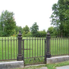
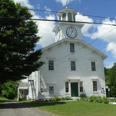
Madison County is an administrative division in central New York spanning roughly 661 square miles with mixed agricultural lands, forests, and water bodies. The territory includes multiple towns and villages, with Wampsville serving as the county seat that handles administrative functions.

History

The county was founded in 1806 and named after James Madison, the fourth President of the United States. Its establishment came during a period when the region took on its current administrative structure.

Culture

The Oneida people have deep roots in this region, where their ancestors lived near Oneida Lake for generations. You can feel this connection today in local communities and through cultural places throughout the county.

Practical

Wampsville houses the main administrative services and county offices you may need to visit. The area spreads across multiple towns and villages, so having a car makes it easier to explore different parts of the county.

Did you know?

The National Abolition Hall of Fame and the International Boxing Hall of Fame have both chosen to establish their permanent homes here. These two distinctive museums draw visitors interested in very different chapters of history and achievement.

Location
Inception
1806
Capital city
Wampsville
Elevation above the sea
147 m
Shares border with
Oneida County, Chenango County, Cortland County, Otsego County, Oswego County, Onondaga County
GPS coordinates
42.91000,-75.67000
Latest update
December 19, 2025 22:24

AroundUs brings together thousands of curated places, local tips, and hidden gems, enriched daily by 60,000 contributors worldwide. Discover all places nearby (New York).

Around this place
International Boxing Hall of Fame
United States of America

International Boxing Hall of Fame

20.9 km
Green Lakes State Park
United States of America

Green Lakes State Park

29.1 km
Utica Psychiatric Center
United States of America

Utica Psychiatric Center

40.3 km
Chittenango Falls State Park
United States of America

Chittenango Falls State Park

16.6 km
Oneida Community Mansion House
United States of America

Oneida Community Mansion House

17.6 km
Munson
United States of America

Munson

40.6 km
Old Erie Canal State Historic Park
United States of America

Old Erie Canal State Historic Park

27.6 km
Chenango Canal
United States of America

Chenango Canal

10 km
Verona Beach State Park
United States of America

Verona Beach State Park

30.3 km
Oriskany Battlefield State Historic Site
United States of America

Oriskany Battlefield State Historic Site

38.5 km
United States of America

Utica Zoo

39.5 km
Farnam Mansion
United States of America

Farnam Mansion

20.3 km
Lorenzo State Historic Site
United States of America

Lorenzo State Historic Site

16 km
Clinton Arena
United States of America

Clinton Arena

28.6 km
United States of America

Andy Kerr Stadium

14.5 km
Round Lake National Natural Landmark
United States of America

Round Lake National Natural Landmark

29.1 km
Gerrit Smith Estate
United States of America

Gerrit Smith Estate

6.6 km
Elihu Root House
United States of America

Elihu Root House

26.6 km
United States of America

Helen L. McNitt State Park

18.1 km
Stone Quarry Hill Art Park
United States of America

Stone Quarry Hill Art Park

13.4 km
United States of America

DeRuyter Reservoir

20.9 km
United States of America

Highland Forest

21.9 km
United States of America

Ruth and Elmer Wellin Museum of Art

26.8 km
Fountain Elms
United States of America

Fountain Elms

40.6 km
United States of America

Old Trees

16.8 km
Smithfield Presbyterian Church
United States of America

Smithfield Presbyterian Church

6.4 km
Manlius Village Historic District
United States of America

Manlius Village Historic District

26.9 km
Earlville Opera House
United States of America

Earlville Opera House

21.6 km
Show the full map
« Madison County - Administrative county in central New York, US » is provided by Around Us (aroundus.com). Images and texts are derived from Wikimedia project under a Creative Commons license. You are allowed to copy, distribute, and modify copies of this page, under the conditions set by the license, as long as this note is clearly visible.

Discover hidden gems everywhere you go!

From secret cafés to breathtaking viewpoints, skip the crowded tourist spots and find places that match your style. Our app makes it easy with voice search, smart filtering, route optimization, and insider tips from travelers worldwide. Download now for the complete mobile experience.

Around Us App Screenshot

A unique approach to discovering new places

Le Figaro

All the places worth exploring

France Info

A tailor-made excursion in just a few clicks

20 Minutes

Around Us
Travel Guide & Maps
Download

Send to your phone

QR Code
1

Open the camera app on your mobile.

2

Point at the QR code with your camera. A notification will appear.

3

Tap the notification to open the link.