Enable Location

We need your location to show you interesting places around you

Discover nearby places

Find interesting locations and hidden gems around you

Precise directions

Get accurate directions and distances to places

Your location is never shared with other users. It's only used when you tap the location button.

Log in to your account

Start exploring — it's free

Trusted by 62,529 travelers worldwide

Continue with Google
Continue with Apple
or

We will send you a code to connect

By continuing, you accept our Terms and Conditions and our Privacy Policy

Check your inbox

We've sent a pincode in your inbox. Please enter the code below.

DeRuyter Reservoir

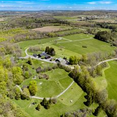
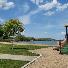
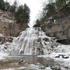
DeRuyter Reservoir, reservoir in New York (state)

DeRuyter Reservoir is a large lake covering more than 550 acres with a maximum depth of about 55 feet (17 meters) and a shoreline extending over 6 miles (10 kilometers). Dense plant growth lines much of the shore, especially in shallower areas up to about 12 feet (3.6 meters) deep, creating habitat for numerous fish species.

The reservoir was built to supply water to the historic Erie Canal, a major waterway that played a crucial role in regional trade and transportation. This water source became essential infrastructure that shaped the area's development during the canal era.

The reservoir takes its name from the nearby town of DeRuyter and has long been woven into the routines of local residents and visitors. Fishing remains a central activity here, reflecting how the lake continues to shape the rhythm of outdoor life in this rural area.

A boat launch is available at DeRuyter Lake General Store on South Lake Road for a fee, and staff can provide access details. Before venturing onto the ice during winter, check conditions carefully as the frozen surface can be thin or uneven in some areas.

Most walleye in the reservoir are older fish, with few young walleye appearing from stocking efforts, suggesting that released fingerlings struggle to survive at expected rates. This unusual pattern means that despite regular stocking programs, the majority of catchable walleye have grown there over many years rather than arriving recently.

The community of curious travelers

AroundUs brings together thousands of curated places, local tips, and hidden gems, enriched daily by 60,000 contributors worldwide.

Start exploring
Location
GPS coordinates
42.81472,-75.89083
Latest update
February 9, 2026 08:20
Around this place
Chittenango Falls State Park
United States of America

Chittenango Falls State Park

18.7 km
Labrador Hollow Unique Area
United States of America

Labrador Hollow Unique Area

13.1 km
Lorenzo State Historic Site
United States of America

Lorenzo State Historic Site

12.2 km
Spirit House
United States of America

Spirit House

19.9 km
Stone Quarry Hill Art Park
United States of America

Stone Quarry Hill Art Park

11.7 km
Manlius Village Historic District
United States of America

Manlius Village Historic District

22.1 km
Morgan Hill State Forest
United States of America

Morgan Hill State Forest

10.2 km
Old Madison County Courthouse
United States of America

Old Madison County Courthouse

22.3 km
Notleymere
United States of America

Notleymere

15 km
Delphi Baptist Church
United States of America

Delphi Baptist Church

7.2 km
Morrisville Public Library
United States of America

Morrisville Public Library

22.3 km
Seventh Day Baptist Church
United States of America

Seventh Day Baptist Church

6 km
South Otselic Historic District
United States of America

South Otselic Historic District

20.7 km
Drover's Tavern
United States of America

Drover's Tavern

17.2 km
First National Bank of Morrisville
United States of America

First National Bank of Morrisville

22.2 km
Jamesville Beach
United States of America

Jamesville Beach

22.7 km
Taylor Center Methodist Episcopal Church and Taylor District No. 3 School
United States of America

Taylor Center Methodist Episcopal Church and Taylor District No. 3 School

22.3 km
Cazenovia Village Historic District
United States of America

Cazenovia Village Historic District

13 km
Fenner Baptist Church
United States of America

Fenner Baptist Church

19.1 km
First Presbyterian Church
United States of America

First Presbyterian Church

22.7 km
Fabius Village Historic District
United States of America

Fabius Village Historic District

8.1 km
Union Valley Congregational Church
United States of America

Union Valley Congregational Church

20.2 km
Pompey Centre District No. 10 Schoolhouse
United States of America

Pompey Centre District No. 10 Schoolhouse

13 km
Albany Street Historic District
United States of America

Albany Street Historic District

13.1 km
Delphi Falls
United States of America

Delphi Falls

5.5 km
Annas Farmhouse
United States of America

Annas Farmhouse

16.1 km
Delphi Village School
United States of America

Delphi Village School

7 km
Nelson Welsh Congregational Church
United States of America

Nelson Welsh Congregational Church

14.8 km
Show the full map
« DeRuyter Reservoir - reservoir in New York (state) » is provided by Around Us (aroundus.com). Images and texts are derived from Wikimedia project under a Creative Commons license. You are allowed to copy, distribute, and modify copies of this page, under the conditions set by the license, as long as this note is clearly visible.

Discover hidden gems everywhere you go!

From secret cafés to breathtaking viewpoints, skip the crowded tourist spots and find places that match your style. Our app makes it easy with voice search, smart filtering, route optimization, and insider tips from travelers worldwide. Download now for the complete mobile experience.

Around Us App Screenshot

A unique approach to discovering new places

Le Figaro

All the places worth exploring

France Info

A tailor-made excursion in just a few clicks

20 Minutes

Around Us
Travel Guide & Maps
Download

Send to your phone

QR Code
1

Open the camera app on your mobile.

2

Point at the QR code with your camera. A notification will appear.

3

Tap the notification to open the link.