
Leouossy, commune and town in Mauritania
Location: Barkewol or Aftout Department
Location: Assaba Region
GPS coordinates: 16.26966,-12.20232
Latest update: March 4, 2025 18:55

Great Mosque of Touba
422.8 km
Niokolo-Koba National Park
374.7 km
Aoukar Depression
346 km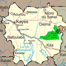
Boucle du Baoulé National Park
431.7 km
River Gambia National Park
416.7 km
MacCarthy Island
410.9 km
Gouina Falls
277.4 km
Bassari Country
415.1 km
Badiar National Park
424 km
Félou Falls
232 km
Lake Manantali
400 km
Talari Gorges
307 km
Cercles de pierres de Wassu
405.1 km
Deer Island (Gambia)
417.8 km
Isla Sepu
417 km
Tata of Koniakary
234.3 km
Isla Brikama
421.7 km
Bird Island
408.6 km
Eisenbahnbrücke von Kidira
201.5 km
Cercles de pierres de Kerbatch
419.2 km
Sankulay Kunda Bridge
411.5 km
Straßenbrücke von Kidira
202 km
Isla Pangon
410.2 km
Isla Pasari
350 km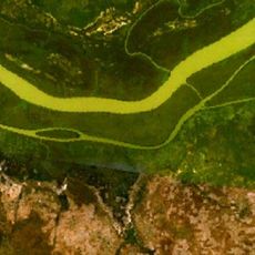
Isla Ba Faraba
432.5 km
Mimang Island
418.9 km
Fort de Médine
228.9 km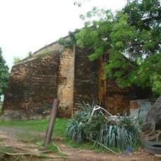
Slave House
409.9 kmReviews
Visited this place? Tap the stars to rate it and share your experience / photos with the community! Try now! You can cancel it anytime.
Discover hidden gems everywhere you go!
From secret cafés to breathtaking viewpoints, skip the crowded tourist spots and find places that match your style. Our app makes it easy with voice search, smart filtering, route optimization, and insider tips from travelers worldwide. Download now for the complete mobile experience.

A unique approach to discovering new places❞
— Le Figaro
All the places worth exploring❞
— France Info
A tailor-made excursion in just a few clicks❞
— 20 Minutes