Enable Location

We need your location to show you interesting places around you

Discover nearby places

Find interesting locations and hidden gems around you

Precise directions

Get accurate directions and distances to places

Your location is never shared with other users. It's only used when you tap the location button.

Coropuna

Log in to your account

Start exploring — it's free

Trusted by 62,862 travelers worldwide

Continue with Google
Continue with Apple
or

We will send you a code to connect

By continuing, you accept our Terms and Conditions and our Privacy Policy

Check your inbox

We've sent a pincode in your inbox. Please enter the code below.

Coropuna

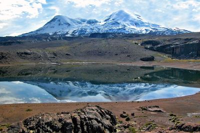
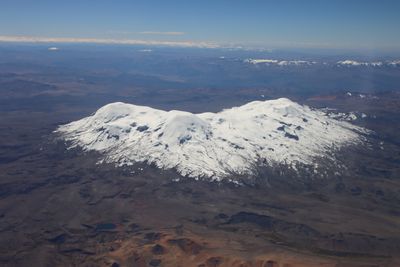
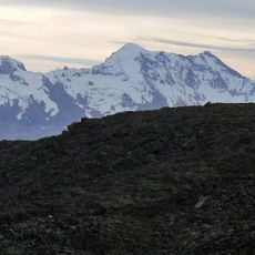
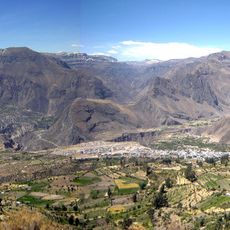
Coropuna, Stratovolcano in Arequipa, Peru.

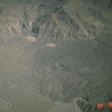
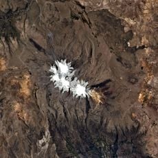
Coropuna extends across 1000 square kilometers in the Ampato range and displays six separate summit cones with an extensive ice cap above. The highest point reaches 6377 meters , while the glaciers gradually retreat due to climate shifts.

The first documented expedition took place in 1911 when Annie Peck and Hiram Bingham III independently tried to measure its height. Scientists later recognized that the summit had been visited in earlier centuries as part of religious activities.

The name in Quechua translates to

The ascent to the summit takes four days with required acclimatization stops at base camp and high camp at different elevations. Climbers should start early in the dry season between May and September when weather becomes more stable and snow conditions are more favorable.

Archaeological evidence found at 6200 meters shows that Indigenous people reached near the summit centuries before European expeditions. This discovery confirms the remarkable adaptation skills and knowledge the Inca had about extreme altitude environments long before modern climbing equipment existed.

The community of curious travelers

AroundUs brings together thousands of curated places, local tips, and hidden gems, enriched daily by 60,000 contributors worldwide.

Start exploring
Elevation above the sea
6,425 m
Part of
Volcanic arc of Peru
GPS coordinates
-15.52028,-72.65722
Latest update
December 5, 2025 22:29
« Coropuna - Stratovolcano in Arequipa, Peru » is provided by Around Us (aroundus.com). Images and texts are derived from Wikimedia project under a Creative Commons license. You are allowed to copy, distribute, and modify copies of this page, under the conditions set by the license, as long as this note is clearly visible.

Discover hidden gems everywhere you go!

From secret cafés to breathtaking viewpoints, skip the crowded tourist spots and find places that match your style. Our app makes it easy with voice search, smart filtering, route optimization, and insider tips from travelers worldwide. Download now for the complete mobile experience.

Around Us App Screenshot

A unique approach to discovering new places

Le Figaro

All the places worth exploring

France Info

A tailor-made excursion in just a few clicks

20 Minutes

Around Us
Travel Guide & Maps
Download

Send to your phone

QR Code
1

Open the camera app on your mobile.

2

Point at the QR code with your camera. A notification will appear.

3

Tap the notification to open the link.