Chest opened
+${chestReward.xp} XP
Explorer
NOUVEAU ×${chestReward.collectible.quantity}
tapez pour fermer
Chest locked

Open chests in the app

Around Us is built for your phone — chests unlock when you walk, explore and capture nearby places.

Enable Location

We need your location to show you interesting places around you

Discover nearby places

Find interesting locations and hidden gems around you

Precise directions

Get accurate directions and distances to places

Your location is never shared with other users. It's only used when you tap the location button.

Congo basin

Log in to your account

Start exploring — it's free

Trusted by 72,878 travelers worldwide

Continue with Google
Continue with Apple
or

We will send you a code to connect

By continuing, you accept our Terms and Conditions and our Privacy Policy

Check your inbox

We've sent a pincode in your inbox. Please enter the code below.

Discussion Reviews 1 Photos
118k Popularity

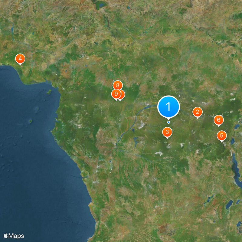
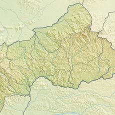
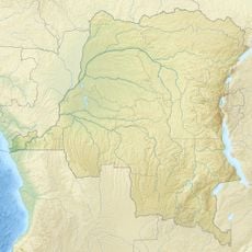
Congo basin, Drainage basin in Central Africa.

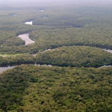
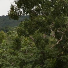
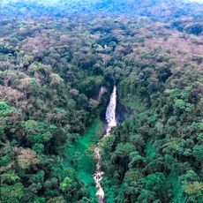
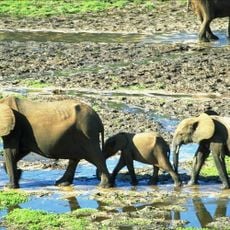
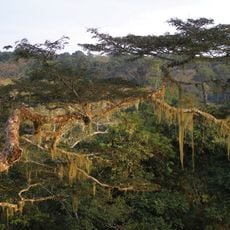
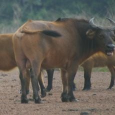
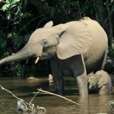
The Congo basin is a vast catchment area in Central Africa that spans more than ten countries and contains the second-largest rainforest on Earth. The region is crossed by a dense network of rivers that wind through deep valleys and wide plains.

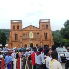
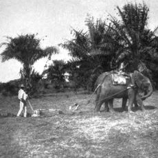
European powers divided the area in the late 19th century during the Berlin Conference and established colonial rule. Extraction of natural resources shaped the region for decades and fundamentally changed how many inhabitants lived.

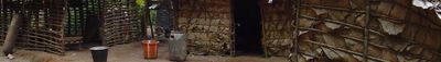
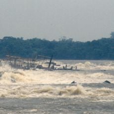
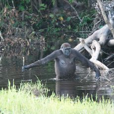
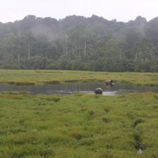
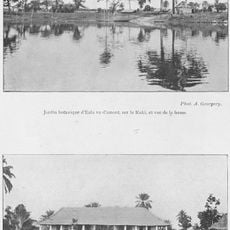
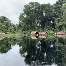
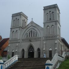
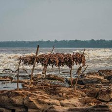
The area takes its name from the great river that winds through the region and has supported life and trade for centuries. Many communities live along the waterways and use canoes as their main mode of transport between villages.

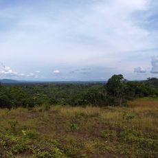
The area is expansive and underdeveloped, so travel between locations often requires several days and careful preparation. Many sections are difficult to reach during the rainy season, so visitors should plan their timing accordingly.

The river reaches depths of over 200 meters in some places, making it one of the deepest rivers in the world. These extraordinary depths were formed by the force of water carving through rocky ground over thousands of years.

The community of curious travelers

AroundUs brings together thousands of curated places, local tips, and hidden gems, enriched daily by 60,000 contributors worldwide.

Start exploring
Shares border with
Nile basin, Zambezi Basin
GPS coordinates
0.00000,22.00000
Latest update
December 12, 2025 22:25
Around this place
Boyoma Falls
Congo, Democratic Republic of the

Boyoma Falls

361.2 km
Salonga National Park
Congo, Democratic Republic of the

Salonga National Park

195.6 km
Okomu National Park
Nigeria

Okomu National Park

1970.6 km
Kahuzi-Biéga National Park
Congo, Democratic Republic of the

Kahuzi-Biéga National Park

698.1 km
Maiko National Park
Congo, Democratic Republic of the

Maiko National Park

621.3 km
Nouabalé-Ndoki National Park
Congo

Nouabalé-Ndoki National Park

664.3 km
Dzanga-Sangha Special Reserve
Central African Republic

Dzanga-Sangha Special Reserve

737.2 km
Dzanga-Ndoki National Park
Central African Republic

Dzanga-Ndoki National Park

706.3 km
Cathédrale Notre-Dame
Central African Republic

Cathédrale Notre-Dame

617.6 km
Mbeli Bai
Congo

Mbeli Bai

670.8 km
Lobéké National Park
Cameroon

Lobéké National Park

739.3 km
Sangha Trinational
Central African Republic

Sangha Trinational

697 km
Jardin Botanique d'Eala
Congo, Democratic Republic of the

Jardin Botanique d'Eala

410.7 km
Api Elephant Domestication Center
Congo, Democratic Republic of the

Api Elephant Domestication Center

559.4 km
Ntokou-Pikounda National Park
Congo

Ntokou-Pikounda National Park

607.9 km
Stade Lumumba
Congo, Democratic Republic of the

Stade Lumumba

359.4 km
Chutes de Boali
Central African Republic

Chutes de Boali

698.2 km
St. Peter Claver Cathedral, Bangassou
Central African Republic

St. Peter Claver Cathedral, Bangassou

536 km
Our Lady of the Rosary Cathedral, Kisangani
Congo, Democratic Republic of the

Our Lady of the Rosary Cathedral, Kisangani

359.2 km
Mbaéré Bodingué National Park
Central African Republic

Mbaéré Bodingué National Park

686.4 km
Domaine de chasse de Bili-Uere
Congo, Democratic Republic of the

Domaine de chasse de Bili-Uere

626.3 km
Stade des Jeunes
Congo, Democratic Republic of the

Stade des Jeunes

657.9 km
Stade Omnisport Marien Ngouabi d'Owando
Congo

Stade Omnisport Marien Ngouabi d'Owando

683 km
Sts. Peter and Paul Cathedral, Basankusu
Congo, Democratic Republic of the

Sts. Peter and Paul Cathedral, Basankusu

280.3 km
Rubi Tele Hunting Reserve
Congo, Democratic Republic of the

Rubi Tele Hunting Reserve

462.1 km
Chutes de Djamila
Central African Republic

Chutes de Djamila

645.7 km
Boyoma Falls
Congo, Democratic Republic of the

Boyoma Falls

389.8 km
Kisangani (teritoryo)
Congo, Democratic Republic of the

Kisangani (teritoryo)

365.7 km
Show the full map
Reviews
Share your experience

No review yet

Discussions
Start a discussion...

No discussion yet

« Congo basin - Drainage basin in Central Africa » is provided by Around Us (aroundus.com). Images and texts are derived from Wikimedia project under a Creative Commons license. You are allowed to copy, distribute, and modify copies of this page, under the conditions set by the license, as long as this note is clearly visible.

Discover hidden gems everywhere you go!

From secret cafés to breathtaking viewpoints, skip the crowded tourist spots and find places that match your style. Our app makes it easy with voice search, smart filtering, route optimization, and insider tips from travelers worldwide. Download now for the complete mobile experience.

Around Us App Screenshot

A unique approach to discovering new places

Le Figaro

All the places worth exploring

France Info

A tailor-made excursion in just a few clicks

20 Minutes

Around Us
Travel Guide & Maps
Download

Send to your phone

QR Code
1

Open the camera app on your mobile.

2

Point at the QR code with your camera. A notification will appear.

3

Tap the notification to open the link.