Villa Pehuenia, Mountain municipality in Neuquén Province, Argentina
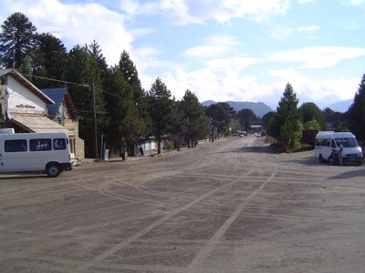
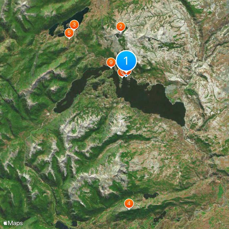
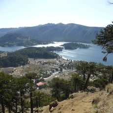
Villa Pehuenia extends along the northern shore of Lake Aluminé, featuring peninsulas that stretch into the water near the Batea Mahuida volcano.
The area was controlled by Mapuche people from Chile in the 18th century until the region became a formal municipality in 1989.
The indigenous Puel community manages a ski resort on Batea Mahuida volcano slopes and maintains traditional practices of gathering pine nuts from monkey puzzle trees.
Travelers reach Villa Pehuenia through a 313-kilometer route from Neuquén Capital using national route 22 and provincial route 13.
The municipality sits at 1,163 meters elevation, surrounded by ancient monkey puzzle tree forests and volcanic sand beaches along Lake Aluminé.
Location: Neuquén Province
Location: Aluminé Department
Inception: January 20, 1989
Elevation above the sea: 1,163 m
Part of: Villa Pehuenia - Moquehue Municipality
Address: Villa Pehuenia, Neuquén Province, Argentina
GPS coordinates: -38.88520,-71.17300
Latest update: May 27, 2025 09:33
Argentina extends across multiple climate zones and contains numerous geological formations. The country encompasses high mountain ranges in the Andes, salt flats in the northwest, rock formations in Patagonia, and extensive grasslands. These areas display the region's geological history and the adaptation of human settlements to different environments. The sites include volcanic craters, thermal springs, canyons, and historic villages. Many of these locations lie away from main routes and require several hours of travel. The regions document pre-Columbian cultures, colonial history, and traditional ways of life that continue today.
Conguillío National Park
48 km
Las Raíces Tunnel
50.6 km
Llaima
52.8 km
Batea Mahuida Volcano
8 km
Icalma
12.6 km
Lonquimay
67 km
Laguna Blanca National Park
72.6 km
Villarrica National Park
79.2 km
Huerquehue National Park
50.5 km
Sollipulli
31.8 km
Ojos del Caburgua
70.5 km
Sierra Nevada
49.7 km
China Muerta National Reserve
30.6 km
Tolhuaca
75.8 km
Malalcahuello National Reserve
55.8 km
Alto Biobío National Reserve
34.2 km
Villarrica National Reserve
31.1 km
Termas Huife
56.6 km
Sierra del Chachil
48.4 km
Cerro Quinquilil
77.8 km
Araucarias Biosphere Reserve
28 km
Category:Iglesia de San Sebastián, Curarrehue
63.8 km
Cordillera de Las Raíces
47.2 km
Capilla de San Conrado
64.9 km
Muséo Historico Reginal "Emilia Ondetti de Fix""
80.4 km
El León waterfall
78.2 km
Blanca, Laguna
71.1 km
La China waterfall
77.4 kmReviews
Visited this place? Tap the stars to rate it and share your experience / photos with the community! Try now! You can cancel it anytime.
Discover hidden gems everywhere you go!
From secret cafés to breathtaking viewpoints, skip the crowded tourist spots and find places that match your style. Our app makes it easy with voice search, smart filtering, route optimization, and insider tips from travelers worldwide. Download now for the complete mobile experience.
A unique approach to discovering new places❞
— Le Figaro
All the places worth exploring❞
— France Info
A tailor-made excursion in just a few clicks❞
— 20 Minutes