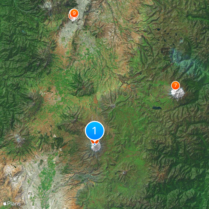
Cotopaxi volcano, Active stratovolcano in Cotopaxi Province, Ecuador
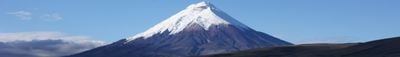
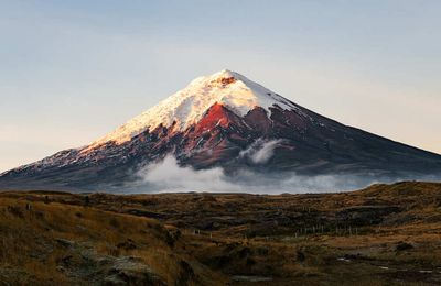
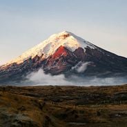
Cotopaxi is an active stratovolcano in Cotopaxi Province, Ecuador, rising to an altitude of 5,897 meters with a nearly symmetrical cone towering over a highland plain. The mountain's flanks climb from around 3,800 meters to the glacier-capped summit, with tuff forming much of the volcanic structure.
In 1877, a major eruption produced pyroclastic flows and lahars that traveled more than 100 kilometers, reaching both the Pacific Ocean and the Amazon basin. Since then, several smaller eruptions have occurred, demonstrating that the volcano remains geologically active.
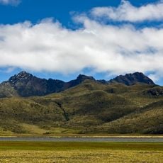
The name comes from the Quechua language, where 'coto' means neck and 'paxi' refers to the moon, describing the crater's distinctive appearance perched above a narrow base. Local highland communities regard the mountain as a sacred presence in their cosmological worldview.
The José F. Ribas refuge at 4,864 meters (15,958 feet) serves as a shelter and acclimatization point for climbers heading to the summit. Weather conditions change quickly at this altitude, so visitors should be prepared for shifting temperatures and sudden fog.
The summit holds one of the few equatorial glaciers in the world, with ice beginning at 5,000 meters (16,404 feet) and persisting year-round. Meltwater from this glacier feeds rivers that drain into both the Pacific Ocean and the Amazon basin.
Location: Cotopaxi Province
Location: Latacunga Canton
Elevation above the sea: 5,897 m
Made from material: tuff
GPS coordinates: -0.68056,-78.43777
Latest update: December 14, 2025 20:20
This collection brings together active volcanoes located on multiple continents, from Cotopaxi in the Ecuadorian Andes to Mount Fuji in Japan, including Vesuvius in Italy and Mauna Loa in Hawaii. Each site demonstrates different geological processes: stratovolcanoes like Mount Saint Helens and Etna...
Ecuador offers diverse landscapes and architectural subjects for photography. The capital city of Quito features colonial buildings such as the Basilica del Voto Nacional and the narrow streets of La Ronda, while the surrounding highlands contain active volcanoes including Cotopaxi, Chimborazo, and...
Cotopaxi National Park
406 m
Rumiñahui volcano
13.1 kmÁrea nacional de recreación El Boliche
15.9 kmVolcán Cotopaxi
446 mMirador
7.4 kmRumiñahui
14.1 kmIngreso parque Volcán Cotopaxi
16.9 kmMöglicher Übernachtungsplatz
8.5 kmSummit ridge
12.9 kmScenic viewpoint
9.1 kmScenic viewpoint
7.3 kmScenic viewpoint
7.4 kmScenic viewpoint
7.3 kmLa Base
12 kmHacienda Yanahurco
17.3 kmPiedra Chilintosa - Virgen del Volcán
17.2 kmWaterfall
7.8 kmWaterfall
16.7 kmWaterfall
20.9 kmWaterfall
21.2 kmCascada Río Pita
12.5 kmWaterfall
12.1 kmWaterfall
21.1 kmWaterfall
20.2 kmWaterfall
20.2 kmWaterfall
20.2 kmWaterfall
20.2 kmCascada de Fuego
19.9 kmVisited this place? Tap the stars to rate it and share your experience / photos with the community! Try now! You can cancel it anytime.
Discover hidden gems everywhere you go!
From secret cafés to breathtaking viewpoints, skip the crowded tourist spots and find places that match your style. Our app makes it easy with voice search, smart filtering, route optimization, and insider tips from travelers worldwide. Download now for the complete mobile experience.
A unique approach to discovering new places❞
— Le Figaro
All the places worth exploring❞
— France Info
A tailor-made excursion in just a few clicks❞
— 20 Minutes