Ecuador offers diverse landscapes and architectural subjects for photography. The capital city of Quito features colonial buildings such as the Basilica del Voto Nacional and the narrow streets of La Ronda, while the surrounding highlands contain active volcanoes including Cotopaxi, Chimborazo, and Tungurahua. The country also includes crater lakes like Quilotoa and Lake Cuicocha, indigenous markets such as Otavalo, and coastal towns like Montanita with their own character.
Ecuador offers diverse landscapes and architectural subjects for photography. The capital city of Quito features colonial buildings such as the Basilica del Voto Nacional and the narrow streets of La Ronda, while the surrounding highlands contain active volcanoes including Cotopaxi, Chimborazo, and Tungurahua. The country also includes crater lakes like Quilotoa and Lake Cuicocha, indigenous markets such as Otavalo, and coastal towns like Montanita with their own character.
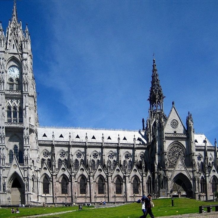
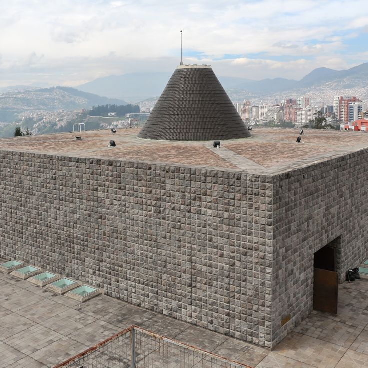
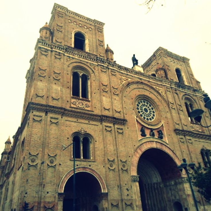
The Basílica del Voto Nacional is a neogothic structure in Quito that serves as a significant subject for photographers interested in architectural monuments. The building features stone spires and gargoyles that define its appearance. An observation platform provides views across the city's rooftops and colonial streets.
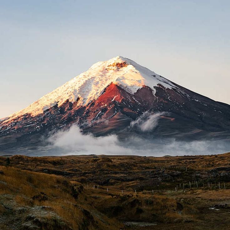
Cotopaxi is a volcano near Latacunga and stands as one of Ecuador's most compelling photographic subjects. The mountain rises to 5897 meters and ranks as the country's second highest peak. The symmetric cone features permanent snow and glacier coverage, creating striking compositions for landscape photography. Visitors and photographers come to capture the towering heights and geological drama of Ecuador's volcanic landscapes.
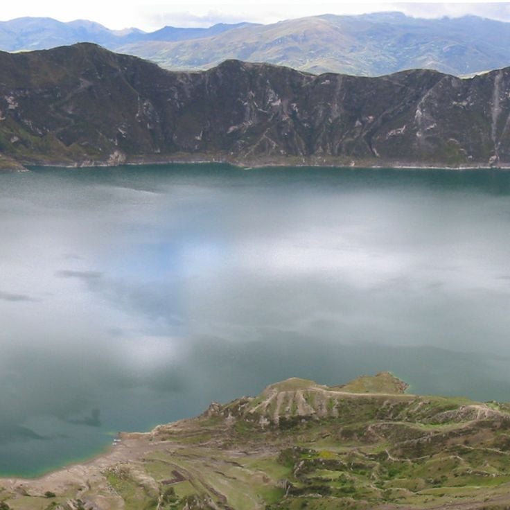
Quilotoa Lake is a crater lake in the Cotopaxi region and provides a striking photographic subject for the collection of Ecuador's natural landscapes. The water lies at about 3800 meters elevation within an extinct volcano. The mineral-rich surface extends roughly 3 kilometers across and displays a turquoise color that shifts with the light and weather. This location captures the drama of Ecuador's high-altitude volcanic zones.
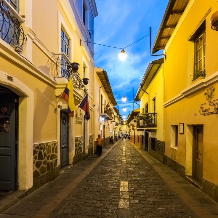
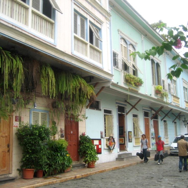
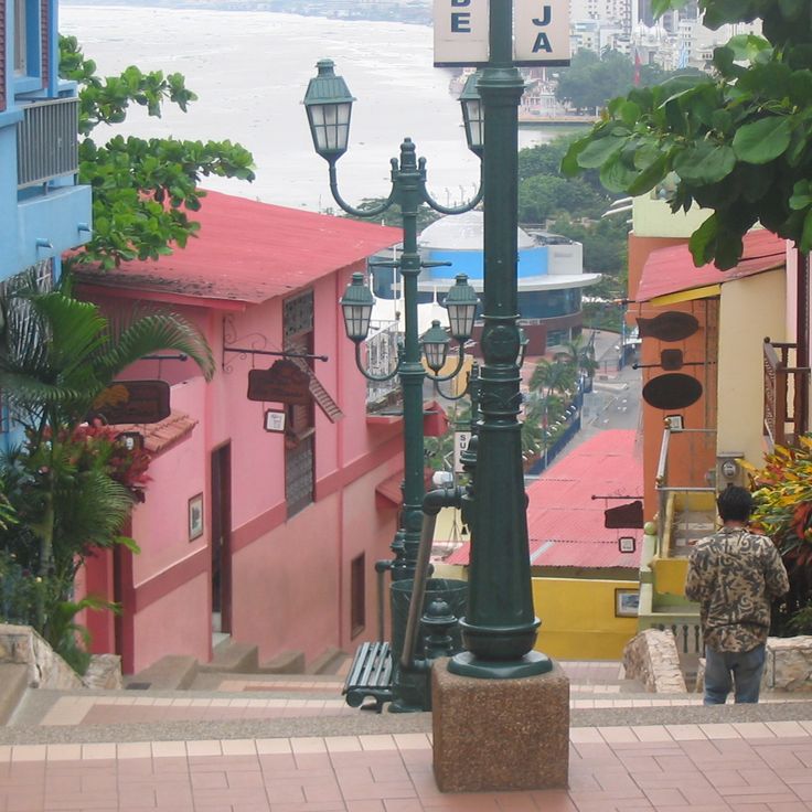
La Ronda is an 18th century street in Quito and part of Ecuador's photographic subjects, ranging from colonial streets to volcanoes and crater lakes. This street features stone pavement and Spanish colonial buildings with wooden balconies. Restaurants and traditional craft shops line the way, offering glimpses into daily life from centuries past.
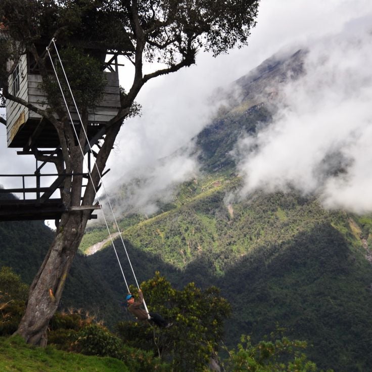
The Casa del Arbol Swing is a viewing platform in Ecuador's mountains where visitors sit on a tree swing and look directly at Tungurahua volcano. The site sits at 2600 meters elevation and offers an open view of the active volcano. This is one of Ecuador's photography locations that shows how everyday objects connect with dramatic landscapes.
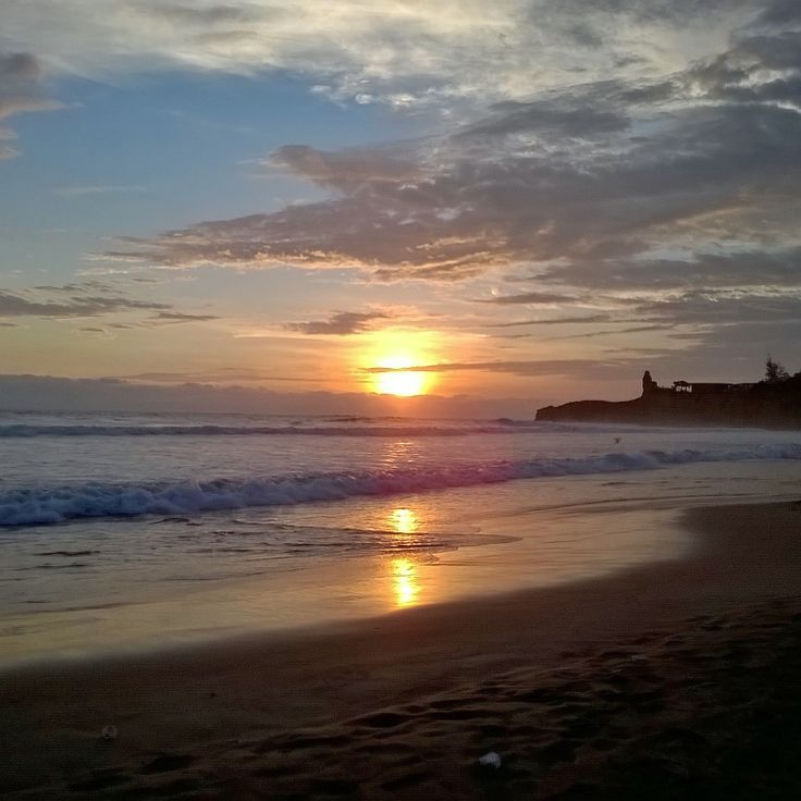
Montañita Beach is a coastal location in Santa Elena Province that offers photographers compelling subjects of Ecuador's seaside landscapes. This 3 kilometer stretch of sand draws surfers from around the world with its consistent waves for water sports. Markets and restaurants dot the beachfront, serving local dishes to visitors and residents alike. The mix of natural coastal features, active beach culture, and everyday human activity makes this location visually interesting for photographers documenting Ecuador's varied environments.
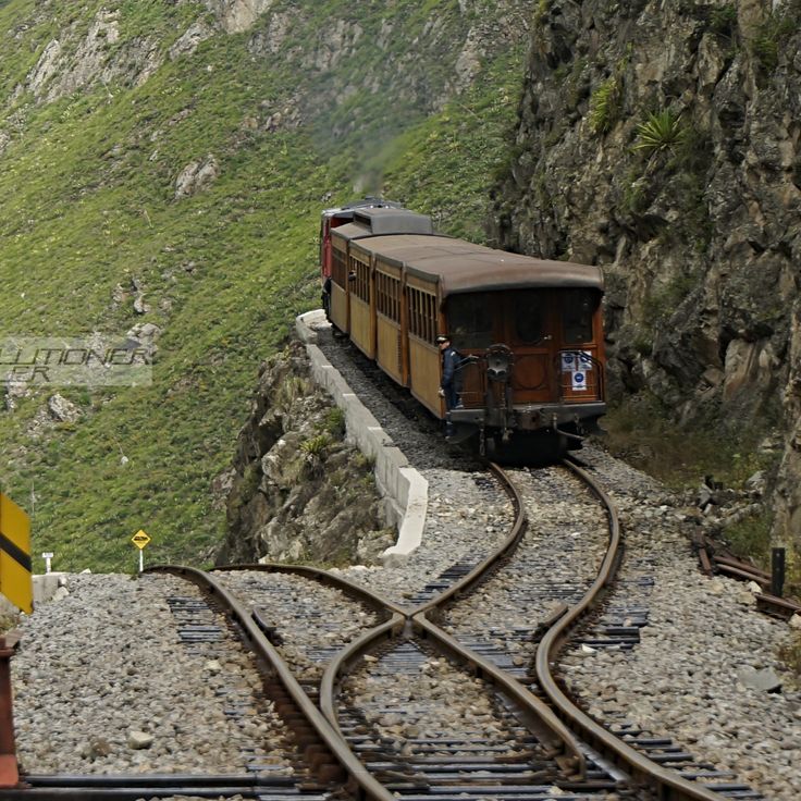
The Devil's Nose Railway is a mountain railway in Ecuador that offers photographers dramatic subjects along its route. The railway climbs 500 meters through zigzag tracks hugging rock walls between the towns of Alausí and Sibambe. Travelers can photograph steep slopes, sharp curves, and the engineering of the historical tracks. The surrounding terrain shows the landscape of the Ecuadorian highlands with its varied elevations and geological features.
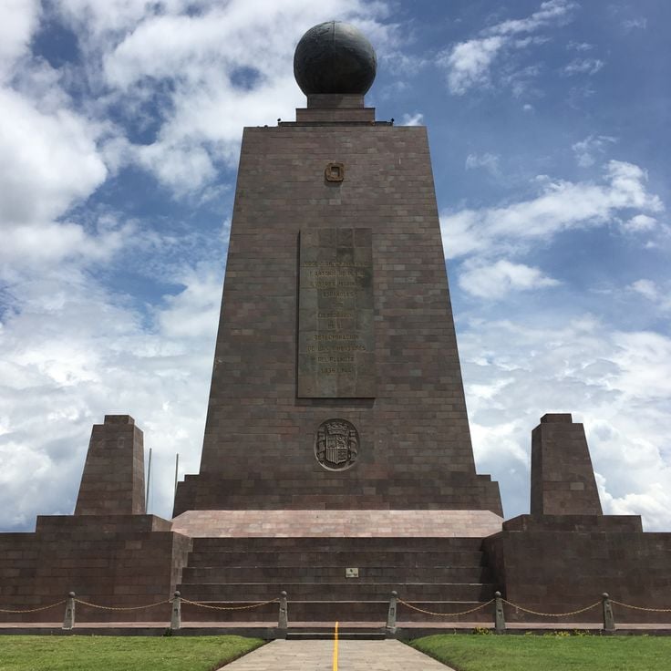
The Equator Monument in San Antonio, Quito, provides a notable subject for this collection of photography locations across Ecuador. The 30 meter stone tower stands directly on the equator line. A museum inside displays the history and culture of Ecuador's indigenous peoples. The location merges architecture with cultural storytelling.
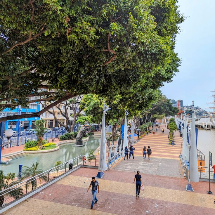
Malecón 2000 is an important photography location in Ecuador, showcasing the modern side of Guayaquil. This riverside promenade stretches along the Guayas River and offers gardens, shops, a commercial center, art galleries and a botanical park. The promenade is a popular spot for photographers seeking to capture both architecture and natural landscapes.
Cuenca's Historic Center is one of Ecuador's most compelling photography locations, showcasing the country's colonial heritage. The city center features buildings dating from the 16th century with stone construction, cobblestone streets, and churches arranged around public squares. When photographing here, you encounter the texture of colonial architecture, the scale of historic plazas, and the way daily life unfolds among centuries-old structures that remain central to the city's identity.
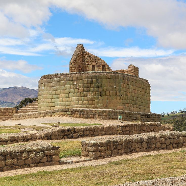
The Ingapirca Ruins are an archaeological complex in Ecuador's highlands that offers photography subjects of stone walls and Inca structures from the 15th century. This site sits at a high elevation and represents one of the country's significant historical locations, complementing the colonial architecture, volcanoes and crater lakes that make Ecuador rich in photographic opportunities.
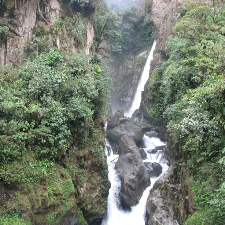
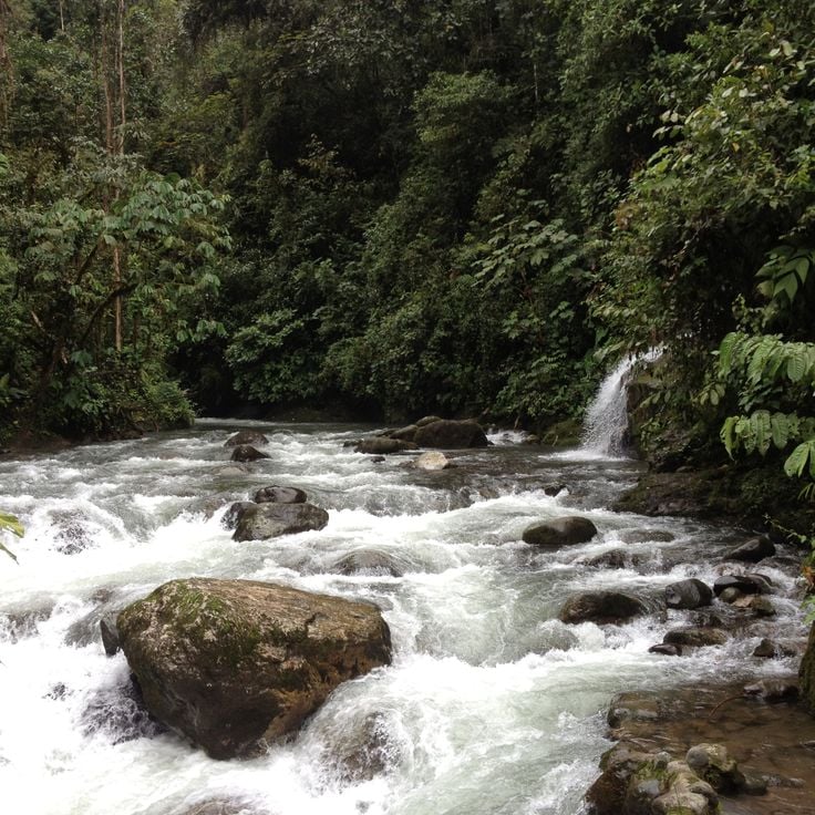
Devil's Cauldron Waterfall is an 80 meter waterfall in the rainforest near Baños and represents Ecuador's natural photography subjects ranging from volcanoes to waterfalls. The waterfall flows along the Pastaza River and is accessed by hiking trails and viewing platforms positioned along the banks. Visitors can photograph the cascading water against the surrounding tropical vegetation and rocky terrain.
Podocarpus National Park in Loja Province is a large protected area with mountains, forests and valleys. The park is home to diverse bird and plant species that thrive in its different elevations and climates. For photographers, this national park offers natural landscapes and habitats that are valuable for documenting Ecuador's biodiversity.
Otovalo Market has operated since the 16th century and remains the principal trading hub for regional communities in Ecuador's northern highlands. Vendors display wool garments, traditional woven hats, alpaca clothing, wooden crafts and agricultural products. The market serves as a gathering place for indigenous traders and visitors seeking regional handicrafts. For photographers, this location offers rich material on local commerce, cultural practices and the daily rhythms of indigenous communities.
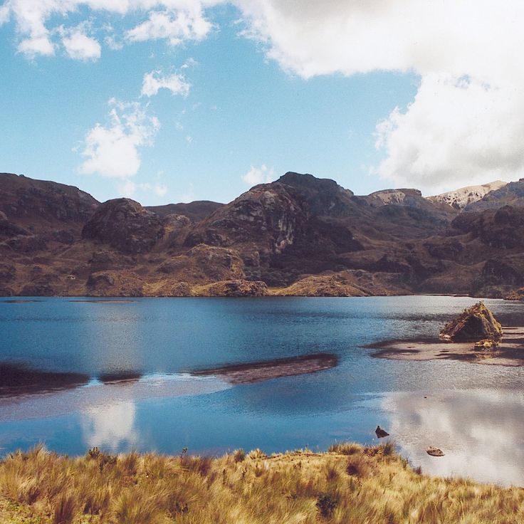
El Cajas National Park is a location for photographers seeking to capture Ecuador's highland landscapes. The park encompasses a mountain area with roughly 235 lakes situated between 3100 and 4450 meters (10,170 and 14,600 feet) in elevation. The vegetation shifts from alpine meadows to cloud forest, giving the terrain a layered appearance. These numerous lakes reflect the sky and offer changing light qualities throughout the day. The park demonstrates how nature transforms at high altitude and provides subjects for varied photographic approaches.
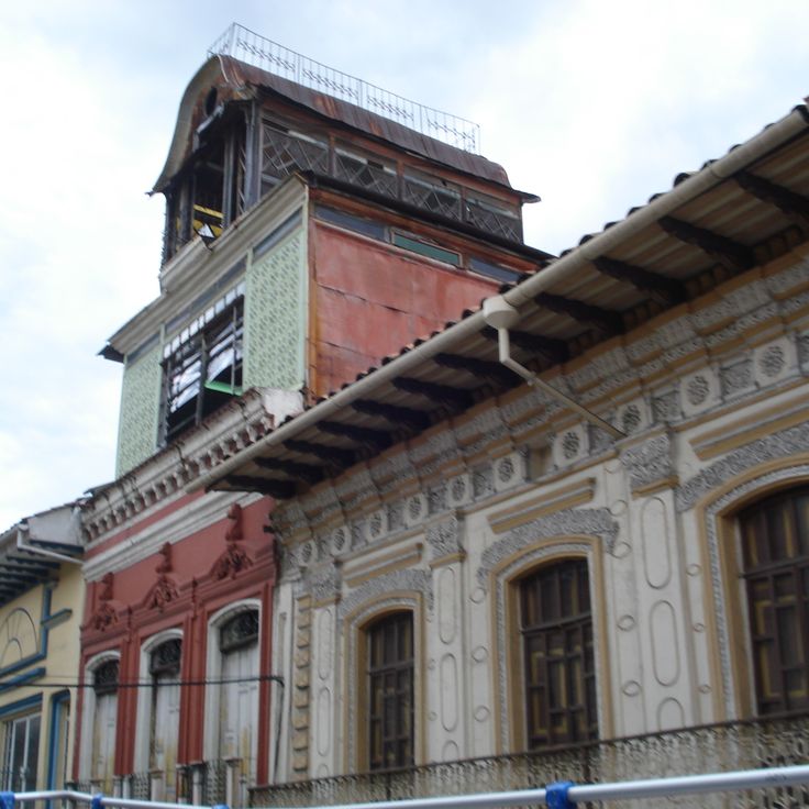
Las Peñas is a photography location in Guayaquil, Ecuador that complements the photographic subjects found across the country, from Quito's colonial streets to Galápagos landscapes. This district features wooden houses from the 19th century with Spanish colonial architecture, and its narrow streets offer photographers opportunities to capture the historic character and architectural details that define this preserved neighborhood.
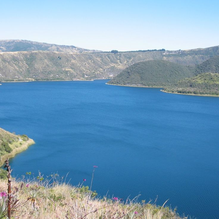
For photography locations in Ecuador, Lake Cuicocha is a crater lake in the Imbabura region. It sits at 3246 meters elevation within a volcanic crater. Two large islands rise from the water. A circular path runs around the lake, offering views of the water, islands, and surrounding mountains from different angles.
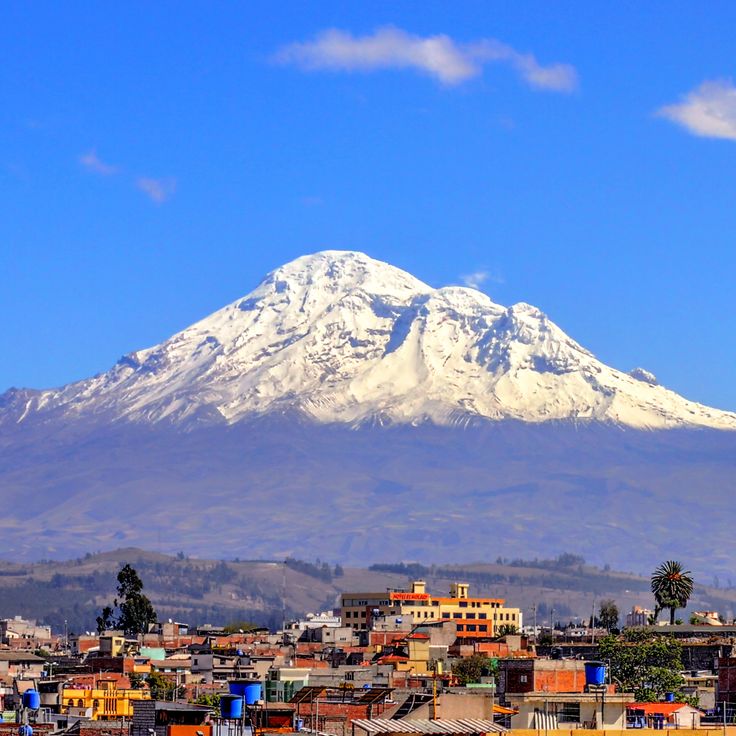
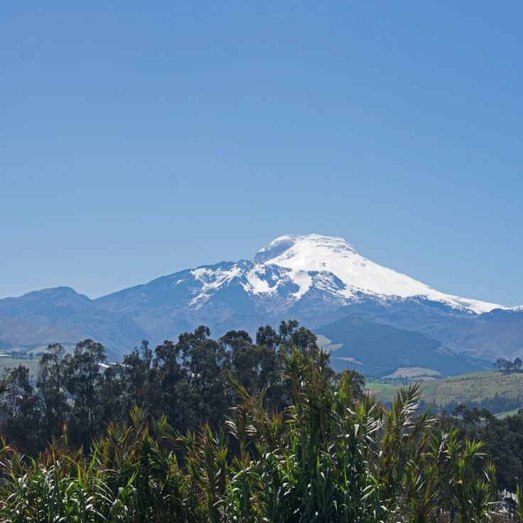
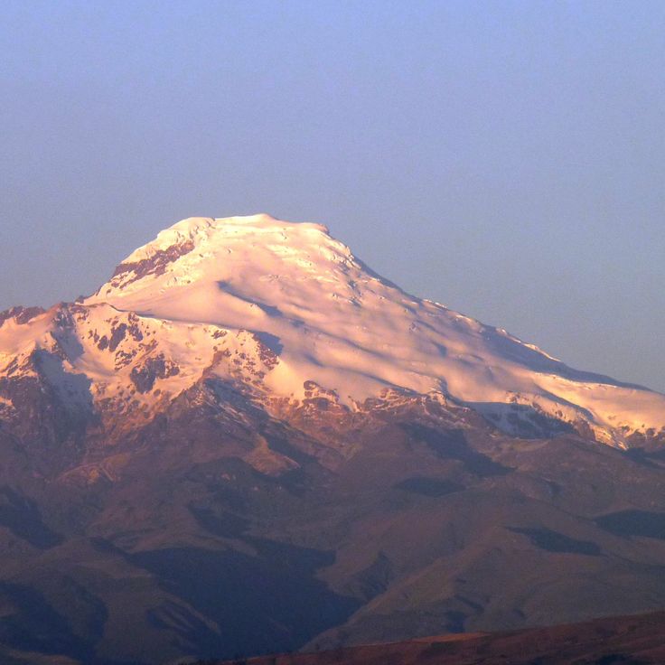
Chimborazo is Ecuador's highest mountain, standing at 6263 meters. This volcano serves as a striking photographic subject for those documenting Ecuador's geological features and volcanic landscape. Its summit reaches farther from Earth's center than any other point on the planet, due to the shape of the Earth. The mountain offers expansive views and represents the volcanic terrain that defines Ecuador's geography.
Chordeleg is the metalwork center featured in this collection of Ecuador's photographic locations. Artisans in this town craft jewelry from gold and silver using techniques inherited from colonial times. Photographers will discover workshops and handmade objects that reveal the town's long-standing craft tradition.
Zaruma is a mountain city in Ecuador located at 1200 meters elevation. It fits among Ecuador's photographic locations that showcase colonial architecture and landscapes. The city contains wooden structures from the 1800s that remain intact today. Gold mines have operated here since before Columbus arrived. This historic settlement provides subjects for photographers interested in colonial structures and mountain geography.
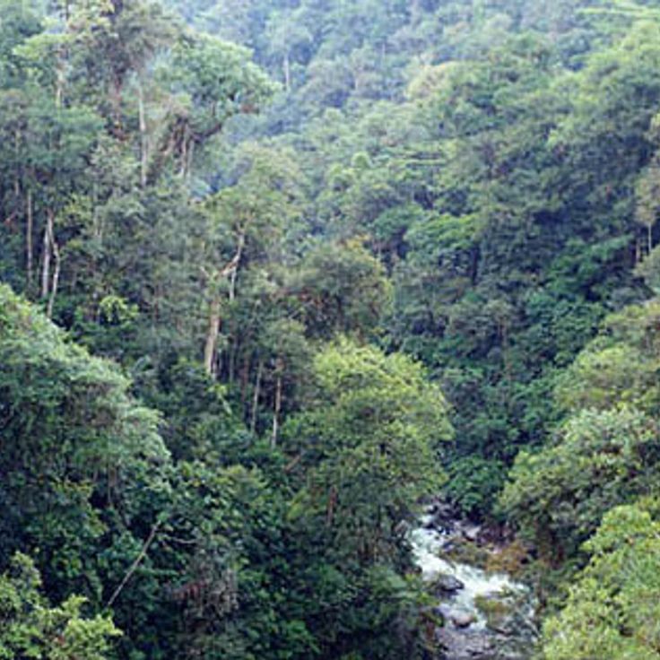
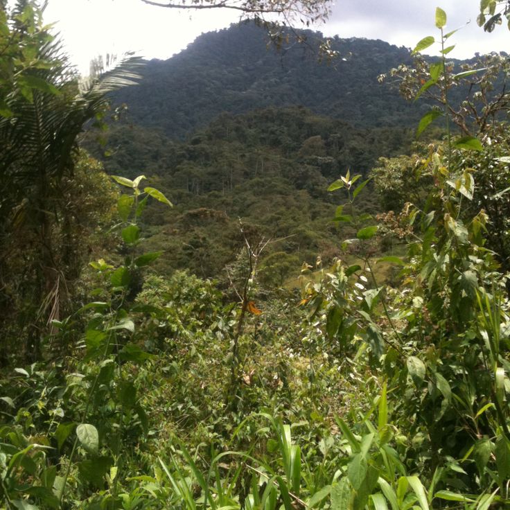
The Cloud Forest sits in the mountains at elevations between 1200 and 1400 meters. It serves as a photography location for Ecuador's natural diversity. The hiking trails enable observation of around 400 bird species and tropical plants. The forest displays the biological variety that defines Ecuador from Quito's colonial streets to the Galapagos Islands.
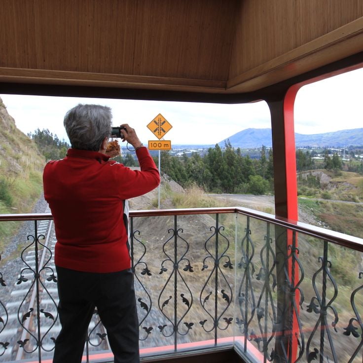
This railway line is a rewarding subject for photographers documenting Ecuador's mountain landscape. The train connects Quito with Guayaquil and passes through Andean passes and valleys. Along the way, you see steep mountain slopes, green hills and the characteristic scenery of the high Andes. The route shows how people live and work in this mountainous region.
Cayambe Peak is a volcano in Pichincha Province that offers compelling subjects for photographers exploring Ecuador's mountain landscapes. Rising to 5790 meters, it holds the distinction of being the highest point on the equator and the only mountain with permanent snow fields along the equatorial line. Its distinctive form and snow-covered slopes provide notable photography opportunities.
The Santa Ana Viewpoint offers views of Guayaquil and the Guayas River from above the city. A white lighthouse marks this observation point, which sits on a hill overlooking the water and urban landscape. From this location you can see the buildings, streets and natural surroundings of the city. It is a good place to photograph the city and its relationship to the river and surrounding terrain.
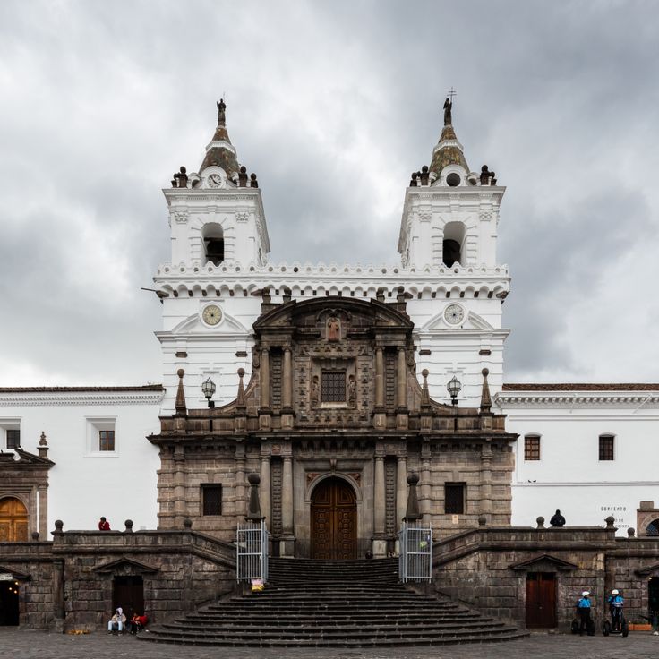
The San Francisco Religious Complex is an important location for photographers documenting Ecuador's religious architecture and colonial heritage. This complex houses a museum of religious art, chapels featuring wooden carvings, and a monastery section. The structure dates from the 16th century and represents the architectural traditions that define Quito's colonial streets. Photographers can capture the craftsmanship of wooden details, historical spaces, and the layers of religious and cultural history preserved within the buildings.
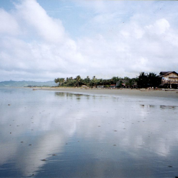
Muisne Beach is a stretch of volcanic gray sand along Ecuador's coast. Coconut palms line the shoreline, and local restaurants serve regional fish dishes. This location offers photographic subjects of coastal landscapes that document Ecuador's diverse geography, contrasting with the country's highland regions.
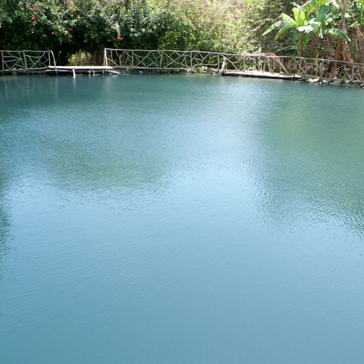
Agua Blanca Community presents artifacts of Manteña culture in a local museum and offers insight into Ecuador's pre-Hispanic history. The site includes mineral pools and stone structures that date before Spanish conquest. As a photography location, this place documents the cultural layers of the country and works well for capturing archaeological remains and traditional bathing pools set in a natural landscape.
Capilla del Hombre is a three-story museum in Quito showcasing works by Ecuadorian artist Oswaldo Guayasamín. The paintings and sculptures explore the history of indigenous peoples and address social themes. As a photography location, this museum offers powerful artistic compositions and insights into Ecuador's cultural expressions.
Sangay National Park is a large protected area in Morona Santiago that offers photographers diverse subjects across different landscapes. The park spans multiple vegetation zones ranging from lowlands to alpine areas. Three active volcanoes shape the terrain and create striking backdrops for photography. The varied habitats support different ecosystems and wildlife. This location provides opportunities to capture volcanic landscapes, mountain forests, and the ecological diversity found throughout Ecuador.
The Cayambe Coca Nature Reserve is a key photography location in Ecuador, showcasing highland landscapes with roughly 80 lakes, several glaciers and a population of about 100 Andean condors. This protected area offers subjects for nature photography, from glacier formations and alpine lakes to rare bird sightings, adding to Ecuador's range of photographic sites from colonial streets to volcanic terrain.
Yasuni National Park is a rainforest area in Orellana Province that draws photographers seeking to capture the region's diverse wildlife and vegetation. The park offers opportunities to photograph rare birds, mammals and plant species in their natural habitat. Dense forests, river landscapes and the abundance of life make this location a destination for nature photography in Ecuador. Visitors can document the biological richness of the Amazon rainforest here.
Catedral Nueva de Cuenca is a photography location in Ecuador that showcases the country's religious architecture. This cathedral impresses with its distinctive blue domes made of Czech ceramic tiles that stand out against the sky. The church occupies a prominent place in the city center and offers subjects for photographers interested in documenting Ecuador's colonial and religious heritage.
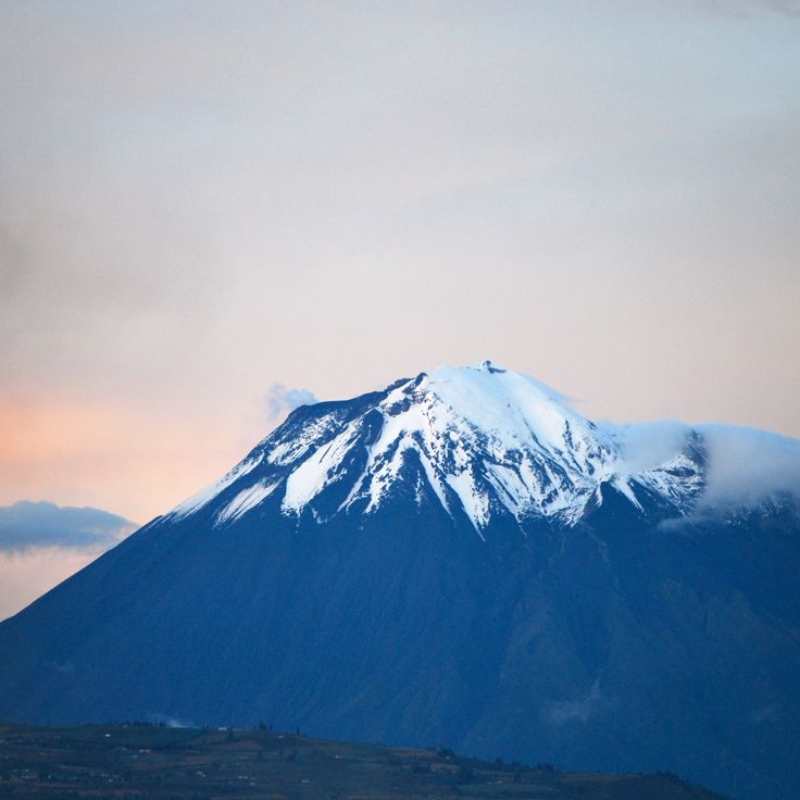
Tungurahua Volcano is a stratovolcano in Ecuador and serves as a striking photographic subject for Ecuador's collection of volcanic and landscape locations. Rising 5023 meters above sea level, this active mountain dominates the Andean terrain. The volcano regularly emits gas plumes and experiences periodic eruptions that produce ash fall and lava flows. Photographers can capture the raw power and geological drama of this natural feature.
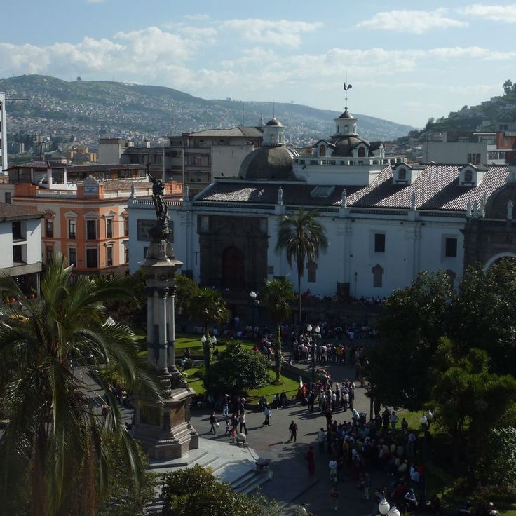
Independence Square is an important photography location in Ecuador, showcasing the heart of Quito's colonial old town. The square is surrounded by buildings from the 16th century, including the Presidential Palace, the Cathedral and the Archbishop's Palace. These structures display the Spanish architecture that defines Quito and hold great value for photographers documenting Ecuador's history.
This protected forest in Ecuador offers photographers a chance to capture the country's rich biodiversity. The Maquipucuna Reserve sits at various elevations where cloud forests give way to highland vegetation. Visitors can find countless bird species and rare plants throughout the woodland. The reserve demonstrates the ecological variety that makes Ecuador a destination for nature photography, from dense forest canopy to hidden clearings and streams.
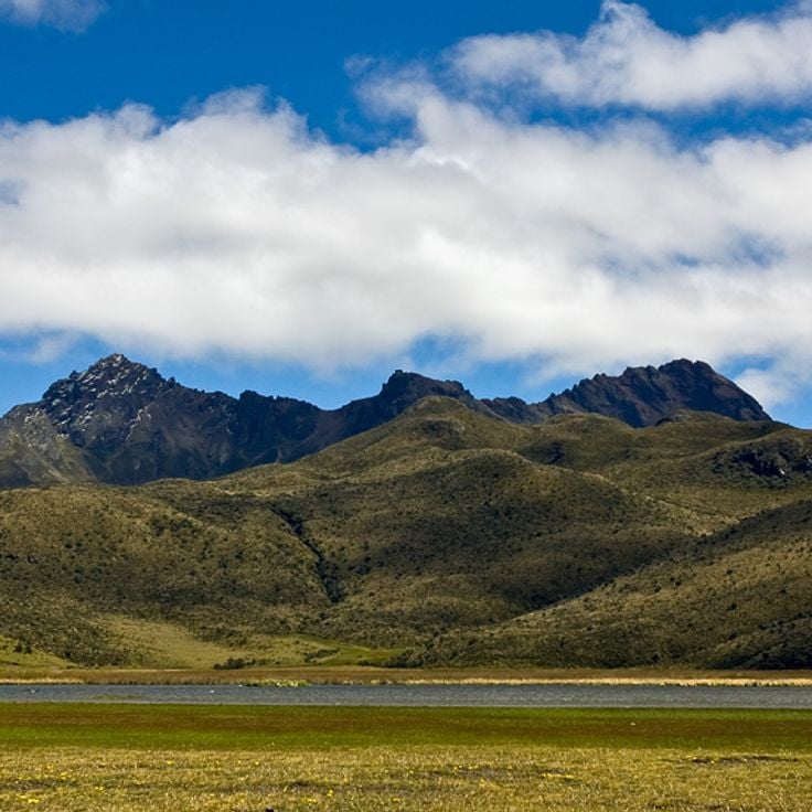
Rumiñahui Volcano in Cotopaxi Province is a dormant volcano that rises 4721 meters with three distinct peaks. Its steep, eroded volcanic slopes offer climbing routes and photography opportunities of the volcanic landscapes that define Ecuador's geological character.
The Basílica del Voto Nacional is a neogothic structure in Quito that serves as a significant subject for photographers interested in architectural monuments. The building features stone spires and gargoyles that define its appearance. An observation platform provides views across the city's rooftops and colonial streets.
Cotopaxi is a volcano near Latacunga and stands as one of Ecuador's most compelling photographic subjects. The mountain rises to 5897 meters and ranks as the country's second highest peak. The symmetric cone features permanent snow and glacier coverage, creating striking compositions for landscape photography. Visitors and photographers come to capture the towering heights and geological drama of Ecuador's volcanic landscapes.
Quilotoa Lake is a crater lake in the Cotopaxi region and provides a striking photographic subject for the collection of Ecuador's natural landscapes. The water lies at about 3800 meters elevation within an extinct volcano. The mineral-rich surface extends roughly 3 kilometers across and displays a turquoise color that shifts with the light and weather. This location captures the drama of Ecuador's high-altitude volcanic zones.
La Ronda is an 18th century street in Quito and part of Ecuador's photographic subjects, ranging from colonial streets to volcanoes and crater lakes. This street features stone pavement and Spanish colonial buildings with wooden balconies. Restaurants and traditional craft shops line the way, offering glimpses into daily life from centuries past.
The Casa del Arbol Swing is a viewing platform in Ecuador's mountains where visitors sit on a tree swing and look directly at Tungurahua volcano. The site sits at 2600 meters elevation and offers an open view of the active volcano. This is one of Ecuador's photography locations that shows how everyday objects connect with dramatic landscapes.
Montañita Beach is a coastal location in Santa Elena Province that offers photographers compelling subjects of Ecuador's seaside landscapes. This 3 kilometer stretch of sand draws surfers from around the world with its consistent waves for water sports. Markets and restaurants dot the beachfront, serving local dishes to visitors and residents alike. The mix of natural coastal features, active beach culture, and everyday human activity makes this location visually interesting for photographers documenting Ecuador's varied environments.
The Devil's Nose Railway is a mountain railway in Ecuador that offers photographers dramatic subjects along its route. The railway climbs 500 meters through zigzag tracks hugging rock walls between the towns of Alausí and Sibambe. Travelers can photograph steep slopes, sharp curves, and the engineering of the historical tracks. The surrounding terrain shows the landscape of the Ecuadorian highlands with its varied elevations and geological features.
The Equator Monument in San Antonio, Quito, provides a notable subject for this collection of photography locations across Ecuador. The 30 meter stone tower stands directly on the equator line. A museum inside displays the history and culture of Ecuador's indigenous peoples. The location merges architecture with cultural storytelling.
Malecón 2000 is an important photography location in Ecuador, showcasing the modern side of Guayaquil. This riverside promenade stretches along the Guayas River and offers gardens, shops, a commercial center, art galleries and a botanical park. The promenade is a popular spot for photographers seeking to capture both architecture and natural landscapes.
Cuenca's Historic Center is one of Ecuador's most compelling photography locations, showcasing the country's colonial heritage. The city center features buildings dating from the 16th century with stone construction, cobblestone streets, and churches arranged around public squares. When photographing here, you encounter the texture of colonial architecture, the scale of historic plazas, and the way daily life unfolds among centuries-old structures that remain central to the city's identity.
The Ingapirca Ruins are an archaeological complex in Ecuador's highlands that offers photography subjects of stone walls and Inca structures from the 15th century. This site sits at a high elevation and represents one of the country's significant historical locations, complementing the colonial architecture, volcanoes and crater lakes that make Ecuador rich in photographic opportunities.
Devil's Cauldron Waterfall is an 80 meter waterfall in the rainforest near Baños and represents Ecuador's natural photography subjects ranging from volcanoes to waterfalls. The waterfall flows along the Pastaza River and is accessed by hiking trails and viewing platforms positioned along the banks. Visitors can photograph the cascading water against the surrounding tropical vegetation and rocky terrain.
Podocarpus National Park in Loja Province is a large protected area with mountains, forests and valleys. The park is home to diverse bird and plant species that thrive in its different elevations and climates. For photographers, this national park offers natural landscapes and habitats that are valuable for documenting Ecuador's biodiversity.
Otovalo Market has operated since the 16th century and remains the principal trading hub for regional communities in Ecuador's northern highlands. Vendors display wool garments, traditional woven hats, alpaca clothing, wooden crafts and agricultural products. The market serves as a gathering place for indigenous traders and visitors seeking regional handicrafts. For photographers, this location offers rich material on local commerce, cultural practices and the daily rhythms of indigenous communities.
El Cajas National Park is a location for photographers seeking to capture Ecuador's highland landscapes. The park encompasses a mountain area with roughly 235 lakes situated between 3100 and 4450 meters (10,170 and 14,600 feet) in elevation. The vegetation shifts from alpine meadows to cloud forest, giving the terrain a layered appearance. These numerous lakes reflect the sky and offer changing light qualities throughout the day. The park demonstrates how nature transforms at high altitude and provides subjects for varied photographic approaches.
Las Peñas is a photography location in Guayaquil, Ecuador that complements the photographic subjects found across the country, from Quito's colonial streets to Galápagos landscapes. This district features wooden houses from the 19th century with Spanish colonial architecture, and its narrow streets offer photographers opportunities to capture the historic character and architectural details that define this preserved neighborhood.
For photography locations in Ecuador, Lake Cuicocha is a crater lake in the Imbabura region. It sits at 3246 meters elevation within a volcanic crater. Two large islands rise from the water. A circular path runs around the lake, offering views of the water, islands, and surrounding mountains from different angles.
Chimborazo is Ecuador's highest mountain, standing at 6263 meters. This volcano serves as a striking photographic subject for those documenting Ecuador's geological features and volcanic landscape. Its summit reaches farther from Earth's center than any other point on the planet, due to the shape of the Earth. The mountain offers expansive views and represents the volcanic terrain that defines Ecuador's geography.
Chordeleg is the metalwork center featured in this collection of Ecuador's photographic locations. Artisans in this town craft jewelry from gold and silver using techniques inherited from colonial times. Photographers will discover workshops and handmade objects that reveal the town's long-standing craft tradition.
Zaruma is a mountain city in Ecuador located at 1200 meters elevation. It fits among Ecuador's photographic locations that showcase colonial architecture and landscapes. The city contains wooden structures from the 1800s that remain intact today. Gold mines have operated here since before Columbus arrived. This historic settlement provides subjects for photographers interested in colonial structures and mountain geography.
The Cloud Forest sits in the mountains at elevations between 1200 and 1400 meters. It serves as a photography location for Ecuador's natural diversity. The hiking trails enable observation of around 400 bird species and tropical plants. The forest displays the biological variety that defines Ecuador from Quito's colonial streets to the Galapagos Islands.
This railway line is a rewarding subject for photographers documenting Ecuador's mountain landscape. The train connects Quito with Guayaquil and passes through Andean passes and valleys. Along the way, you see steep mountain slopes, green hills and the characteristic scenery of the high Andes. The route shows how people live and work in this mountainous region.
Cayambe Peak is a volcano in Pichincha Province that offers compelling subjects for photographers exploring Ecuador's mountain landscapes. Rising to 5790 meters, it holds the distinction of being the highest point on the equator and the only mountain with permanent snow fields along the equatorial line. Its distinctive form and snow-covered slopes provide notable photography opportunities.
The Santa Ana Viewpoint offers views of Guayaquil and the Guayas River from above the city. A white lighthouse marks this observation point, which sits on a hill overlooking the water and urban landscape. From this location you can see the buildings, streets and natural surroundings of the city. It is a good place to photograph the city and its relationship to the river and surrounding terrain.
The San Francisco Religious Complex is an important location for photographers documenting Ecuador's religious architecture and colonial heritage. This complex houses a museum of religious art, chapels featuring wooden carvings, and a monastery section. The structure dates from the 16th century and represents the architectural traditions that define Quito's colonial streets. Photographers can capture the craftsmanship of wooden details, historical spaces, and the layers of religious and cultural history preserved within the buildings.
Muisne Beach is a stretch of volcanic gray sand along Ecuador's coast. Coconut palms line the shoreline, and local restaurants serve regional fish dishes. This location offers photographic subjects of coastal landscapes that document Ecuador's diverse geography, contrasting with the country's highland regions.
Agua Blanca Community presents artifacts of Manteña culture in a local museum and offers insight into Ecuador's pre-Hispanic history. The site includes mineral pools and stone structures that date before Spanish conquest. As a photography location, this place documents the cultural layers of the country and works well for capturing archaeological remains and traditional bathing pools set in a natural landscape.
Capilla del Hombre is a three-story museum in Quito showcasing works by Ecuadorian artist Oswaldo Guayasamín. The paintings and sculptures explore the history of indigenous peoples and address social themes. As a photography location, this museum offers powerful artistic compositions and insights into Ecuador's cultural expressions.
Sangay National Park is a large protected area in Morona Santiago that offers photographers diverse subjects across different landscapes. The park spans multiple vegetation zones ranging from lowlands to alpine areas. Three active volcanoes shape the terrain and create striking backdrops for photography. The varied habitats support different ecosystems and wildlife. This location provides opportunities to capture volcanic landscapes, mountain forests, and the ecological diversity found throughout Ecuador.
The Cayambe Coca Nature Reserve is a key photography location in Ecuador, showcasing highland landscapes with roughly 80 lakes, several glaciers and a population of about 100 Andean condors. This protected area offers subjects for nature photography, from glacier formations and alpine lakes to rare bird sightings, adding to Ecuador's range of photographic sites from colonial streets to volcanic terrain.
Yasuni National Park is a rainforest area in Orellana Province that draws photographers seeking to capture the region's diverse wildlife and vegetation. The park offers opportunities to photograph rare birds, mammals and plant species in their natural habitat. Dense forests, river landscapes and the abundance of life make this location a destination for nature photography in Ecuador. Visitors can document the biological richness of the Amazon rainforest here.
Catedral Nueva de Cuenca is a photography location in Ecuador that showcases the country's religious architecture. This cathedral impresses with its distinctive blue domes made of Czech ceramic tiles that stand out against the sky. The church occupies a prominent place in the city center and offers subjects for photographers interested in documenting Ecuador's colonial and religious heritage.
Tungurahua Volcano is a stratovolcano in Ecuador and serves as a striking photographic subject for Ecuador's collection of volcanic and landscape locations. Rising 5023 meters above sea level, this active mountain dominates the Andean terrain. The volcano regularly emits gas plumes and experiences periodic eruptions that produce ash fall and lava flows. Photographers can capture the raw power and geological drama of this natural feature.
Independence Square is an important photography location in Ecuador, showcasing the heart of Quito's colonial old town. The square is surrounded by buildings from the 16th century, including the Presidential Palace, the Cathedral and the Archbishop's Palace. These structures display the Spanish architecture that defines Quito and hold great value for photographers documenting Ecuador's history.
This protected forest in Ecuador offers photographers a chance to capture the country's rich biodiversity. The Maquipucuna Reserve sits at various elevations where cloud forests give way to highland vegetation. Visitors can find countless bird species and rare plants throughout the woodland. The reserve demonstrates the ecological variety that makes Ecuador a destination for nature photography, from dense forest canopy to hidden clearings and streams.
Rumiñahui Volcano in Cotopaxi Province is a dormant volcano that rises 4721 meters with three distinct peaks. Its steep, eroded volcanic slopes offer climbing routes and photography opportunities of the volcanic landscapes that define Ecuador's geological character.