Tungurahua volcano, Active stratovolcano in Morona-Santiago Province, Ecuador
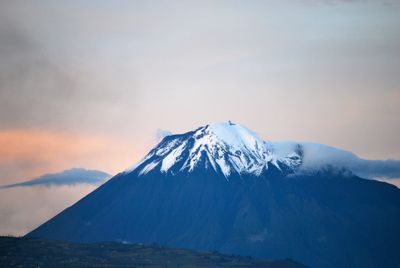
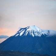
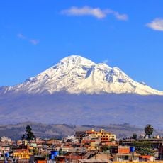
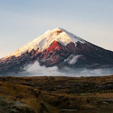
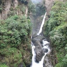
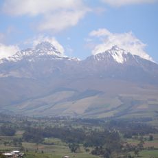
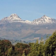
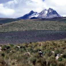
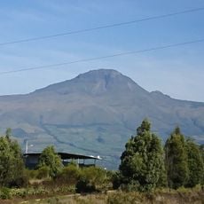
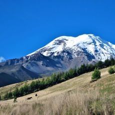
Tungurahua is a stratovolcano in Tungurahua Province, Ecuador, located inside Sangay National Park. The summit reaches 5016 meters and is made of layers of andesite rock that built up over time.
The first documented climb took place in February 1873 by German volcanologists Alphons Stübel and Wilhelm Reiss during their South American expedition. Since the 19th century, several eruptive phases have been recorded that shaped the surrounding land.
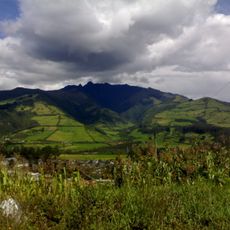
The name comes from Kichwa and means Throat of Fire, which reflects how local communities see this mountain. Families in the area have lived with eruptions for generations and learned to read the signs the mountain gives.
Monitoring stations nearby track seismic activity and gas emissions around the clock. Visitors should check current warnings from authorities as conditions can change quickly.
Between 1999 and 2016, the mountain went through a continuous eruptive phase that made the entire summit glacier disappear. Today you see only bare rock and fresh lava layers where ice once covered the top.
Location: Baños
Elevation above the sea: 5,016 m
Made from material: andesite
Part of: Sangay National Park
GPS coordinates: -1.46691,-78.44921
Latest update: December 5, 2025 22:22
Ecuador offers diverse landscapes and architectural subjects for photography. The capital city of Quito features colonial buildings such as the Basilica del Voto Nacional and the narrow streets of La Ronda, while the surrounding highlands contain active volcanoes including Cotopaxi, Chimborazo, and...
Chimborazo
40.8 km
Cotopaxi volcano
87.5 km
Quilotoa
84.9 km
Cotopaxi National Park
87.1 km
Sangay National Park
42.8 km
Sangay volcano
61.1 km
Llanganates National Park
44.2 km
Antisana volcano
114.6 km
El Altar volcano
23.2 km
Cascada el Pailón del Diablo
18.4 km
Antisana National Park
109.3 km
Illinizas Ecological Reserve
88.7 km
Illiniza volcano
95.9 km
El Chalupas
70.3 km
Chimborazo Fauna Production Reserve
44.8 km
Carihuairazo volcano
34.2 km
Refugio de vida silvestre Pasochoa
113 km
Iglesia de La Balbanera
45.1 km
Corazón volcano
106.7 km
Rumiñahui volcano
98.3 km
Cathedral Basilica of Our Lady of the Elevation
32.1 km
Nariz del Diablo
98.6 km
Atocha-La Liria Botanical Garden
31.4 km
Chimborazo
39.8 km
Our Lady of the Rosary Cathedral, Puyo
50.4 km
Martínez-Holguín House
32.8 km
Mulatos River
69.1 km
Sacred Heart Basilica
31.8 kmVisited this place? Tap the stars to rate it and share your experience / photos with the community! Try now! You can cancel it anytime.
Discover hidden gems everywhere you go!
From secret cafés to breathtaking viewpoints, skip the crowded tourist spots and find places that match your style. Our app makes it easy with voice search, smart filtering, route optimization, and insider tips from travelers worldwide. Download now for the complete mobile experience.
A unique approach to discovering new places❞
— Le Figaro
All the places worth exploring❞
— France Info
A tailor-made excursion in just a few clicks❞
— 20 Minutes