Enable Location

We need your location to show you interesting places around you

Discover nearby places

Find interesting locations and hidden gems around you

Precise directions

Get accurate directions and distances to places

Your location is never shared with other users. It's only used when you tap the location button.

Tungurahua Province

Log in to your account

Start exploring — it's free

Trusted by 61,952 travelers worldwide

Continue with Google
Continue with Apple
or

We will send you a code to connect

By continuing, you accept our Terms and Conditions and our Privacy Policy

Check your inbox

We've sent a pincode in your inbox. Please enter the code below.

Tungurahua Province, Provincial capital in central Ecuador.

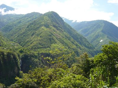
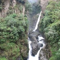
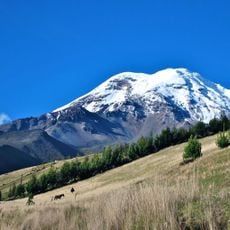
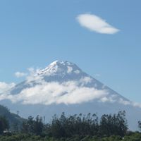
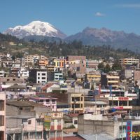
Tungurahua is a province in the Ecuadorian Andes extending across valleys and mountain ranges from 1800 to 5000 meters altitude. The area divides into nine cantons with towns, villages, hot springs, and agricultural fields along river courses.

The province was founded in 1860 during Ecuador's reorganization and served as a link between the coast and the eastern rainforest regions. Road construction in the 20th century allowed closer trade connections with neighboring provinces.

The region developed from a long tradition of craftsmanship visible today in woodwork, leather goods, and traditional textiles. Local festivals follow the agricultural calendar and feature dances, music, and costumes combining elements from pre-Columbian and European times.

The provincial capital and larger towns connect by intercity buses from major Ecuadorian cities, while smaller villages often require unpaved roads. Due to the altitude, slow acclimatization is advisable, especially for travelers from lower regions.

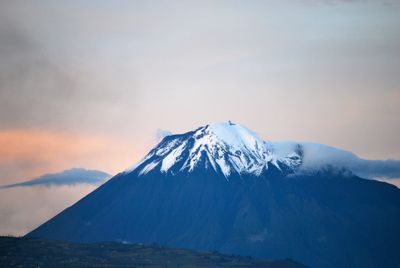
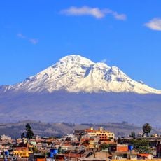
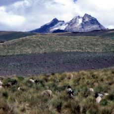
The active Tungurahua volcano sits at the western edge and occasionally sends ash clouds drifting over surrounding valleys. Residents have evacuation plans and shelters in several communities that can be reached quickly when needed.

The community of curious travelers

AroundUs brings together thousands of curated places, local tips, and hidden gems, enriched daily by 60,000 contributors worldwide.

Start exploring
Location
Inception
July 3, 1860
Capital city
Ambato
Elevation above the sea
2,718 m
Shares border with
Napo Province, Pastaza Province, Morona-Santiago Province, Chimborazo Province, Bolívar Province, Cotopaxi Province
GPS coordinates
-1.23333,-78.53333
Latest update
December 13, 2025 16:40
« Tungurahua Province - Provincial capital in central Ecuador » is provided by Around Us (aroundus.com). Images and texts are derived from Wikimedia project under a Creative Commons license. You are allowed to copy, distribute, and modify copies of this page, under the conditions set by the license, as long as this note is clearly visible.

Discover hidden gems everywhere you go!

From secret cafés to breathtaking viewpoints, skip the crowded tourist spots and find places that match your style. Our app makes it easy with voice search, smart filtering, route optimization, and insider tips from travelers worldwide. Download now for the complete mobile experience.

Around Us App Screenshot

A unique approach to discovering new places

Le Figaro

All the places worth exploring

France Info

A tailor-made excursion in just a few clicks

20 Minutes

Around Us
Travel Guide & Maps
Download

Send to your phone

QR Code
1

Open the camera app on your mobile.

2

Point at the QR code with your camera. A notification will appear.

3

Tap the notification to open the link.