Enable Location

We need your location to show you interesting places around you

Discover nearby places

Find interesting locations and hidden gems around you

Precise directions

Get accurate directions and distances to places

Your location is never shared with other users. It's only used when you tap the location button.

Cerro Vinciguerra

Log in to your account

Start exploring — it's free

Trusted by 61,990 travelers worldwide

Continue with Google
Continue with Apple
or

We will send you a code to connect

By continuing, you accept our Terms and Conditions and our Privacy Policy

Check your inbox

We've sent a pincode in your inbox. Please enter the code below.

Cerro Vinciguerra

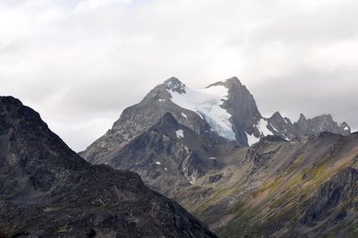
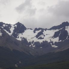
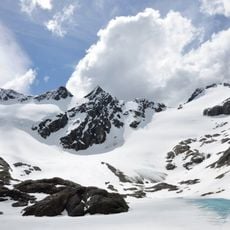
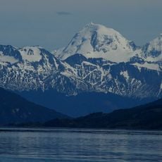
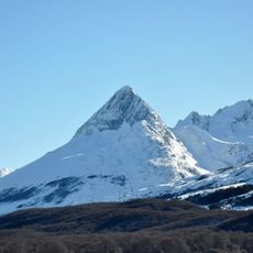
Cerro Vinciguerra, Mountain summit in Tierra del Fuego, Argentina.

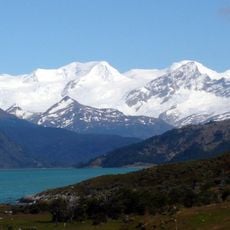
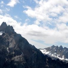
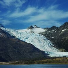
Cerro Vinciguerra is a mountain peak in the eastern Fuegian Andes that rises to 1,470 meters above sea level. The summit area includes multiple peaks with different climbing difficulties based on terrain and glacial coverage.

The peak was named in 1882 by Lieutenant Giacomo Bove to honor zoologist Decio Vinciguerra during a scientific expedition. The naming occurred when European explorers were systematically documenting the geography of southern Patagonia.

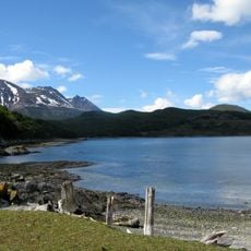
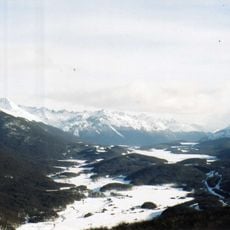
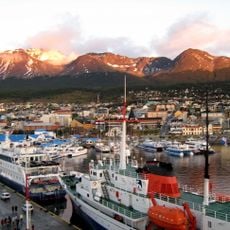
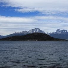
The peak serves as a landmark that shapes how local residents experience the southern Andes landscape around Ushuaia. People here connect the summit to their daily surroundings and the natural features that define their region.

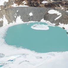
The western peak can be reached with basic hiking gear, while the eastern summit requires professional climbing equipment for glacier travel. Weather changes quickly in this area, so visitors should prepare for cold temperatures and sudden conditions regardless of starting conditions.

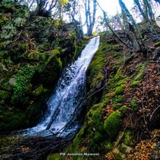
The peak's water drainage system feeds drinking water into Ushuaia through Arroyo Grande on its southern slope. The northern side contributes to Rio Olivia, meaning this mountain quietly supplies water to multiple communities in the southernmost city.

The community of curious travelers

AroundUs brings together thousands of curated places, local tips, and hidden gems, enriched daily by 60,000 contributors worldwide.

Start exploring
GPS coordinates
-54.68366,-68.47950
Latest update
December 14, 2025 13:05
« Cerro Vinciguerra - Mountain summit in Tierra del Fuego, Argentina » is provided by Around Us (aroundus.com). Images and texts are derived from Wikimedia project under a Creative Commons license. You are allowed to copy, distribute, and modify copies of this page, under the conditions set by the license, as long as this note is clearly visible.

Discover hidden gems everywhere you go!

From secret cafés to breathtaking viewpoints, skip the crowded tourist spots and find places that match your style. Our app makes it easy with voice search, smart filtering, route optimization, and insider tips from travelers worldwide. Download now for the complete mobile experience.

Around Us App Screenshot

A unique approach to discovering new places

Le Figaro

All the places worth exploring

France Info

A tailor-made excursion in just a few clicks

20 Minutes

Around Us
Travel Guide & Maps
Download

Send to your phone

QR Code
1

Open the camera app on your mobile.

2

Point at the QR code with your camera. A notification will appear.

3

Tap the notification to open the link.