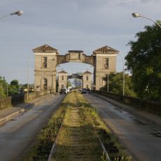
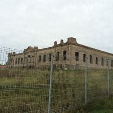
Fuerte de Santa Tecla, Colonial fortress in Bagé, Brazil
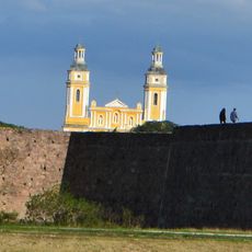
The Fuerte de Santa Tecla is a fortress with pentagonal stone and masonry walls surrounded by a moat about 9 meters (30 feet) wide, located near the banks of the Rio Negro. The remaining stone foundations reveal the military construction methods used in this border region during the colonial period.
Built in 1774 under Spanish command, the fortress served military control along a border region. It endured multiple sieges and reconstructions before being definitively destroyed by Portuguese forces in 1801.
The fortress takes its name from Saint Thecla, reflecting the strong Catholic traditions of the colonial era in the region. This choice shows how faith and military purpose were intertwined during the settlement period.
The fortress remains are protected as cultural heritage by Brazil's National Institute for Historical and Artistic Heritage since 1970. Visitors should wear sturdy footwear as the foundations are uneven and situated along the riverbank.
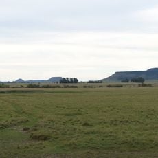
The fortress occupied a strategic location where several rivers originate, making it possible to control movements between Portuguese and Spanish territories. This position made it a crucial outpost for the powers contending over the region.
Location: Bagé
GPS coordinates: -31.26389,-54.09028
Latest update: December 13, 2025 11:43
Baron of Mauá International Bridge
160.3 km
Estadio Arquitecto Antonio Eleuterio Ubilla
122.2 km
Posta del Chuy
124.7 km
Forte de D. Pedro II de Caçapava
101.7 km
Rincon de tres cerros
150.6 km
Dom Diogo de Souza Museum
7.7 km
Estádio Pedra Moura
7.8 km
Ponte Marechal José de Abreu
138.5 km
Cathedral of Melo
123.9 km
Palacete Pedro Osório
6.9 km
Regional History Museum of Melo
123.8 km
Palácio Farroupilha
96.1 km
Museu da Gravura Brasileira
5.9 km
Stones of Segredo Park
95.9 km
Casa de Ulhôa Cintra
101.4 km
Casa de Antônio Augusto Borges de Medeiros
101.3 km
Catedral de São Sebastião
8.2 km
Igreja Matriz Nossa Senhora da Assunção
101.4 km
Caixa d'Água
63.8 km
Antiga Escola de Agronomia Eliseu Maciel
175.1 km
Castelo Simões Lopes
174.4 km
Antiga Enfermaria Militar
158.8 km
Prefeitura Municipal
63.8 km
Forum
101.4 km
Centro Histórico de Bagé
8.2 km
Centro de detención del Regimiento de Caballería No. 3
145.9 km
Caixa D'Água localizada na Praça Piratinino de Almeida, antigo Largo da Caridade
174.7 km
Banco Pelotense
175.1 kmVisited this place? Tap the stars to rate it and share your experience / photos with the community! Try now! You can cancel it anytime.
Discover hidden gems everywhere you go!
From secret cafés to breathtaking viewpoints, skip the crowded tourist spots and find places that match your style. Our app makes it easy with voice search, smart filtering, route optimization, and insider tips from travelers worldwide. Download now for the complete mobile experience.
A unique approach to discovering new places❞
— Le Figaro
All the places worth exploring❞
— France Info
A tailor-made excursion in just a few clicks❞
— 20 Minutes