Enable Location

We need your location to show you interesting places around you

Discover nearby places

Find interesting locations and hidden gems around you

Precise directions

Get accurate directions and distances to places

Your location is never shared with other users. It's only used when you tap the location button.

Caminho das Tropas

Log in to your account

Start exploring — it's free

Trusted by 63,118 travelers worldwide

Continue with Google
Continue with Apple
or

We will send you a code to connect

By continuing, you accept our Terms and Conditions and our Privacy Policy

Check your inbox

We've sent a pincode in your inbox. Please enter the code below.

Caminho das Tropas
Discussion Reviews 1 Photos
16.4k Popularity

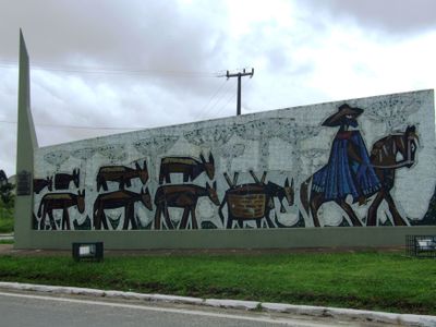
Caminho das Tropas, Historic transport route in Lapa, Paraná, Brazil

The Caminho das Tropas crossed mountainous regions and plateaus in the Brazilian interior, connecting the southern provinces with the southeast through extensive land trails traveled by muleteers and their pack animals during the eighteenth and nineteenth centuries over distances exceeding 930 miles (1,500 kilometers).

Initiated around 1731 by Portuguese explorer Cristóvão Pereira de Abreu, the route was developed to transport cattle and mules from Rio Grande do Sul to São Paulo, replacing dangerous maritime routes and providing essential animals for the mining economy of Minas Gerais during the gold rush.

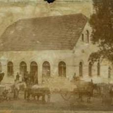
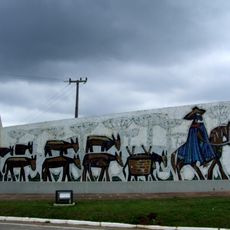
The muleteers who traveled the route for months established culinary traditions such as feijão tropeiro and influenced the cultural formation of the southern and southeastern regions, leaving marks on local festivals, music, and customs in cities along the path that connected colonial Brazil.

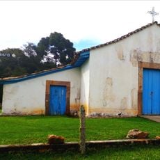
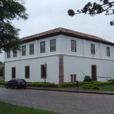
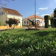
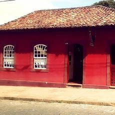
The route passed through important trade centers such as Sorocaba, Curitiba, and Lapa, where animal fairs were held and muleteers rested at stopping points that later evolved into cities, establishing a network of territorial integration in colonial Brazil with inspection posts collecting taxes.

Otávio Reis, born in Porto Amazonas, was considered the last muleteer to travel the historic route, completing his journeys at 100 years of age in 2014 and preserving living memories of a concluded era of land transport with mules and horses through the Brazilian interior.

The community of curious travelers

AroundUs brings together thousands of curated places, local tips, and hidden gems, enriched daily by 60,000 contributors worldwide.

Start exploring
Location
GPS coordinates
-25.78897,-49.86806
Latest update
November 28, 2025 15:17
Reviews
Share your experience

No review yet

Discussions
Start a discussion...

No discussion yet

« Caminho das Tropas - Historic transport route in Lapa, Paraná, Brazil » is provided by Around Us (aroundus.com). Images and texts are derived from Wikimedia project under a Creative Commons license. You are allowed to copy, distribute, and modify copies of this page, under the conditions set by the license, as long as this note is clearly visible.

Discover hidden gems everywhere you go!

From secret cafés to breathtaking viewpoints, skip the crowded tourist spots and find places that match your style. Our app makes it easy with voice search, smart filtering, route optimization, and insider tips from travelers worldwide. Download now for the complete mobile experience.

Around Us App Screenshot

A unique approach to discovering new places

Le Figaro

All the places worth exploring

France Info

A tailor-made excursion in just a few clicks

20 Minutes

Around Us
Travel Guide & Maps
Download

Send to your phone

QR Code
1

Open the camera app on your mobile.

2

Point at the QR code with your camera. A notification will appear.

3

Tap the notification to open the link.