Jurupará State Park, State park in Ibiúna, Brazil
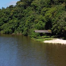
Jurupará State Park is a 26,250-hectare protected area in Ibiúna and Piedade, São Paulo, covered by dense Atlantic Forest and crossed by streams feeding the Juquiá, Juquiá-Guaçu and Peixe rivers. Its terrain runs from 700 to 1,119 metres at Laje do Descalvado. Two operational bases give access: Juquiá-Bonito, with trails to the Juquiá-Bonito, Rio Bonito and Paredão waterfalls, and Juquiá-Guaçu, with the Descalvado Peak interpretive trail.
The protected area was officially established in 1992 and placed under state management. A consultative council and management plan were later created to ensure the forest's long-term care.
The park's name comes from the Tupi-Guarani word Jurupará, and the area is a core zone of the Atlantic Forest Biosphere Reserve, part of the São Paulo Green Belt. Its resident population lives from subsistence farming and extraction of palm hearts, ferns, bromeliads and orchids, practices that park managers list among the main threats to the forest.
As of 2010 there was no regulated public use, and small numbers of visitors entered at their own risk without supervision. Trails leave from the Juquiá-Bonito base to the Juquiá-Bonito, Rio Bonito and Paredão waterfalls, while the Juquiá-Guaçu base gives access to the Descalvado Peak interpretive trail and a cycling route between the two park roads.
The land harbors dozens of endangered species under state monitoring, along with hydroelectric plants that generate power within the park. This combination of nature conservation and energy production makes managing the place particularly complex.
The community of curious travelers
AroundUs brings together thousands of curated places, local tips, and hidden gems, enriched daily by 92,953 contributors worldwide.