Enable Location

We need your location to show you interesting places around you

Discover nearby places

Find interesting locations and hidden gems around you

Precise directions

Get accurate directions and distances to places

Your location is never shared with other users. It's only used when you tap the location button.

Mairiporã

Log in to your account

Start exploring — it's free

Trusted by 63,120 travelers worldwide

Continue with Google
Continue with Apple
or

We will send you a code to connect

By continuing, you accept our Terms and Conditions and our Privacy Policy

Check your inbox

We've sent a pincode in your inbox. Please enter the code below.

Discussion Reviews 2 Photos
46.1k Popularity

Mairiporã, Municipal district in São Paulo, Brazil.

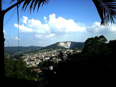
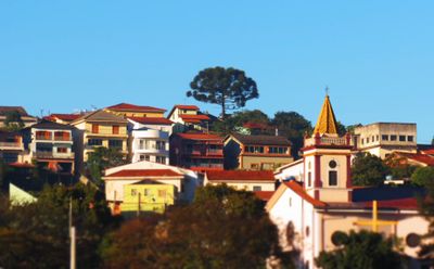
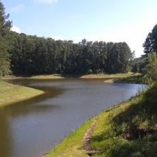
Mairiporã is a municipality in the São Paulo metropolitan area and spreads across hilly terrain with sections of the Serra da Cantareira mountain range. The landscape features forests and highland areas that shape the character of the region.

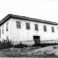
The area separated from Guarulhos in 1889 and was originally called Juqueri before receiving its current name in 1948. This renaming reflected a fresh start for the then-growing municipality.

The municipality is closely tied to outdoor sports, particularly Enduro racing, where local athletes regularly compete in national championships. This passion for motorsport challenges shapes the lives of many residents.

Access is provided by the BR-381 highway and SP-023 road network, which offer direct connections to São Paulo city. These routes ensure good accessibility from across the broader region.

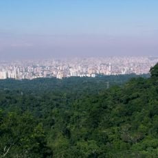
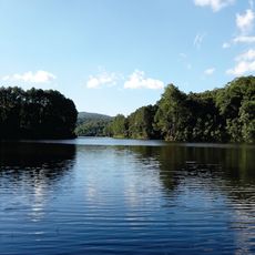
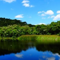
The Cantareira State Park here encompasses thousands of hectares of protected forest and serves as a primary drinking water source for the São Paulo metropolitan region. This forest area supplies millions of people with clean water.

The community of curious travelers

AroundUs brings together thousands of curated places, local tips, and hidden gems, enriched daily by 60,000 contributors worldwide.

Start exploring
Location
Elevation above the sea
752 m
Shares border with
São Paulo, Franco da Rocha, Atibaia, Bom Jesus dos Perdões, Caieiras, Guarulhos, Nazaré Paulista
GPS coordinates
-23.31889,-46.58694
Latest update
December 14, 2025 19:59
Reviews
Share your experience

No review yet

Discussions
Start a discussion...

No discussion yet

« Mairiporã - Municipal district in São Paulo, Brazil » is provided by Around Us (aroundus.com). Images and texts are derived from Wikimedia project under a Creative Commons license. You are allowed to copy, distribute, and modify copies of this page, under the conditions set by the license, as long as this note is clearly visible.

Discover hidden gems everywhere you go!

From secret cafés to breathtaking viewpoints, skip the crowded tourist spots and find places that match your style. Our app makes it easy with voice search, smart filtering, route optimization, and insider tips from travelers worldwide. Download now for the complete mobile experience.

Around Us App Screenshot

A unique approach to discovering new places

Le Figaro

All the places worth exploring

France Info

A tailor-made excursion in just a few clicks

20 Minutes

Around Us
Travel Guide & Maps
Download

Send to your phone

QR Code
1

Open the camera app on your mobile.

2

Point at the QR code with your camera. A notification will appear.

3

Tap the notification to open the link.