São Bento do Sapucaí, Mountain municipality in São Paulo state, Brazil
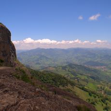
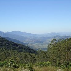
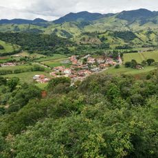
São Bento do Sapucaí is a mountain municipality in São Paulo state located within the Serra da Mantiqueira region at an elevation of about 886 meters. The landscape is characterized by steep terrain and forested hillsides that define this part of southeastern Brazil.
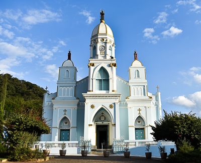
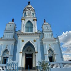
The municipality was founded in 1832 when José Pereira Alves and Ignez Leite de Toledo donated land for building Saint Benedict's church. This act formed the basis for settlement and development in the mountain region.
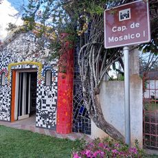
The Matrix Church stands at the center of town life with artworks created by regional craftspeople during its construction. Residents and visitors gather there to experience the local heritage through its decoration and design.
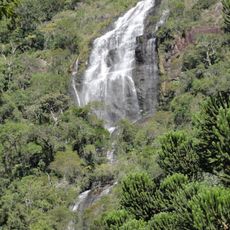
The mountain terrain is best explored by foot on established trails that wind through local forests. Bring sturdy shoes and water, as the paths can be steep and demand physical effort.
A large portion of the municipality is protected by an Environmental Protection Area that preserves forests and wildlife habitats. This conservation creates a balance between nature and human settlement that visitors can sense while exploring the region.
Location: São Paulo
Inception: 1832
Elevation above the sea: 886 m
Shares border with: Campos do Jordão, Brasópolis, Gonçalves, Paraisópolis, Piranguçu, Santo Antônio do Pinhal, Sapucaí-Mirim
Website: http://saobentodosapucai.sp.gov.br
GPS coordinates: -22.68889,-45.73083
Latest update: December 6, 2025 21:30
Amantikir
17.1 km
Pico do Itapeva
22.3 km
Boa Vista Palace
13.2 km
Pico Agudo
21.1 km
Pico dos Dias Observatory
23 km
Museu Histórico Pedagógico Dom Pedro I e Dona Leopoldina
37.8 km
Campos do Jordão State Park
21 km
Pedra de São Domingos
23.6 km
Basilica of the Good Lord Jesus, Tremembé
35.4 km
Q! Emporium
37.9 km
Mananciais de Campos do Jordão State Park
19.3 km
Casa da Xilogravura
15.5 km
O Verdadeiro Sítio do Picapau Amarelo
34.1 km
Mantiqueira Mosaic
16.7 km
Sapucaí Mirim Environmental Protection Area
3.4 km
Toldi Falls
9.5 km
Fernão Dias Environmental Protection Area
31 km
Palacete Palmeira
37.9 km
Campos do Jordão Environmental Protection Area
19.9 km
Henriques waterfall
18 km
Mirante Lageado 2
16.2 km
Igreja Matriz de São Bento do Sapucaí
89 m
Busto de Homem de Mello
38.4 km
1.6m Perkin-Elmer
22.9 km
Capelinha de Mosaico
494 m
0.6m Boller & Chivens
22.9 km
Gruta dos Crioulos
14.3 km
Mother Curch of Our Lady of Sorrows
13.3 kmVisited this place? Tap the stars to rate it and share your experience / photos with the community! Try now! You can cancel it anytime.
Discover hidden gems everywhere you go!
From secret cafés to breathtaking viewpoints, skip the crowded tourist spots and find places that match your style. Our app makes it easy with voice search, smart filtering, route optimization, and insider tips from travelers worldwide. Download now for the complete mobile experience.
A unique approach to discovering new places❞
— Le Figaro
All the places worth exploring❞
— France Info
A tailor-made excursion in just a few clicks❞
— 20 Minutes