Vassouras, Historical municipality in Rio de Janeiro, Brazil
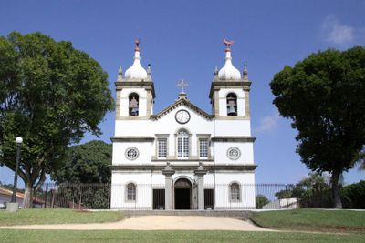
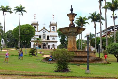
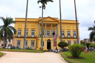
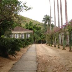
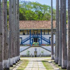
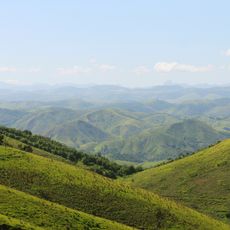
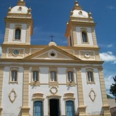
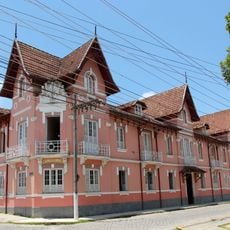
Vassouras is a municipality located in the inland region of Rio de Janeiro state on elevated terrain. The town spreads across hills with a downtown area containing colonial-era buildings alongside more recent construction.
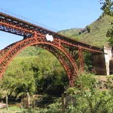
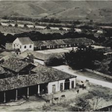
The municipality became a major coffee production center during the 1800s, playing a key role in Brazil's economy at that time. Many buildings and infrastructure from this era remain visible in the landscape today.
The town's buildings reflect the colonial period when coffee plantations shaped life here. Walking through the streets, you see structures that tell the story of how the community was organized around farming.
The town is accessible by bus from Rio de Janeiro, though the journey takes a couple of hours through inland roads. Wear comfortable shoes since the terrain is hilly and many areas are best explored on foot.
The municipality keeps detailed records documenting how labor practices changed over time as the region transformed. These records provide a window into an important chapter of Brazil's past that many visitors find thought-provoking.
Location: Rio de Janeiro
Elevation above the sea: 517 m
Shares border with: Barra do Piraí, Engenheiro Paulo de Frontin, Mendes, Miguel Pereira, Paraíba do Sul, Paty do Alferes, Rio das Flores, Valença
Website: http://vassouras.rj.gov.br
GPS coordinates: -22.40389,-43.66278
Latest update: December 14, 2025 20:20
Museu Casa da Hera
563 m
Viaduto Paulo de Frontin
23.8 km
Terra dos Dinos
17.5 km
Fazenda São Luiz da Boa Sorte
22.7 km
Serra da Concórdia State Park
9.9 kmFazenda Santa Eufrásia
8.3 km
Fazenda do Pocinho
12.4 km
Our Lady of Glory Cathedral, Valença
18 kmFazenda Santo Antônio do Paiol
19.4 kmSolar dos Nogueira
18.1 kmConjunto do Centro Histórico
18.1 kmCatedral de Nossa Senhora da Glória
18 kmAnnex of Deputy Luiz Pinto Education Institute
18 kmPublic Jail of Valença
17.8 kmPraça da Bandeira
18 kmColégio Sagrado Coração de Jesus e antigo Solar Moreno D’Alagão
18.1 kmAntiga Fábrica de Rendas e Bordados e construções anexas
18.2 kmPraça Dr. Paulo de Frontin
18 kmColégio Estadual Benjamin Guimarães
18 kmSolar dos Calmon
18.1 kmAntigas Oficinas e Escritórios da Rede Ferroviária Central
18 kmIgreja Matriz de Nossa Senhora da Conceição
24.9 km
Hotel Valenciano
18 kmSolar dos Paiva Mattos
18 kmSolar dos Farina e dos Ariosa
18 kmSanta Casa de Misericórdia
17.9 kmPraça XV de Novembro
18.1 kmFirst School of Valença
17.5 kmVisited this place? Tap the stars to rate it and share your experience / photos with the community! Try now! You can cancel it anytime.
Discover hidden gems everywhere you go!
From secret cafés to breathtaking viewpoints, skip the crowded tourist spots and find places that match your style. Our app makes it easy with voice search, smart filtering, route optimization, and insider tips from travelers worldwide. Download now for the complete mobile experience.
A unique approach to discovering new places❞
— Le Figaro
All the places worth exploring❞
— France Info
A tailor-made excursion in just a few clicks❞
— 20 Minutes