Chest opened
+${chestReward.xp} XP
Explorer
NOUVEAU ×${chestReward.collectible.quantity}
tapez pour fermer
Chest locked

Open chests in the app

Around Us is built for your phone — chests unlock when you walk, explore and capture nearby places.

Enable Location

We need your location to show you interesting places around you

Discover nearby places

Find interesting locations and hidden gems around you

Precise directions

Get accurate directions and distances to places

Your location is never shared with other users. It's only used when you tap the location button.

Parana River Basin

Log in to your account

Start exploring — it's free

Trusted by 72,884 travelers worldwide

Continue with Google
Continue with Apple
or

We will send you a code to connect

By continuing, you accept our Terms and Conditions and our Privacy Policy

Check your inbox

We've sent a pincode in your inbox. Please enter the code below.

Parana River Basin
Discussion Reviews 1 Photos
12.6k Popularity

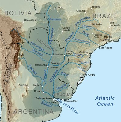
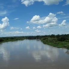
Parana River Basin, Major drainage basin in South America.

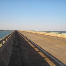
The Paraná River Basin is a major drainage system spanning multiple South American countries and connecting four nations through its waterways. The system includes numerous rivers and streams on the surface, as well as a vast underground aquifer beneath it that supplies water to millions of people.

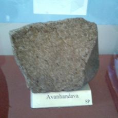
The drainage system formed through geological processes spanning millions of years, with layers from different prehistoric eras stacking upon each other over time. Scientific study of the region began less than two centuries ago when governments first systematically investigated its resources and structure.

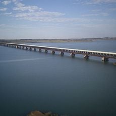
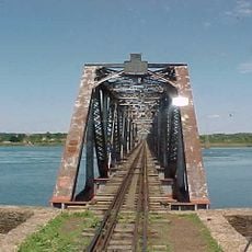
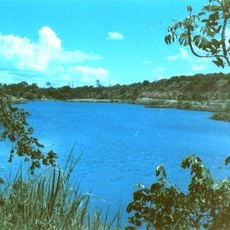
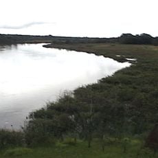
The river system has drawn people to settle and work, shaping the towns and villages that developed along its banks over generations. Today it remains a place where fishing communities, farmers, and workers at hydroelectric facilities depend on the waters and connect across borders.

The best time for exploring is during the dry season, when water levels are lower and riverbanks become more accessible for walking and viewing. Access points are scattered across local communities, and it helps to ask locals for directions to the nearest launching points or observation areas.

Beneath the surface lie rock layers older than 300 million years that originated from ancient seas covering the world in prehistoric times. These ancient sediments tell the story of how this part of the earth transformed over incredibly long periods, revealing evidence of vanished oceans and shifting continents.

The community of curious travelers

AroundUs brings together thousands of curated places, local tips, and hidden gems, enriched daily by 60,000 contributors worldwide.

Start exploring
Part of
Río de la Plata Basin
GPS coordinates
-21.46107,-51.20924
Latest update
December 7, 2025 20:44
Reviews
Share your experience

No review yet

Discussions
Start a discussion...

No discussion yet

« Parana River Basin - Major drainage basin in South America » is provided by Around Us (aroundus.com). Images and texts are derived from Wikimedia project under a Creative Commons license. You are allowed to copy, distribute, and modify copies of this page, under the conditions set by the license, as long as this note is clearly visible.

Discover hidden gems everywhere you go!

From secret cafés to breathtaking viewpoints, skip the crowded tourist spots and find places that match your style. Our app makes it easy with voice search, smart filtering, route optimization, and insider tips from travelers worldwide. Download now for the complete mobile experience.

Around Us App Screenshot

A unique approach to discovering new places

Le Figaro

All the places worth exploring

France Info

A tailor-made excursion in just a few clicks

20 Minutes

Around Us
Travel Guide & Maps
Download

Send to your phone

QR Code
1

Open the camera app on your mobile.

2

Point at the QR code with your camera. A notification will appear.

3

Tap the notification to open the link.