Rio Doce State Park, State park and Ramsar site in Minas Gerais, Brazil.
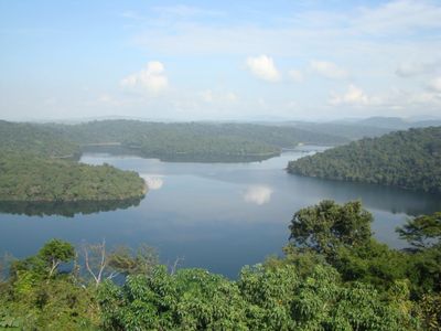
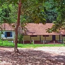
Rio Doce State Park spans a large forested area with numerous natural lakes that together form one of Brazil's largest freshwater systems. The terrain sits across three municipalities and features dense forest cover alongside open water areas.
The conservation area was established in 1944 and became the first state-level protected zone in the region at that time. Its creation was part of an early effort to preserve Atlantic Forest landscapes.
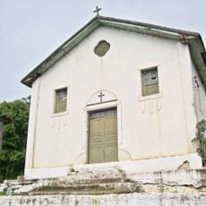
The region was home to the Borun people, who lived among the forests and lakes before Portuguese colonization arrived. Today it serves as a place where visitors come to experience and respect the natural world.
The park is open Tuesday through Sunday and offers visitors facilities including dining and overnight accommodation. Boat trips on the lakes are available, allowing guests to explore the water more closely.
One of the largest lakes here reaches significant depth and spans a broad area, making it an important habitat for many native fish species. Visitors often find this body of water particularly striking when they encounter it.
Location: Dionísio
Location: Marliéria
Location: Timóteo
Inception: 1944
Elevation above the sea: 289 m
Email: periodoce@meioambiente.mg.gov.br
GPS coordinates: -19.65361,-42.53556
Latest update: December 8, 2025 13:42
Angélica College
17.9 km
Saint Sebastian Mother Church
16.8 km
Cathedral of san sebastian
19.6 km
Estádio Louis Ensch
17.4 km
Centro Cultural Usiminas
17.6 km
Our Lady of Hope church
16.8 km
Saint Joseph the Worker church
17.2 km
Cristo da Paz
29.8 km
Escola Estadual Professor Pedro Calmon
17 km
Carmelo Santíssima Trindade
24.2 km
Shrine of Our Lady of Piety
21.9 km
Grande Hotel Ipatinga
20.1 km
Estádio João Teotônio Ferreira
20.6 km
Sobrado dos Pereira
16.6 km
Our Lady Help of Christians chapel
16.9 km
Moviecom Ipatinga
17.9 km
Cine Alvorada
20 km
Teatro do Instituto Católico de Minas Gerais
17.3 km
Academia Olguin
17.4 km
Teatro Zélia Olguin
17.6 km
Capela Nossa Senhora da Vitória
28.4 km
Pontilhão de ferro entre os bairros Centro e Veneza
19.7 km
Árvore ficus elástica
18.2 km
Casa dos Ferroviários
19.9 km
Estádio Josemar Soares
19.9 km
Escola Técnica de Metalurgia
17.5 km
Estação Memória Zeza Souto
19.5 km
Fazendinha
19.2 kmVisited this place? Tap the stars to rate it and share your experience / photos with the community! Try now! You can cancel it anytime.
Discover hidden gems everywhere you go!
From secret cafés to breathtaking viewpoints, skip the crowded tourist spots and find places that match your style. Our app makes it easy with voice search, smart filtering, route optimization, and insider tips from travelers worldwide. Download now for the complete mobile experience.
A unique approach to discovering new places❞
— Le Figaro
All the places worth exploring❞
— France Info
A tailor-made excursion in just a few clicks❞
— 20 Minutes