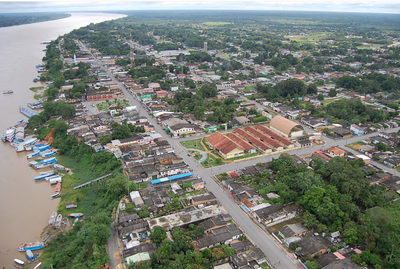
Manicoré, Municipality in Amazonas, Brazil.
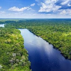
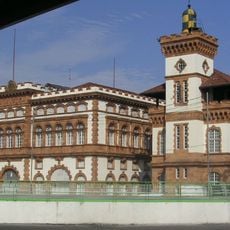
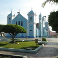
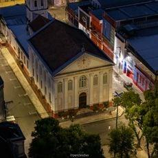
Manicoré is an administrative division in southeastern Amazonas, situated along the Madeira River in the heart of the Amazon region. The settlement features a compact downtown area with an airport, medical services, and schools that serve the surrounding communities.
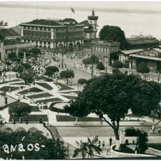
The area started as a small trading post in the late 1700s and later received official municipal status. This evolution reflects the gradual colonization of the Amazon region by Portuguese settlers.
The population of 57,405 residents maintains a mixture of Portuguese colonial and indigenous traditions through local festivals and regional cuisine.
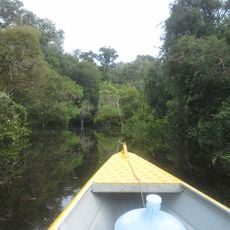
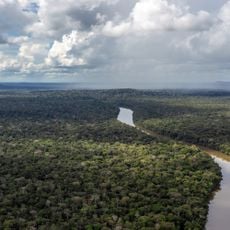
Boats are the best way to travel in this area, as the Madeira River is the main transport route. Keep in mind that infrastructure is basic, and the rainy season can affect accessibility and travel conditions.
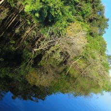
Two rivers meet at a natural junction that shapes daily life and the local economy. This water crossing point has influenced fishing and farming practices for many generations.
GPS coordinates: -5.80462,-61.28948
Latest update: December 7, 2025 19:25
Madeira-Mamoré Railroad
438.7 km
Rio Negro Bridge
327.4 km
Mercado Adolpho Lisboa
328.2 km
Samuel Hydroelectric Dam
405.9 km
Amazon River
287.3 km
Customs building (Manaus)
328.4 km
Juruena National Park
416.7 km
Campos Amazônicos National Park
305.5 km
Mapinguari National Park
456 km
Faculdade de Direito da Universidade Federal do Amazonas
328.3 km
Juma Sustainable Development Reserve
105.2 km
Ituxi Extractive Reserve
489 km
Aquariquara Extractive Reserve
448.1 km
Association of Machadinho Rubber Tappers
410.6 km
Catuá-Ipixuna Extractive Reserve
386.5 km
Lago do Cuniã Extractive Reserve
369.7 km
Lago do Capanã Grande Extractive Reserve
97.9 km
Customs lighthouse
328.4 km
Madeira-Mamoré Railroad, rail yard
438.5 km
Castanheira do Estádio Aluízio Pinheiro Ferreira
438 km
Borba Cathedral
245.6 km
Capela de Santo Antônio de Pádua
444.7 km
Conjunto arquitetônico Porto de Manaus
328.3 km
Church Our Lady of the Remedies
328.4 km
Três Caixas d'Água
438.2 km
Indigenous Territory Tenharim do Igarapé Preto
298.5 km
Cathedral of St. Ann and St. Sebastian, Coari
280.8 km
Prédio da Administração Central da EFMM
438.4 kmVisited this place? Tap the stars to rate it and share your experience / photos with the community! Try now! You can cancel it anytime.
Discover hidden gems everywhere you go!
From secret cafés to breathtaking viewpoints, skip the crowded tourist spots and find places that match your style. Our app makes it easy with voice search, smart filtering, route optimization, and insider tips from travelers worldwide. Download now for the complete mobile experience.
A unique approach to discovering new places❞
— Le Figaro
All the places worth exploring❞
— France Info
A tailor-made excursion in just a few clicks❞
— 20 Minutes