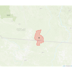
Juruena National Park, Protected rainforest reserve in northern Mato Grosso and southern Amazonas, Brazil.
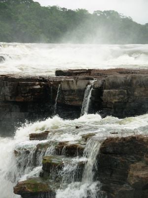
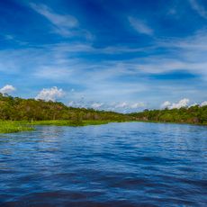
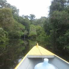
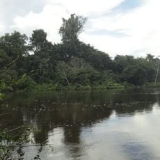
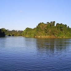
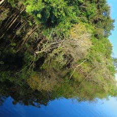
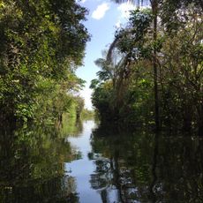
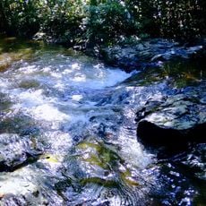
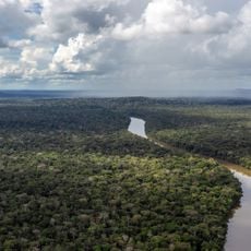
Juruena National Park is a protected rainforest reserve spanning dense tropical forests, open woodlands, and river systems across the border of northern Mato Grosso and southern Amazonas. The terrain rises from flat lowlands to rolling hills, creating varied habitats throughout the region.
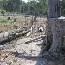
The park was established in 2006 as part of Brazil's efforts to protect Amazon regions from agricultural and settlement expansion. Its creation represented a significant commitment to safeguarding the rainforest from deforestation pressures.
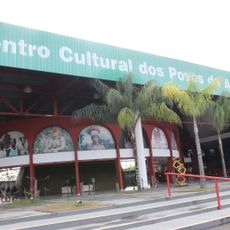
The Kayabi and Apiacás peoples have called this region home for generations and maintain traditional ways of life here. Visitors may notice how their presence shapes the landscape and how the forest is used respectfully.
Entry to the park requires permits from the Chico Mendes Institute for Biodiversity Conservation, which must be arranged in advance. Planning your visit ahead of time will ensure you have the necessary authorization to explore the reserve.
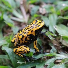
The park harbors more than 400 bird species, with many found nowhere else in southern Amazonia. This remarkable bird diversity makes it a sought-after destination for those interested in ornithology and wildlife observation.
Location: Mato Grosso
Location: Amazonas
Inception: 2006
Elevation above the sea: 136 m
Operator: Instituto Chico Mendes de Conservação da Biodiversidade
GPS coordinates: -7.86722,-58.14306
Latest update: December 13, 2025 11:41
Mercado Adolpho Lisboa
566 km
Rio Negro Palace
566.2 km
Forte de São José da Barra do Rio Negro
562.3 km
Amazônia National Park
407.9 km
Benjamin Constant suspended bridge
566 km
Campos Amazônicos National Park
293.7 km
Tapajós hydroelectric complex
417.5 km
Parque Senador Jefferson Péres
566 km
Cristalino State Park
330.5 km
Jamanxim National Park
345.5 km
Rio Novo National Park
207.8 km
Juma Sustainable Development Reserve
322.5 km
Chaminé Theatre
565.8 km
Jamanxim National Forest
266.8 km
Tapajós Environmental Protection Area
218.3 km
Aquariquara Extractive Reserve
480.2 km
Association of Machadinho Rubber Tappers
458.3 km
Lago do Cuniã Extractive Reserve
591.4 km
Crepori National Forest
197.6 km
Itaituba II National Forest
327.3 km
Trairão National Forest
437.2 km
Moronas Lighthouse
563.5 km
Lago do Capanã Grande Extractive Reserve
513.3 km
Terra Indígena Panará
471.6 km
Centro Cultural dos Povos da Amazônia
565.3 km
Borba Cathedral
419.5 km
Church Our Lady of the Remedies
566 km
Indigenous Territory Tenharim do Igarapé Preto
375.7 kmVisited this place? Tap the stars to rate it and share your experience / photos with the community! Try now! You can cancel it anytime.
Discover hidden gems everywhere you go!
From secret cafés to breathtaking viewpoints, skip the crowded tourist spots and find places that match your style. Our app makes it easy with voice search, smart filtering, route optimization, and insider tips from travelers worldwide. Download now for the complete mobile experience.
A unique approach to discovering new places❞
— Le Figaro
All the places worth exploring❞
— France Info
A tailor-made excursion in just a few clicks❞
— 20 Minutes