Serra da Capivara National Park

Log in to your account

AroundUs is a community-driven map of interesting places, built by curious explorers like you. It grows with every review, story, and photo you share.
Connect to save your favorite spots, contribute locations, and create personalized routes.
By continuing, you accept our Terms and Conditions and our Privacy Policy
Add to collection
Map
Suggest a change
Share

Serra da Capivara National Park, Archaeological nature reserve in Piauí, Brazil

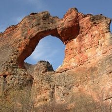
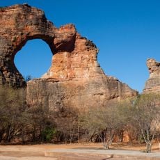
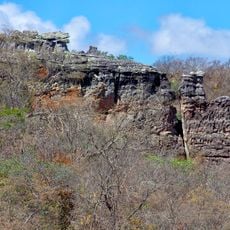
Serra da Capivara National Park is a nature reserve in northeastern Brazil covering 129,140 hectares of dry terrain with sandstone cliffs, valleys, and plains in the caatinga region. The landscape consists of red and beige rock formations rising above flat valley floors, connected by narrow canyons and stone pathways.

Archaeological discoveries at Boqueirão da Pedra Furada point to human settlements dating back around 50,000 years, challenging theories about the first inhabitants of the Americas. The park was established in 1979 to protect the prehistoric sites and declared a World Heritage Site in 1991.

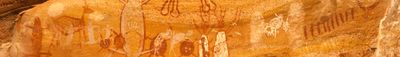
The sandstone walls display more than 39,000 rock paintings in red ochre, documenting hunting scenes, animals, and ritual practices of early inhabitants. Visitors follow trails to sheltered rock overhangs where people found protection for thousands of years.

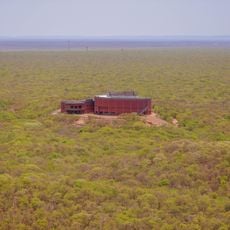
Access to the park is through São Raimundo Nonato municipality, where guides lead tours to the archaeological sites and geological formations. The best time to visit is between June and December, when temperatures are slightly cooler and trails remain drier.

Local capuchin monkeys demonstrate advanced tool usage by cracking nuts with stones, displaying complex foraging strategies passed down through generations. The monkeys carefully select flat stones as anvils and heavy pebbles as hammers to open the hard shells.

Location: São Raimundo Nonato

Location: Canto do Buriti

Location: Coronel José Dias

Location: São João da Varjota

Location: Piauí

Inception: 1979

Operator: Instituto Chico Mendes de Conservação da Biodiversidade

GPS coordinates: -8.66670,-42.55000

Latest update: December 4, 2025 19:02

Brazil northeast natural and cultural sites

Brazil's Northeast region extends from coast to inland with national parks, colonial towns and natural areas. From the dunes of Lençóis Maranhenses to the cliffs of Morro Branco, the region contains geological formations, waterfalls and historical sites.

Reviews

Visited this place? Tap the stars to rate it and share your experience / photos with the community! Try now! You can cancel it anytime.

« Serra da Capivara National Park - Archaeological nature reserve in Piauí, Brazil » is provided by Around Us (aroundus.com). Images and texts are derived from Wikimedia project under a Creative Commons license. You are allowed to copy, distribute, and modify copies of this page, under the conditions set by the license, as long as this note is clearly visible.

Discover hidden gems everywhere you go!

From secret cafés to breathtaking viewpoints, skip the crowded tourist spots and find places that match your style. Our app makes it easy with voice search, smart filtering, route optimization, and insider tips from travelers worldwide. Download now for the complete mobile experience.

Around Us App Screenshot

A unique approach to discovering new places

Le Figaro

All the places worth exploring

France Info

A tailor-made excursion in just a few clicks

20 Minutes