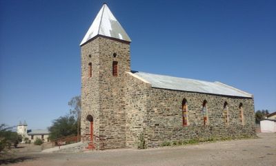
Bethanie, Historic mission settlement in Karas Region, Namibia
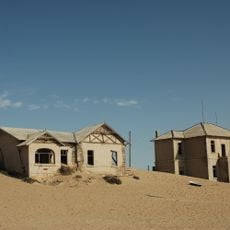
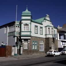
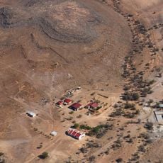
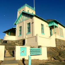
Bethanie is a mission village in southern Namibia situated in open countryside with scattered dwellings and basic structures. The settlement spreads loosely across the landscape with simple buildings and some older religious structures that mark its core.
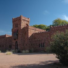
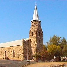
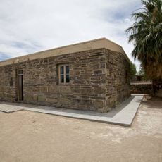
A missionary established a religious outpost here in 1814 and built a house that later became a National Monument. Decades later, an important land agreement reshaped the political future of the region.
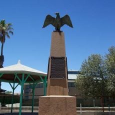
The village keeps its Nama heritage alive through traditional music and community gatherings held throughout the year. Local residents gather in and around the older buildings to celebrate their customs and shared history.
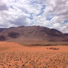
Reaching Bethanie requires personal transportation, as public transport options are limited or unavailable in this remote area. The village has few accommodation choices and offers only basic services and facilities.
A major land agreement was signed here that triggered colonization of the entire region. This event played a key role in shaping Namibia's past and is often overlooked by visitors to the village.
Location: Berseba Constituency
Location: Karas Region
GPS coordinates: -26.50056,17.16000
Latest update: December 6, 2025 17:42
Berlin has many stories beyond its famous attractions. This collection shows places where the city's complex history comes alive through creative reuse and unexpected discoveries. The old Tempelhof Airport is now a sprawling public park where people jog and cycle on former runways. Teufelsberg rises...
Fish River Canyon
141.8 km
Gibeon
164.8 km
Karas Region
97.2 km
Apollo 11 Cave
139.2 km
Quiver Tree Forest
107.3 km
Sperrgebiet
153.8 km
ǀAi-ǀAis/Richtersveld Transfrontier Park
158.8 km
Duwisib Castle
151.6 km
Brukkaros Mountain
94.9 km
Giants' playground
110.9 km
Magistrate's Residence
200.5 km
Lüderitz Memorial
198.7 km
Kaiser-Wilhelm-II.-Denkmal
91.4 km
Deutsche Bank Afrika Building
200.4 km
Farm Aar
90.8 km
Losberg
196.2 km
Nai-Ams Fortification
60.4 km
Eagle Monument
93 km
Rhenish Mission Church
97.2 km
Kolmannskuppe
193.2 km
Josef Fredericks' House
206 m
Schlangkopf
75.2 km
Erholungsgebiet Naute
91 km
Cemetery at Nomtsas
189.9 km
Haai-eilandvuurtoring
200.4 km
Quivertree Forest and Mesosaurus Fossiles
107.3 km
Hiker's Viewpoint
127.8 km
Prisoner-of-War Camp Site
89.7 kmVisited this place? Tap the stars to rate it and share your experience / photos with the community! Try now! You can cancel it anytime.
Discover hidden gems everywhere you go!
From secret cafés to breathtaking viewpoints, skip the crowded tourist spots and find places that match your style. Our app makes it easy with voice search, smart filtering, route optimization, and insider tips from travelers worldwide. Download now for the complete mobile experience.
A unique approach to discovering new places❞
— Le Figaro
All the places worth exploring❞
— France Info
A tailor-made excursion in just a few clicks❞
— 20 Minutes