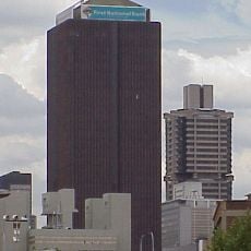
Metsimaholo Local Municipality, administrative area in South Africa
Location: Fezile Dabi District Municipality
Inception: December 5, 2000
Capital city: Sasolburg
Elevation above the sea: 1,499 m
Website: http://www.metsimaholo.gov.za/
Shares border with: Emfuleni Local Municipality, Midvaal Local Municipality
Website: http://metsimaholo.gov.za
GPS coordinates: -26.81667,27.81667
Latest update: March 7, 2025 08:15
Vredefort crater
37.5 km
Gold Reef City
67.5 km
Apartheid Museum
67.2 km
Mandela House
65 km
Hector Pieterson Museum
65.4 km
Suikerbosrand Nature Reserve
55.7 km
Tutu House
64.9 km
Standard Bank Centre
71.4 km
Dobsonville Stadium
65.8 km
Regina Mundi
62.1 km
Klipriviersberg Nature Reserve
60.3 km
Rand Club Building
71.6 km
Walter Sisulu Square of dedication
60.4 km
James Hall Transport Museum
69 km
Southern Life Centre
71.4 km
James Mpanza House
66 km
Hector Pieterson Memorial
65.3 km
Chancellor House
71.3 km
Chamber of Mines Building
69.1 km
Orlando East Public Library
65.6 km
Fordsburg Square
71.1 km
Tower of Terror (Gold Reef City)
67.4 km
Consolidated Building
71.4 km
Witkop Blockhouse
46.5 km
Anaconda (Gold Reef City)
67.6 km
Danie Theron Monument
55.5 km
Kidson Weir
38.7 km
Brenda Fassie memorial
71.5 kmReviews
Visited this place? Tap the stars to rate it and share your experience / photos with the community! Try now! You can cancel it anytime.
Discover hidden gems everywhere you go!
From secret cafés to breathtaking viewpoints, skip the crowded tourist spots and find places that match your style. Our app makes it easy with voice search, smart filtering, route optimization, and insider tips from travelers worldwide. Download now for the complete mobile experience.
A unique approach to discovering new places❞
— Le Figaro
All the places worth exploring❞
— France Info
A tailor-made excursion in just a few clicks❞
— 20 Minutes