Chest opened
+${chestReward.xp} XP
Explorer
NOUVEAU ×${chestReward.collectible.quantity}
tapez pour fermer

See the monuments around you in AR Open chests in the app

Around Us is built for your phone — point your camera at the streets and discover the monuments and places around you in augmented reality. Around Us is built for your phone — chests unlock when you walk, explore and capture nearby places.

•

Enable Location

We need your location to show you interesting places around you

Discover nearby places

Find interesting locations and hidden gems around you

Precise directions

Get accurate directions and distances to places

Your location is never shared with other users. It's only used when you tap the location button.

Cape to Cape Track

Log in to your account

Start exploring — it's free

Trusted by 94,795 travelers worldwide

Continue with Google
Continue with Apple
or

We will send you a code to connect

By continuing, you accept our Terms and Conditions and our Privacy Policy

Check your inbox

We've sent a pincode in your inbox. Please enter the code below.

Cape to Cape Track

Cape to Cape Track, Long-distance walk trail in the South West region, Western Australia, Australia

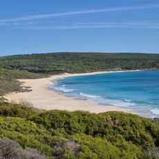
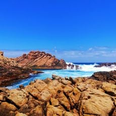
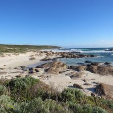
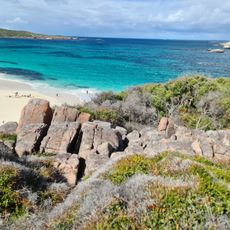
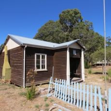
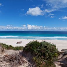
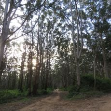
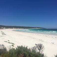
Cape to Cape Track runs 123 kilometres along the Leeuwin-Naturaliste Ridge in Western Australia, from the lighthouse at Cape Naturaliste to the lighthouse at Cape Leeuwin. Its surface varies from wide smooth tracks to narrow rocky paths, soft sandy beaches and a few rough scrambles, with steps built on some steep sections. The section between Cape Naturaliste and Sugarloaf is constructed for wheelchair users; the rest is a single-use walking track.

The Wardandi people are the area's original inhabitants; Nicolas Baudin was the first recorded European visitor, in 1801. In March 1831, five settlers walked from Augusta to the Swan River, reaching Cape Naturaliste in six days. In the 1980s local resident Jane Scott found walking routes between the two capes, and a 1988 Bicentenary Grant funded the dedicated track, officially opened in April 2001.

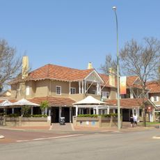
The track runs from the lighthouses at Cape Naturaliste to Cape Leeuwin, passing through Yallingup, Gracetown, Prevelly and Hamelin Bay, where walkers can resupply. Streams dry up in summer, so carry at least 3 litres of water per day of walking and treat all water except town taps. The section between Cape Naturaliste and Sugarloaf is built for wheelchair users; elsewhere the track is for walkers only. Camp only at the designated sites, roughly a day's walk apart.

The track's only formal stream crossing is a bridge over Boodjidup Brook; elsewhere, creeks form sandbars in summer and flow to the sea in winter. Square pine posts bearing a triangular logo mark the route at most intersections, and larger wooden signs guide walkers off beaches.

The community of curious travelers

AroundUs brings together thousands of curated places, local tips, and hidden gems, enriched daily by 94,795 contributors worldwide.

Start exploring
GPS coordinates
-33.95766,114.98872
Latest update
October 29, 2026 00:19
Reviews
Share your experience

No review yet

Discussions
Start a discussion...

No discussion yet

« Cape to Cape Track - Long-distance walk trail in the South West region, Western Australia, Australia » is provided by Around Us (aroundus.com). Images and texts are derived from Wikimedia project under a Creative Commons license. You are allowed to copy, distribute, and modify copies of this page, under the conditions set by the license, as long as this note is clearly visible.

Discover hidden gems everywhere you go!

From secret cafés to breathtaking viewpoints, skip the crowded tourist spots and find places that match your style. Our app makes it easy with voice search, smart filtering, route optimization, and insider tips from travelers worldwide. Download now for the complete mobile experience.

Around Us App Screenshot
❝

A unique approach to discovering new places❞

— Le Figaro

❝

All the places worth exploring❞

— France Info

❝

A tailor-made excursion in just a few clicks❞

— 20 Minutes

Around Us
Travel Guide & Maps
Download

Send to your phone

QR Code
1

Open the camera app on your mobile.

2

Point at the QR code with your camera. A notification will appear.

3

Tap the notification to open the link.