Chest opened
+${chestReward.xp} XP
Explorer
NOUVEAU ×${chestReward.collectible.quantity}
tapez pour fermer
Chest locked

Open chests in the app

Around Us is built for your phone — chests unlock when you walk, explore and capture nearby places.

Enable Location

We need your location to show you interesting places around you

Discover nearby places

Find interesting locations and hidden gems around you

Precise directions

Get accurate directions and distances to places

Your location is never shared with other users. It's only used when you tap the location button.

Log in to your account

Start exploring — it's free

Trusted by 72,894 travelers worldwide

Continue with Google
Continue with Apple
or

We will send you a code to connect

By continuing, you accept our Terms and Conditions and our Privacy Policy

Check your inbox

We've sent a pincode in your inbox. Please enter the code below.

Gunbarrel Highway
Discussion Reviews Photo
17.9k Popularity

Gunbarrel Highway, track in Western Australia, South Australia and the Northern Territory

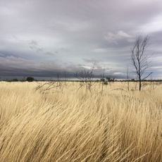
The Gunbarrel Highway is a long, straight road that stretches across the Australian outback, connecting three states: Northern Territory, South Australia, and Western Australia. The surface consists mostly of gravel or compacted earth, passing through flat terrain with sparse vegetation and wide-open views that extend to the horizon.

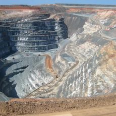
Built in the 1950s to connect remote communities and support mining exploration, the road was named after the shape of its original route, which resembled a gun barrel. It initially served military purposes and helped facilitate supply movements across isolated regions of the outback.

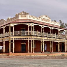
The road passes through territories where Aboriginal communities maintain deep connections to the land that span countless generations. This remote setting preserves a landscape where traditional relationships with nature remain central to how people experience and move through the outback.

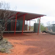
Traveling here requires good preparation since long stretches have no petrol stations, shops, or services available. You need to carry enough water, fuel, food, and a spare tire, and it is important to inform someone of your travel plans before heading out.

The road takes its name from the shape of its original route, which resembled the barrel of a gun, giving the highway its distinctive identity. This naming origin adds a layer of character to the journey, connecting travelers to a piece of outback history.

The community of curious travelers

AroundUs brings together thousands of curated places, local tips, and hidden gems, enriched daily by 60,000 contributors worldwide.

Start exploring
Location
GPS coordinates
-25.79563,122.97359
Latest update
February 17, 2026 00:20
Reviews
Share your experience

No review yet

Discussions
Start a discussion...

No discussion yet

« Gunbarrel Highway - track in Western Australia, South Australia and the Northern Territory » is provided by Around Us (aroundus.com). Images and texts are derived from Wikimedia project under a Creative Commons license. You are allowed to copy, distribute, and modify copies of this page, under the conditions set by the license, as long as this note is clearly visible.

Discover hidden gems everywhere you go!

From secret cafés to breathtaking viewpoints, skip the crowded tourist spots and find places that match your style. Our app makes it easy with voice search, smart filtering, route optimization, and insider tips from travelers worldwide. Download now for the complete mobile experience.

Around Us App Screenshot

A unique approach to discovering new places

Le Figaro

All the places worth exploring

France Info

A tailor-made excursion in just a few clicks

20 Minutes

Around Us
Travel Guide & Maps
Download

Send to your phone

QR Code
1

Open the camera app on your mobile.

2

Point at the QR code with your camera. A notification will appear.

3

Tap the notification to open the link.