Chest opened
+${chestReward.xp} XP
Explorer
NOUVEAU ×${chestReward.collectible.quantity}
tapez pour fermer
Chest locked

Open chests in the app

Around Us is built for your phone — chests unlock when you walk, explore and capture nearby places.

Enable Location

We need your location to show you interesting places around you

Discover nearby places

Find interesting locations and hidden gems around you

Precise directions

Get accurate directions and distances to places

Your location is never shared with other users. It's only used when you tap the location button.

Nullabor Plain

Log in to your account

Start exploring — it's free

Trusted by 72,893 travelers worldwide

Continue with Google
Continue with Apple
or

We will send you a code to connect

By continuing, you accept our Terms and Conditions and our Privacy Policy

Check your inbox

We've sent a pincode in your inbox. Please enter the code below.

Nullabor Plain
Discussion Reviews 1 Photos
109k Popularity

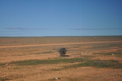
Nullabor Plain, Limestone plateau in South and Western Australia.

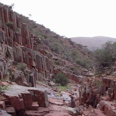
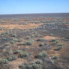
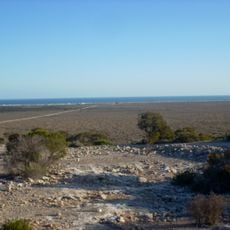
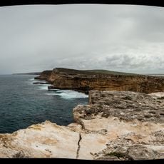
The Nullarbor Plain stretches 650 kilometers from Ooldea into Western Australia and forms a vast limestone surface covering 260,000 square kilometers at roughly 180 meters elevation. This flat expanse is one of the largest continuous limestone plateaus on Earth and extends almost uninterrupted through two Australian states.

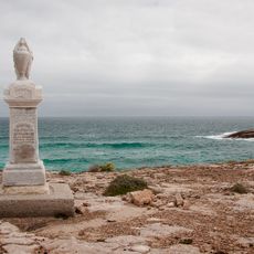
Edward John Eyre crossed the Nullarbor Plain in 1841 as the first documented European and struggled with extreme water scarcity and limited provisions. His expedition laid the groundwork for later routes and transport links that now connect the two coasts of Australia.

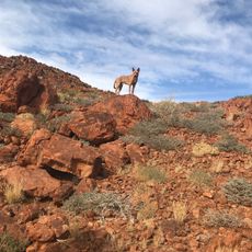
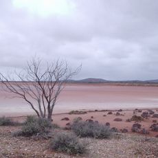
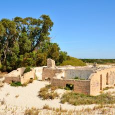
The Mirning clans and Yinyila people traditionally named this region Oondiri, meaning waterless, and established seasonal settlements distributed across the entire territory. Their connection to this harsh land remains visible today through ancient pathways and sites scattered across the plain, where travelers occasionally encounter traces of this centuries-long presence.

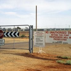
The sealed Eyre Highway connects Norseman with Port Augusta and crosses the entire plain, with travelers advised to carry extra fuel, water, and food supplies. Distances between the few service stations and rest stops can reach several hundred kilometers, making careful planning before the crossing important.

The Trans-Australian Railway runs through the plain and features the longest straight railway section in the world at 478 kilometers. This lengthy section without curves arose from the simple necessity of crossing the flat limestone landscape without major detours.

The community of curious travelers

AroundUs brings together thousands of curated places, local tips, and hidden gems, enriched daily by 60,000 contributors worldwide.

Start exploring
Location
Elevation above the sea
157 m
GPS coordinates
-30.76778,128.97000
Latest update
March 5, 2026 18:55
Reviews
Share your experience

No review yet

Discussions
Start a discussion...

No discussion yet

« Nullabor Plain - Limestone plateau in South and Western Australia » is provided by Around Us (aroundus.com). Images and texts are derived from Wikimedia project under a Creative Commons license. You are allowed to copy, distribute, and modify copies of this page, under the conditions set by the license, as long as this note is clearly visible.

Discover hidden gems everywhere you go!

From secret cafés to breathtaking viewpoints, skip the crowded tourist spots and find places that match your style. Our app makes it easy with voice search, smart filtering, route optimization, and insider tips from travelers worldwide. Download now for the complete mobile experience.

Around Us App Screenshot

A unique approach to discovering new places

Le Figaro

All the places worth exploring

France Info

A tailor-made excursion in just a few clicks

20 Minutes

Around Us
Travel Guide & Maps
Download

Send to your phone

QR Code
1

Open the camera app on your mobile.

2

Point at the QR code with your camera. A notification will appear.

3

Tap the notification to open the link.