Kingston, Historic capital in Norfolk Island, Australia
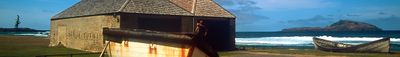
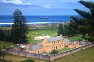
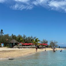
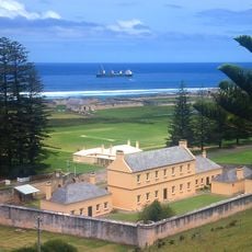
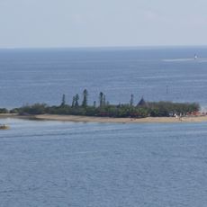
Kingston is a small settlement on the southern coast of Norfolk Island featuring stone buildings, heritage structures, and a natural harbor at Emily Bay. The layout combines early colonial lanes from the 1788 settlement with organized street patterns designed by military engineers in later decades.
The settlement was established in March 1788, making it Australia's second-oldest colonial site after Sydney. Royal Engineers redesigned and reorganized the street system during the 1830s to create a more ordered layout.
The area preserves colonial-era architecture through its stone buildings and layout, reflecting the period when it served as a British convict settlement. Walking through the streets, you encounter structures that carry the memory of this penal history into the present day.
The area is walkable and relatively flat, making it easy to explore on foot. The main buildings and the harbor sit close together, so you can see the highlights without much planning.
Many visitors don't realize the settlement has two distinct street systems layered on top of each other, each reflecting different planning approaches from different eras. This overlap makes the spatial evolution of the place immediately visible as you walk around.
Location: Norfolk Island
Inception: 1788
Elevation above the sea: 20 m
Website: http://pitcairners.org/vt_kingston.html
GPS coordinates: -29.05000,167.96667
Latest update: December 20, 2025 16:04
Amédée lighthouse
746.9 km
Norfolk Island National Park
4.9 km
Cape Reinga Lighthouse
746.2 km
Hikurua / de Surville Cliffs
762.9 km
Government House
946 m
Île aux Canards
765.5 km
Aquarium des lagons
766.6 km
Kingston and Arthurs Vale Historic Area
855 m
Unterwasserpfad Île aux Canards
765.6 km
Édouard-Pentecost stadium
766.9 km
Oro Natural Pool
721.2 km
Plage de la Baie des Citrons
767.1 km
Cape Maria van Diemen Lighthouse
747.6 km
Bishop Patteson Memorial Church (St Barnabas)
4.2 km
Chute de La Madeleine
767 km
Église Notre-Dame de l'Assomption de Vao
711.9 km
Grotte de la Reine Hortense
721.3 km
Paengarēhia / Twilight Beach
753.3 km
Église d'Ouara
746.2 km
Plage de l'Anse Vata
766.3 km
Te Werahi Beach
748.3 km
Kauaeparāoa Stream / Te Paki Stream
760.9 km
Sacred Rock of Kanuméa
713 km
Te Werahi Stream
749.1 km
Ouen Toro Hill
765.3 km
Church
711.9 km
Baie de Upi
716.3 km
Route du Cap N'Dua
754 kmVisited this place? Tap the stars to rate it and share your experience / photos with the community! Try now! You can cancel it anytime.
Discover hidden gems everywhere you go!
From secret cafés to breathtaking viewpoints, skip the crowded tourist spots and find places that match your style. Our app makes it easy with voice search, smart filtering, route optimization, and insider tips from travelers worldwide. Download now for the complete mobile experience.
A unique approach to discovering new places❞
— Le Figaro
All the places worth exploring❞
— France Info
A tailor-made excursion in just a few clicks❞
— 20 Minutes