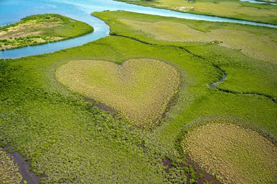
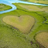
Cœur de Voh, Mangrove formation in New Caledonia
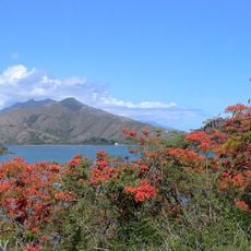
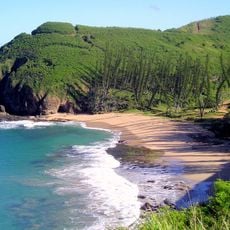
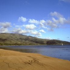
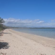
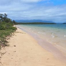
The heart-shaped natural formation extends over 150 hectares within a mangrove area, surrounded by dense coastal vegetation patterns.
Yann Arthus-Bertrand's aerial photograph in his 1990 book 'The Earth from Above' introduced this formation to the international public.
This natural formation represents a strong connection between environment and human emotions, recognized throughout the world.
Visitors can observe the formation from Mount Kathépaïk after a two-hour walk or during a gyrocopter flight over the area.
The natural formation changes appearance with tides and seasons, creating variations in the definition of the heart-shaped pattern.
Location: Voh
Elevation above the sea: 0 m
Address: 3M65+V8X, Voh, New Caledonia Voh
GPS coordinates: -20.93760,164.65800
Latest update: June 23, 2025 09:41
Heart-shaped geographic formations result from natural processes including erosion, coral growth, and tectonic activity. These features appear in various landscape types, from islands and atolls to lakes and coastlines. The distinctive shape typically becomes apparent only from aerial perspectives, making these locations popular destinations for scenic flights and aerial photography. Examples occur worldwide: the Heart Reef within Australia's Great Barrier Reef, Galešnjak Island in Croatia's Adriatic Sea, and Lake Toyoni on Japan's Hokkaido Island. Additional formations exist in the waters of French Polynesia and along North American coastlines. These sites combine geological interest with their symbolic shape, attracting visitors who seek both natural environments and the opportunity to witness these formations from above.
Natural and cultural sites of New Caledonia, featuring national parks, beaches, islands, bays, historical monuments, and cultural centers. This South Pacific region offers natural geological formations, marine reserves, colonial and religious buildings, as well as traditional Kanak sites. The territory includes diving spots, caves, cliffs, maritime lighthouses, and local markets representing the natural and architectural heritage of the archipelago.
New Caledonia Barrier Reef
59.3 km
Mont Panié
40.6 km
Bourail New Zealand War Cemetery
119.5 km
Gouaro Deva
95.3 km
Baie des Tortues
111.2 km
Fort Teremba
140.6 km
Passerelle Marguerite
149.4 km
Musée de Bourail
111 km
Baie des amoureux
110.8 km
Plage de Tiéti
68.9 km
Plage de Poé
106.3 km
Le Bonhomme
111.5 km
Église Sainte-Anne de Boulouparis
177.2 km
Église du Sacré-Cœur de Bourail
111.7 km
Église de la Sainte-Famille d'Ouégoa
70 km
Église de la Pentecôte de La Foa
148.8 km
Plage de la Roche Percée
112.3 km
Église Notre-Dame-de-l'Assomption de Koné
25.3 km
Bourail Memorial
118.7 km
Grotte de Lindéralique
43.5 km
Népia
78.1 km
Plage de Mahamaté
73.3 km
Plage de Ouano
156.6 km
Plage de Pindai
55.9 km
Golf de la Ouenghi
184.9 km
Plage de Franco
37.6 km
Piscine intercommunale
148.4 km
Plage de Tanghi
141.2 kmReviews
Visited this place? Tap the stars to rate it and share your experience / photos with the community! Try now! You can cancel it anytime.
Discover hidden gems everywhere you go!
From secret cafés to breathtaking viewpoints, skip the crowded tourist spots and find places that match your style. Our app makes it easy with voice search, smart filtering, route optimization, and insider tips from travelers worldwide. Download now for the complete mobile experience.
A unique approach to discovering new places❞
— Le Figaro
All the places worth exploring❞
— France Info
A tailor-made excursion in just a few clicks❞
— 20 Minutes