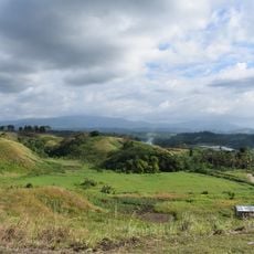
Command Ridge, Summit of Command Ridge in Nauru.
Command Ridge is the highest point on Nauru, rising about 65 meters above sea level. The ridge runs between the Aiwo and Buada districts and displays steep limestone cliffs with uneven, rocky terrain.
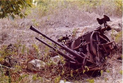
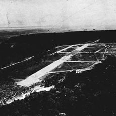
Japanese forces built their main communications center here during World War II, constructing extensive military fortifications across the summit. The ridge served as a key strategic position on the occupied island.
The limestone formations here hold meaning in local geography education, helping island children understand natural elevation. For residents, this ridge marks a physical landmark that divides two districts and shapes how they navigate their small island.
The site lacks developed pathways and basic facilities, so bring sturdy footwear and plenty of water when you go. Plan to move carefully across the rocky terrain and account for the lack of shade.
Japanese inscriptions are still visible on bunker walls from the 1940s military occupation. Rusted artillery pieces remain scattered across the summit as physical reminders of that period.
The community of curious travelers
AroundUs brings together thousands of curated places, local tips, and hidden gems, enriched daily by 60,000 contributors worldwide.