Enable Location

We need your location to show you interesting places around you

Discover nearby places

Find interesting locations and hidden gems around you

Precise directions

Get accurate directions and distances to places

Your location is never shared with other users. It's only used when you tap the location button.

Log in to your account

Start exploring — it's free

Trusted by 61,416 travelers worldwide

Continue with Google
Continue with Apple
or

We will send you a code to connect

By continuing, you accept our Terms and Conditions and our Privacy Policy

Check your inbox

We've sent a pincode in your inbox. Please enter the code below.

Fort Ruger, Military historic district at Diamond Head, United States

Description

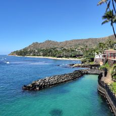
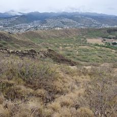
Fort Ruger Historic District is a military installation around Diamond Head Crater that features multiple fortification structures and fire control stations spread across the area. These elements were built to take advantage of the natural elevation provided by the crater for defense purposes.

History

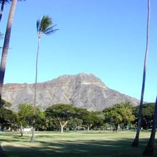
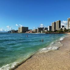
The United States acquired Diamond Head and surrounding land in 1905 to build its first military installation in the Hawaiian Islands. The site was later named after a senior military officer and served as a key defensive position for the region.

Culture

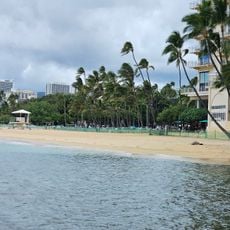
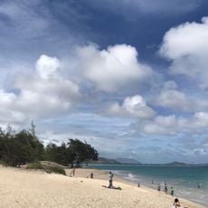
This place represents an early chapter of American military presence in Hawaii and reflects how the islands became strategically important for defense. The fortifications remain visible in the landscape and shape how people experience the Diamond Head area today.

Practical

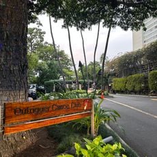
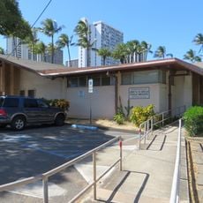
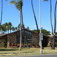
The historic district is located along Diamond Head Road and marked by stone gates that serve as reference points for visitors. Some structures sit on slopes, so be prepared for walking on uneven terrain in certain areas.

Did you know?

One of the fortifications was equipped with eight large mortars positioned to take advantage of the crater's natural height. This arrangement allowed defenders to cover a wide area toward the ocean and surrounding territory.

Location
Inception
1983
GPS coordinates
21.26750,-157.80861
Latest update
December 8, 2025 20:02

AroundUs brings together thousands of curated places, local tips, and hidden gems, enriched daily by 60,000 contributors worldwide. Discover all places nearby (Honolulu).

Around this place
Diamond Head
United States of America

Diamond Head

919 m
Moana Hotel
United States of America

Moana Hotel

2.1 km
Shangri La Museum
United States of America

Shangri La Museum

1.9 km
Trump International Hotel and Tower
United States of America

Trump International Hotel and Tower

2.8 km
Honolulu Zoo
United States of America

Honolulu Zoo

1.1 km
Waikiki Natatorium War Memorial
United States of America

Waikiki Natatorium War Memorial

1.4 km
Queen Kapiʻolani Regional Park
United States of America

Queen Kapiʻolani Regional Park

1.1 km
Waikiki Shell
United States of America

Waikiki Shell

1.4 km
Waikiki Aquarium
United States of America

Waikiki Aquarium

1.4 km
Kuhio Beach Park
United States of America

Kuhio Beach Park

1.7 km
Queen's Surf Beach
United States of America

Queen's Surf Beach

1.5 km
'Alohilani Resort Waikiki Beach
United States of America

'Alohilani Resort Waikiki Beach

1.8 km
C.W. Dickey House
United States of America

C.W. Dickey House

1.4 km
Sans Souci Beach
United States of America

Sans Souci Beach

1.5 km
Lemon Wond Holt House
United States of America

Lemon Wond Holt House

2.5 km
Outrigger Canoe Club Beach
United States of America

Outrigger Canoe Club Beach

1.5 km
Shangri La Museum of Islamic Art, Culture & Design
United States of America

Shangri La Museum of Islamic Art, Culture & Design

1.8 km
Hunakai Beach
United States of America

Hunakai Beach

2.6 km
Kapiolani Park Beach
United States of America

Kapiolani Park Beach

1.5 km
Kāhala Beach
United States of America

Kāhala Beach

2.9 km
Saint Louis School
United States of America

Saint Louis School

2.5 km
Library for the Blind and Physically Handicap
United States of America

Library for the Blind and Physically Handicap

1.1 km
Waikiki-Kapahulu Public Library
United States of America

Waikiki-Kapahulu Public Library

1.1 km
Kaalawai Beach
United States of America

Kaalawai Beach

1.5 km
Kuilei Cliffs
United States of America

Kuilei Cliffs

751 m
Grays Beach
United States of America

Grays Beach

2.6 km
Kaluahole Beach
United States of America

Kaluahole Beach

1.5 km
Kuilei Beach
United States of America

Kuilei Beach

1.4 km
Show the full map
« Fort Ruger - Military historic district at Diamond Head, United States » is provided by Around Us (aroundus.com). Images and texts are derived from Wikimedia project under a Creative Commons license. You are allowed to copy, distribute, and modify copies of this page, under the conditions set by the license, as long as this note is clearly visible.

Discover hidden gems everywhere you go!

From secret cafés to breathtaking viewpoints, skip the crowded tourist spots and find places that match your style. Our app makes it easy with voice search, smart filtering, route optimization, and insider tips from travelers worldwide. Download now for the complete mobile experience.

Around Us App Screenshot

A unique approach to discovering new places

Le Figaro

All the places worth exploring

France Info

A tailor-made excursion in just a few clicks

20 Minutes

Around Us
Travel Guide & Maps
Download

Send to your phone

QR Code
1

Open the camera app on your mobile.

2

Point at the QR code with your camera. A notification will appear.

3

Tap the notification to open the link.