Chest opened
+${chestReward.xp} XP
Explorer
NOUVEAU ×${chestReward.collectible.quantity}
tapez pour fermer
Chest locked

Open chests in the app

Around Us is built for your phone — chests unlock when you walk, explore and capture nearby places.

Enable Location

We need your location to show you interesting places around you

Discover nearby places

Find interesting locations and hidden gems around you

Precise directions

Get accurate directions and distances to places

Your location is never shared with other users. It's only used when you tap the location button.

Log in to your account

Start exploring — it's free

Trusted by 73,068 travelers worldwide

Continue with Google
Continue with Apple
or

We will send you a code to connect

By continuing, you accept our Terms and Conditions and our Privacy Policy

Check your inbox

We've sent a pincode in your inbox. Please enter the code below.

Hawaii's 1st congressional district
Discussion Reviews Photo
34.6k Popularity

Hawaii's 1st congressional district, Congressional district in Honolulu, United States

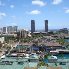
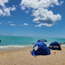
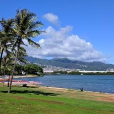
Hawaii's 1st congressional district covers the urban Honolulu area and surrounding neighborhoods along the Pacific coast. The region spans from Makapuu Point in the northeast to Kapolei in the west, combining densely populated city neighborhoods with more rural outlying areas.

The district was created in 1971 following Hawaii's statehood in 1959 and the shift away from at-large voting across the entire state. This redistricting established a dedicated electoral district to represent island interests more directly in Congress.

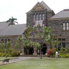
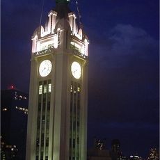
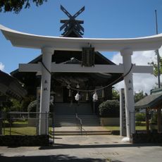
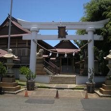
The district encompasses communities with deep Asian, Pacific Islander, and mixed heritage that shapes daily life across Honolulu. These populations are visible in the neighborhoods' architecture, local shops, and the way residents interact with their shared spaces.

The district is easily accessible for visitors since most locations fall within or near Honolulu and are reachable by car or public transit. Those interested in local issues can visit the congressional representative's office for information about regional concerns.

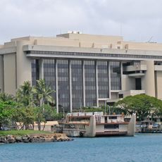
The district houses the islands' largest military presence, including strategically critical naval installations. These facilities form a cornerstone of American defense operations across the Pacific region.

The community of curious travelers

AroundUs brings together thousands of curated places, local tips, and hidden gems, enriched daily by 60,000 contributors worldwide.

Start exploring
Location
GPS coordinates
21.32278,-157.90583
Latest update
December 19, 2025 22:36
Around this place
Naval Station Pearl Harbor
United States of America

Naval Station Pearl Harbor

4.9 km
Hickam Field
United States of America

Hickam Field

1.8 km
Bishop Museum
United States of America

Bishop Museum

3.8 km
Aloha Tower
United States of America

Aloha Tower

4.5 km
Izumo Taishakyo Mission of Hawaii
United States of America

Izumo Taishakyo Mission of Hawaii

4.7 km
Falls of Clyde
United States of America

Falls of Clyde

4.6 km
First Hawaiian Center
United States of America

First Hawaiian Center

4.8 km
Cathedral Basilica of Our Lady of Peace
United States of America

Cathedral Basilica of Our Lady of Peace

5 km
Foster Botanical Garden
United States of America

Foster Botanical Garden

4.9 km
Hawaii Theatre
United States of America

Hawaii Theatre

4.8 km
Hawaii State Public Library System
United States of America

Hawaii State Public Library System

4.7 km
Hawaii Kotohira Jinsha – Hawaii Dazaifu Tenmangu
United States of America

Hawaii Kotohira Jinsha – Hawaii Dazaifu Tenmangu

3.8 km
Prince Kuhio Federal Building
United States of America

Prince Kuhio Federal Building

5 km
Jhamandas Watumull Planetarium
United States of America

Jhamandas Watumull Planetarium

3.8 km
Hawaii Maritime Center
United States of America

Hawaii Maritime Center

4.7 km
Merchant Street Historic District
United States of America

Merchant Street Historic District

4.7 km
Aloha Jewish Chapel
United States of America

Aloha Jewish Chapel

4.6 km
King David Kalakaua Building
United States of America

King David Kalakaua Building

5 km
Kaumakapili Church
United States of America

Kaumakapili Church

4.1 km
YWCA Building
United States of America

YWCA Building

4.9 km
United States Immigration Office
United States of America

United States Immigration Office

4.5 km
Palm Circle
United States of America

Palm Circle

3.4 km
C. Brewer Building
United States of America

C. Brewer Building

4.3 km
Kakaako Pumping Station
United States of America

Kakaako Pumping Station

4.7 km
Stangenwald Building
United States of America

Stangenwald Building

4.7 km
Hickam Harbor Beach
United States of America

Hickam Harbor Beach

4.7 km
Melchers Building
United States of America

Melchers Building

4.6 km
Keʻehi Lagoon Beach
United States of America

Keʻehi Lagoon Beach

1.2 km
Show the full map
Reviews
Share your experience

No review yet

Discussions
Start a discussion...

No discussion yet

« Hawaii's 1st congressional district - Congressional district in Honolulu, United States » is provided by Around Us (aroundus.com). Images and texts are derived from Wikimedia project under a Creative Commons license. You are allowed to copy, distribute, and modify copies of this page, under the conditions set by the license, as long as this note is clearly visible.

Discover hidden gems everywhere you go!

From secret cafés to breathtaking viewpoints, skip the crowded tourist spots and find places that match your style. Our app makes it easy with voice search, smart filtering, route optimization, and insider tips from travelers worldwide. Download now for the complete mobile experience.

Around Us App Screenshot

A unique approach to discovering new places

Le Figaro

All the places worth exploring

France Info

A tailor-made excursion in just a few clicks

20 Minutes

Around Us
Travel Guide & Maps
Download

Send to your phone

QR Code
1

Open the camera app on your mobile.

2

Point at the QR code with your camera. A notification will appear.

3

Tap the notification to open the link.