Chest opened
+${chestReward.xp} XP
Explorer
NOUVEAU ×${chestReward.collectible.quantity}
tapez pour fermer
Chest locked

Open chests in the app

Around Us is built for your phone — chests unlock when you walk, explore and capture nearby places.

Enable Location

We need your location to show you interesting places around you

Discover nearby places

Find interesting locations and hidden gems around you

Precise directions

Get accurate directions and distances to places

Your location is never shared with other users. It's only used when you tap the location button.

Santa Barbara Channel

Log in to your account

Start exploring — it's free

Trusted by 72,944 travelers worldwide

Continue with Google
Continue with Apple
or

We will send you a code to connect

By continuing, you accept our Terms and Conditions and our Privacy Policy

Check your inbox

We've sent a pincode in your inbox. Please enter the code below.

Santa Barbara Channel
Discussion Reviews 1 Photos
13.6k Popularity

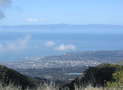
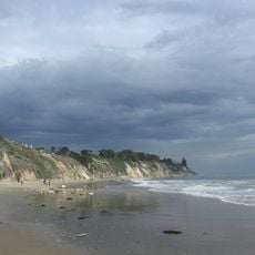
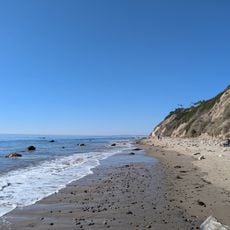
Santa Barbara Channel, Strait between mainland California and Channel Islands, United States.

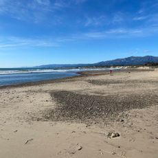
The Santa Barbara Channel is a strait separating mainland California from the Northern Channel Islands. The waterway stretches roughly 130 kilometers from east to west with an average width of about 45 kilometers.

During the last ice age, the four northern islands formed a single landmass called Santa Rosae. This connected land lay just 8 kilometers from the California coast before rising ocean levels separated the islands.

The Chumash people built settlements on both coastlines and used the waters to trade and travel between the islands and mainland. These connections shaped how communities lived and interacted across the channel for generations.

Large cargo vessels and tankers travel through established shipping lanes heading to Los Angeles and Long Beach ports. People exploring the region should know that heavy vessel traffic is common and the waters are in constant use.

At Coal Oil Point, natural petroleum seepages emerge from the seafloor. Each day, roughly 40 tons of oil rise naturally into the water, making it a rare location where large-scale natural oil seepage is visible.

The community of curious travelers

AroundUs brings together thousands of curated places, local tips, and hidden gems, enriched daily by 60,000 contributors worldwide.

Start exploring
GPS coordinates
34.24194,-119.89000
Latest update
December 7, 2025 20:25
Around this place
United States of America

Offshore oil and gas in California

16.5 km
Moreton Bay Fig Tree
United States of America

Moreton Bay Fig Tree

26.3 km
Harder Stadium
United States of America

Harder Stadium

20.1 km
AlloSphere
United States of America

AlloSphere

19.9 km
Arroyo Burro Beach
United States of America

Arroyo Burro Beach

22.4 km
Karpeles Manuscript Library Museums
United States of America

Karpeles Manuscript Library Museums

26.3 km
Las Cumbres Observatory Global Telescope Network
United States of America

Las Cumbres Observatory Global Telescope Network

21.4 km
Storke Tower
United States of America

Storke Tower

19.4 km
Douglas Family Preserve
United States of America

Douglas Family Preserve

22.6 km
Devils Peak
United States of America

Devils Peak

25.6 km
Goleta Beach
United States of America

Goleta Beach

19.8 km
Leadbetter Beach
United States of America

Leadbetter Beach

25.2 km
Stow House
United States of America

Stow House

22.6 km
Casa Dolores
United States of America

Casa Dolores

25.9 km
Santa Barbara Light
United States of America

Santa Barbara Light

23.1 km
Art, Design & Architecture Museum
United States of America

Art, Design & Architecture Museum

19.3 km
Bren Hall
United States of America

Bren Hall

19.4 km
Joseph and Lucy Foster Sexton House
United States of America

Joseph and Lucy Foster Sexton House

22.7 km
South Coast Railroad Museum
United States of America

South Coast Railroad Museum

22.6 km
The Wolf Museum of Exploration and Innovation
United States of America

The Wolf Museum of Exploration and Innovation

26.4 km
Thomas Hope House
United States of America

Thomas Hope House

24.1 km
Janssens-Orella-Birk Building
United States of America

Janssens-Orella-Birk Building

26.4 km
Santa Barbara Maritime Museum
United States of America

Santa Barbara Maritime Museum

25.5 km
Hendrys Beach
United States of America

Hendrys Beach

22.5 km
Sands Beach
United States of America

Sands Beach

18.6 km
Hope Ranch Private Beach
United States of America

Hope Ranch Private Beach

21.7 km
Devereux Beach
United States of America

Devereux Beach

18.6 km
Karpeles Manuscript Library Museum, Santa Barbara
United States of America

Karpeles Manuscript Library Museum, Santa Barbara

26.3 km
Show the full map
Reviews
Share your experience

No review yet

Discussions
Start a discussion...

No discussion yet

« Santa Barbara Channel - Strait between mainland California and Channel Islands, United States » is provided by Around Us (aroundus.com). Images and texts are derived from Wikimedia project under a Creative Commons license. You are allowed to copy, distribute, and modify copies of this page, under the conditions set by the license, as long as this note is clearly visible.

Discover hidden gems everywhere you go!

From secret cafés to breathtaking viewpoints, skip the crowded tourist spots and find places that match your style. Our app makes it easy with voice search, smart filtering, route optimization, and insider tips from travelers worldwide. Download now for the complete mobile experience.

Around Us App Screenshot

A unique approach to discovering new places

Le Figaro

All the places worth exploring

France Info

A tailor-made excursion in just a few clicks

20 Minutes

Around Us
Travel Guide & Maps
Download

Send to your phone

QR Code
1

Open the camera app on your mobile.

2

Point at the QR code with your camera. A notification will appear.

3

Tap the notification to open the link.