Enable Location

We need your location to show you interesting places around you

Discover nearby places

Find interesting locations and hidden gems around you

Precise directions

Get accurate directions and distances to places

Your location is never shared with other users. It's only used when you tap the location button.

Simi Valley

Log in to your account

Start exploring — it's free

Trusted by 63,103 travelers worldwide

Continue with Google
Continue with Apple
or

We will send you a code to connect

By continuing, you accept our Terms and Conditions and our Privacy Policy

Check your inbox

We've sent a pincode in your inbox. Please enter the code below.

Discussion Reviews 2 Photos
202k Popularity

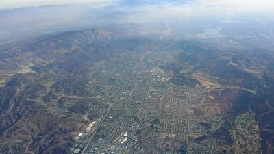
Simi Valley, Suburban city in Ventura County, California.

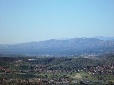
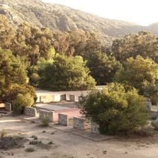
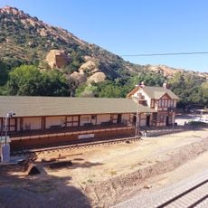
Simi Valley is a city in Ventura County, California, nestled between the Santa Susana Mountains and the Simi Hills. The area spreads across flat valleys and gentle slopes with residential neighborhoods, parks, and commercial districts.

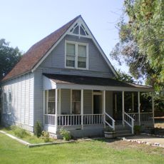
The Chumash lived in the region for centuries before Spanish settlers established the Rancho Simi land grant in 1795. In the 20th century, the area transformed from agricultural land into a modern suburb.

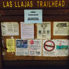
The city takes its name from Shimiyi, a Chumash word for the cloud formations above the valley. Many street names and parks today recall this early settlement by indigenous communities.

The city sits about 40 miles from Los Angeles and is easily accessible via the Ronald Reagan Freeway. Many visitors combine a stay here with trips to the San Fernando Valley or surrounding mountains.

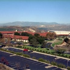
The Ronald Reagan Presidential Library houses sections of the Berlin Wall and the Air Force One that transported the president. Visitors can walk through recreated White House rooms.

The community of curious travelers

AroundUs brings together thousands of curated places, local tips, and hidden gems, enriched daily by 60,000 contributors worldwide.

Start exploring
Location
Inception
October 10, 1969
Shares border with
Moorpark, Thousand Oaks
GPS coordinates
34.27083,-118.73917
Latest update
December 12, 2025 20:29
Around this place
Ronald Reagan Presidential Library
United States of America

Ronald Reagan Presidential Library

7.5 km
United States of America

Brandeis-Bardin Institute

2.7 km
Corriganville Movie Ranch
United States of America

Corriganville Movie Ranch

8.3 km
Grandma Prisbrey's Bottle Village
United States of America

Grandma Prisbrey's Bottle Village

3.3 km
Mount McCoy
United States of America

Mount McCoy

6.1 km
Simi Adobe-Strathearn House
United States of America

Simi Adobe-Strathearn House

5.7 km
United States of America

Simi Peak

8.3 km
Las Llajas Canyon
United States of America

Las Llajas Canyon

6.1 km
Colony House
United States of America

Colony House

5.7 km
Santa Susana Railroad Depot & Museum
United States of America

Santa Susana Railroad Depot & Museum

7.2 km
United States of America

Rancho Santa Susana Community Park

4.1 km
United States of America

Air Force 1

7.5 km
United States of America

Wood Ranch Clock

6.8 km
United States of America

Simi Hills Golf Course

5.1 km
United States of America

Wood Ranch Golf Club

7.2 km
United States of America

Back to the Future Part III -- Delgado Mine Entrance

7.4 km
United States of America

Back to the Future Part III -- Boot Hill Cemetery

7.4 km
United States of America

Back to the Future Part III -- Doc Brown's Tombstone

7.4 km

Outdoor Amphitheatre

8.2 km
United States of America

Coyote Statues

5.7 km
United States of America

Sinaloa Golf Course

5.4 km
United States of America

Sisters of Notre Dame

3.5 km
United States of America

Scenic viewpoint

7.5 km
United States of America

Scenic viewpoint

7.4 km
United States of America

Scenic viewpoint

4 km
United States of America

Scenic viewpoint

7.6 km
United States of America

Waterfall

5.3 km
United States of America

Waterfall

3.7 km
Show the full map
Reviews
Share your experience

No review yet

Discussions
Start a discussion...

No discussion yet

« Simi Valley - Suburban city in Ventura County, California » is provided by Around Us (aroundus.com). Images and texts are derived from Wikimedia project under a Creative Commons license. You are allowed to copy, distribute, and modify copies of this page, under the conditions set by the license, as long as this note is clearly visible.

Discover hidden gems everywhere you go!

From secret cafés to breathtaking viewpoints, skip the crowded tourist spots and find places that match your style. Our app makes it easy with voice search, smart filtering, route optimization, and insider tips from travelers worldwide. Download now for the complete mobile experience.

Around Us App Screenshot

A unique approach to discovering new places

Le Figaro

All the places worth exploring

France Info

A tailor-made excursion in just a few clicks

20 Minutes

Around Us
Travel Guide & Maps
Download

Send to your phone

QR Code
1

Open the camera app on your mobile.

2

Point at the QR code with your camera. A notification will appear.

3

Tap the notification to open the link.