Chest opened
+${chestReward.xp} XP
Explorer
NOUVEAU ×${chestReward.collectible.quantity}
tapez pour fermer
Chest locked

Open chests in the app

Around Us is built for your phone — chests unlock when you walk, explore and capture nearby places.

Enable Location

We need your location to show you interesting places around you

Discover nearby places

Find interesting locations and hidden gems around you

Precise directions

Get accurate directions and distances to places

Your location is never shared with other users. It's only used when you tap the location button.

Porter Ranch

Log in to your account

Start exploring — it's free

Trusted by 72,876 travelers worldwide

Continue with Google
Continue with Apple
or

We will send you a code to connect

By continuing, you accept our Terms and Conditions and our Privacy Policy

Check your inbox

We've sent a pincode in your inbox. Please enter the code below.

Porter Ranch
Discussion Reviews 1 Photos
53.7k Popularity

Porter Ranch, Residential suburb in Los Angeles, California.

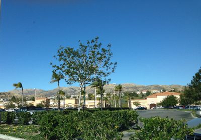
Porter Ranch is a residential neighborhood in the northwest San Fernando Valley, sitting on elevated terrain and bordered by natural canyons. The area is made up of single-family homes and modern developments spread across rolling hills.

The area gained official recognition as a Los Angeles community in 2011 when residents petitioned for neighborhood name recognition. This marked an important step toward establishing the district's formal identity.

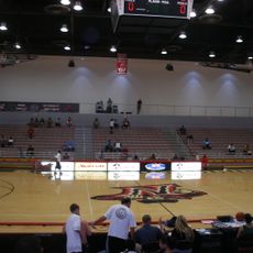
The neighborhood maintains strong educational standards with multiple public schools, including Castlebay Lane Charter School and Porter Ranch Community School serving local families.

The area is well connected by main roads such as Mason Avenue and offers various retail options for daily needs. Visitors can easily find restaurants, shops, and services along the principal traffic routes.

In 2015, a major methane leak at the nearby Aliso Canyon gas storage facility prompted the evacuation of thousands of residents. This event significantly shaped community awareness about environmental and safety concerns.

The community of curious travelers

AroundUs brings together thousands of curated places, local tips, and hidden gems, enriched daily by 60,000 contributors worldwide.

Start exploring
Location
Elevation above the sea
390 m
Shares border with
Santa Susana Mountains
GPS coordinates
34.28182,-118.56127
Latest update
March 5, 2026 21:06
Around this place
Shepherd of the Hills Church
United States of America

Shepherd of the Hills Church

908 m
Matadome
United States of America

Matadome

5.5 km
O'Melveny Park
United States of America

O'Melveny Park

4.9 km
California State University Northridge Botanic Garden
United States of America

California State University Northridge Botanic Garden

5.7 km
Minnie Hill Palmer House
United States of America

Minnie Hill Palmer House

5.4 km
Munch Box
United States of America

Munch Box

4.5 km
United States of America

Eddleston Park

2.6 km

Elisabeth Waldo Theatre

5.4 km
United States of America

Matador Statue

5.6 km
United States of America

E.T. the Extra-Terrestrial filming location - E.T. Park

2.2 km
United States of America

E.T. the Extra-Terrestrial filming location - The Halloween scene

1.7 km
United States of America

E.T. The Extra Terrestrial filming location - the flying bicycles

4.1 km
United States of America

Ralph Prator Fountain

5.4 km
United States of America

Big Oak Little Theater

4.9 km
United States of America

Porter Valley Country Club

648 m
United States of America

Younes and Soraya Nazarian Center for the Performing Arts

5.9 km
United States of America

Quad Stage

4 km
United States of America

Galactic Challenge

4.9 km
United States of America

Apollo Rocket Engine

6 km
United States of America

Epicenter (not)

5.9 km
United States of America

Tiki

2.2 km
United States of America

Rotary Club Armed Forces Memorial

4 km
United States of America

Celebrating the Filming of E.T. on White Oak in 1981

4.2 km
United States of America

Tree of Life

4.6 km
United States of America

Earthquake Garden

5.9 km
United States of America

Work of art

5.6 km
United States of America

Scenic viewpoint

5.9 km
United States of America

Waterfall

5.9 km
Show the full map
Reviews
Share your experience

No review yet

Discussions
Start a discussion...

No discussion yet

« Porter Ranch - Residential suburb in Los Angeles, California » is provided by Around Us (aroundus.com). Images and texts are derived from Wikimedia project under a Creative Commons license. You are allowed to copy, distribute, and modify copies of this page, under the conditions set by the license, as long as this note is clearly visible.

Discover hidden gems everywhere you go!

From secret cafés to breathtaking viewpoints, skip the crowded tourist spots and find places that match your style. Our app makes it easy with voice search, smart filtering, route optimization, and insider tips from travelers worldwide. Download now for the complete mobile experience.

Around Us App Screenshot

A unique approach to discovering new places

Le Figaro

All the places worth exploring

France Info

A tailor-made excursion in just a few clicks

20 Minutes

Around Us
Travel Guide & Maps
Download

Send to your phone

QR Code
1

Open the camera app on your mobile.

2

Point at the QR code with your camera. A notification will appear.

3

Tap the notification to open the link.