Enable Location

We need your location to show you interesting places around you

Discover nearby places

Find interesting locations and hidden gems around you

Precise directions

Get accurate directions and distances to places

Your location is never shared with other users. It's only used when you tap the location button.

Interstate 110 and State Route 110

Log in to your account

Start exploring — it's free

Trusted by 61,434 travelers worldwide

Continue with Google
Continue with Apple
or

We will send you a code to connect

By continuing, you accept our Terms and Conditions and our Privacy Policy

Check your inbox

We've sent a pincode in your inbox. Please enter the code below.

Interstate 110 and State Route 110

Interstate 110 and State Route 110, Multilevel highway system in Los Angeles County, United States

Description

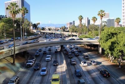
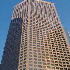
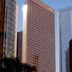
Interstate 110 and State Route 110 form a major north-south corridor that runs from the port area through downtown Los Angeles toward Pasadena. The system includes the Harbor Freeway and the Arroyo Seco Parkway, with multiple lanes and elevated sections that navigate the city's terrain.

History

The Arroyo Seco Parkway section, finished in 1940, became the first freeway built in the western United States and kept many of its original architectural details. The broader Interstate 110 system grew over the following decades as part of the nation's highway expansion.

Culture

The route passes through neighborhoods where you can see how Los Angeles connects different communities, from the port area to residential and cultural centers, shaping how people move across the city.

Practical

Expect heavy traffic during morning and evening rush hours when traveling this route, as it is one of the busiest corridors in the region. Free standard lanes are available for all drivers alongside toll lanes for carpools and solo drivers willing to pay for faster travel.

Did you know?

In 2001, an artist created and installed realistic directional signs along the highway that authorities didn't remove for eight years because they were accurate and appeared official. The project became an unusual example of subtle street art that blended seamlessly with real infrastructure.

GPS coordinates
34.05580,-118.25600
Latest update
December 17, 2025 10:58

AroundUs brings together thousands of curated places, local tips, and hidden gems, enriched daily by 60,000 contributors worldwide. Discover all places nearby (Los Angeles County).

« Interstate 110 and State Route 110 - Multilevel highway system in Los Angeles County, United States » is provided by Around Us (aroundus.com). Images and texts are derived from Wikimedia project under a Creative Commons license. You are allowed to copy, distribute, and modify copies of this page, under the conditions set by the license, as long as this note is clearly visible.

Discover hidden gems everywhere you go!

From secret cafés to breathtaking viewpoints, skip the crowded tourist spots and find places that match your style. Our app makes it easy with voice search, smart filtering, route optimization, and insider tips from travelers worldwide. Download now for the complete mobile experience.

Around Us App Screenshot

A unique approach to discovering new places

Le Figaro

All the places worth exploring

France Info

A tailor-made excursion in just a few clicks

20 Minutes

Around Us
Travel Guide & Maps
Download

Send to your phone

QR Code
1

Open the camera app on your mobile.

2

Point at the QR code with your camera. A notification will appear.

3

Tap the notification to open the link.