Chest opened
+${chestReward.xp} XP
Explorer
NOUVEAU ×${chestReward.collectible.quantity}
tapez pour fermer
Chest locked

Open chests in the app

Around Us is built for your phone — chests unlock when you walk, explore and capture nearby places.

Enable Location

We need your location to show you interesting places around you

Discover nearby places

Find interesting locations and hidden gems around you

Precise directions

Get accurate directions and distances to places

Your location is never shared with other users. It's only used when you tap the location button.

Log in to your account

Start exploring — it's free

Trusted by 72,999 travelers worldwide

Continue with Google
Continue with Apple
or

We will send you a code to connect

By continuing, you accept our Terms and Conditions and our Privacy Policy

Check your inbox

We've sent a pincode in your inbox. Please enter the code below.

Encanto, San Diego
Discussion Reviews Photo
11k Popularity

Encanto, San Diego, Residential neighborhood in southeastern San Diego, US.

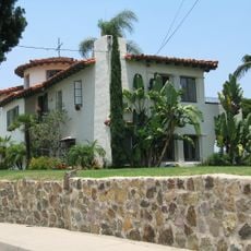
Encanto is a residential neighborhood in southeastern San Diego made up of single-family homes, small shops, and local businesses spread across rolling terrain. The area sits between California State Route 94 and O'Farrell Street, with streets that wind through older and newer housing stock.

The area began development in the mid-20th century as a residential district and gradually transformed through successive waves of new residents settling in the neighborhood. These demographic shifts shaped the character of the place over several decades.

The neighborhood is home to residents who run local shops, restaurants, and services that reflect their heritage and daily routines. Walking through the streets, you notice how people gather in parks and along sidewalks, creating a lived-in community where multiple traditions coexist.

The area is well connected by public transportation, including the San Diego Trolley and bus lines that make it easy to explore the neighborhood and reach other parts of the city. The hilly terrain means some streets have steep grades, which is worth noting when walking around.

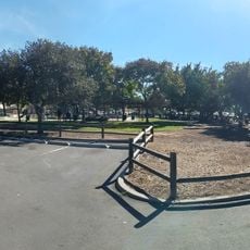
The Chollas Creek Enhancement Program has been working to restore native plants and create open green spaces throughout the neighborhood. This grassroots effort is slowly transforming the area and offers visitors unexpected moments of nature among residential blocks.

The community of curious travelers

AroundUs brings together thousands of curated places, local tips, and hidden gems, enriched daily by 60,000 contributors worldwide.

Start exploring
Location
GPS coordinates
32.70960,-117.06700
Latest update
March 5, 2026 21:06
Around this place
United States of America

Cerutti Mastodon site

5.1 km
Chicano Park
United States of America

Chicano Park

7.2 km
Beth Sarim
United States of America

Beth Sarim

7.5 km
Cornerstone Church of San Diego
United States of America

Cornerstone Church of San Diego

5.7 km
Aztec Bowl
United States of America

Aztec Bowl

7.4 km
Villa Montezuma
United States of America

Villa Montezuma

7.4 km
Sweetwater Dam
United States of America

Sweetwater Dam

5.9 km
Hepner Hall
United States of America

Hepner Hall

7.4 km
Switzer Canyon
United States of America

Switzer Canyon

6.5 km
Hardy Memorial Tower
United States of America

Hardy Memorial Tower

7.4 km
Dryden Historic District
United States of America

Dryden Historic District

7.3 km
Granger Hall
United States of America

Granger Hall

3.6 km
Aztec Student Union
United States of America

Aztec Student Union

7.2 km
Christian Fellowship Congregational Church
United States of America

Christian Fellowship Congregational Church

1.5 km
San Diego State College
United States of America

San Diego State College

7.4 km
Casa Alfred Haines
United States of America

Casa Alfred Haines

6.9 km
Brick Row
United States of America

Brick Row

5.3 km
Cal Coast Credit Union Open Air Theatre
United States of America

Cal Coast Credit Union Open Air Theatre

7.2 km
Station and General Office, California Southern Railroad
United States of America

Station and General Office, California Southern Railroad

6.9 km
Ken Cinema
United States of America

Ken Cinema

7.1 km
Physical Sciences Building
United States of America

Physical Sciences Building

7.5 km
ENS Annex
United States of America

ENS Annex

7.3 km
Love Library Addition
United States of America

Love Library Addition

7.3 km
Communication Building
United States of America

Communication Building

7.4 km
Lemon Grove Park
United States of America

Lemon Grove Park

4.7 km
Administration Building
United States of America

Administration Building

7.4 km
Music Building
United States of America

Music Building

7.2 km
Geology, Math and Computer Science Building
United States of America

Geology, Math and Computer Science Building

7.5 km
Show the full map
Reviews
Share your experience

No review yet

Discussions
Start a discussion...

No discussion yet

« Encanto, San Diego - Residential neighborhood in southeastern San Diego, US » is provided by Around Us (aroundus.com). Images and texts are derived from Wikimedia project under a Creative Commons license. You are allowed to copy, distribute, and modify copies of this page, under the conditions set by the license, as long as this note is clearly visible.

Discover hidden gems everywhere you go!

From secret cafés to breathtaking viewpoints, skip the crowded tourist spots and find places that match your style. Our app makes it easy with voice search, smart filtering, route optimization, and insider tips from travelers worldwide. Download now for the complete mobile experience.

Around Us App Screenshot

A unique approach to discovering new places

Le Figaro

All the places worth exploring

France Info

A tailor-made excursion in just a few clicks

20 Minutes

Around Us
Travel Guide & Maps
Download

Send to your phone

QR Code
1

Open the camera app on your mobile.

2

Point at the QR code with your camera. A notification will appear.

3

Tap the notification to open the link.