Chest opened
+${chestReward.xp} XP
Explorer
NOUVEAU ×${chestReward.collectible.quantity}
tapez pour fermer
Chest locked

Open chests in the app

Around Us is built for your phone — chests unlock when you walk, explore and capture nearby places.

Enable Location

We need your location to show you interesting places around you

Discover nearby places

Find interesting locations and hidden gems around you

Precise directions

Get accurate directions and distances to places

Your location is never shared with other users. It's only used when you tap the location button.

California State Route 133

Log in to your account

Start exploring — it's free

Trusted by 72,988 travelers worldwide

Continue with Google
Continue with Apple
or

We will send you a code to connect

By continuing, you accept our Terms and Conditions and our Privacy Policy

Check your inbox

We've sent a pincode in your inbox. Please enter the code below.

California State Route 133
Discussion Reviews 1 Photos
16.6k Popularity

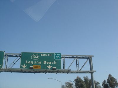
California State Route 133, highway in California

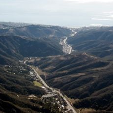
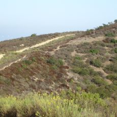
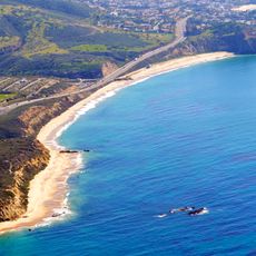
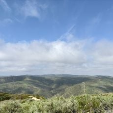
California State Route 133 is a short highway that runs entirely within Orange County, starting at the coast in Laguna Beach. The route winds through Laguna Canyon with curves and scenic views of canyon walls, and later becomes a limited access expressway north of Laguna Beach with toll sections.

The route was added to the road system in 1933 as Legislative Route Number 185, originally connecting Laguna Beach and Irvine as a simple country road. By the 1950s it was upgraded to meet expressway standards, and in the 1960s it was renamed California State Route 133 with new connections to Interstate 405 and Interstate 5.

The route passes by art galleries and small cafes that reflect Laguna Beach's artist heritage. These spots show how the community has kept its character while the road itself has become a modern traffic corridor.

Drivers should be aware of toll sections north of Laguna Beach and plan ahead to avoid surprises. The route is well-marked, but traffic can be heavy during peak hours, especially in summer, so allow extra time when traveling.

Parts of this route operate as the Eastern Toll Road, managed by a special agency that keeps traffic moving efficiently during busy hours with less congestion than alternative routes. This toll operation offers travelers a faster option through one of Southern California's busiest traffic corridors.

The community of curious travelers

AroundUs brings together thousands of curated places, local tips, and hidden gems, enriched daily by 60,000 contributors worldwide.

Start exploring
Location
Inception
1933
GPS coordinates
33.65671,-117.75825
Latest update
February 17, 2026 02:01
Around this place
Saddleback Church
United States of America

Saddleback Church

10.3 km
Marine Corps Air Station Tustin
United States of America

Marine Corps Air Station Tustin

8.1 km
Orange County Great Park
United States of America

Orange County Great Park

3 km
Mariners Church
United States of America

Mariners Church

7.6 km
Wild Rivers
United States of America

Wild Rivers

1.8 km
Chet Holifield Federal Building
United States of America

Chet Holifield Federal Building

11.4 km
Laguna Woods Village
United States of America

Laguna Woods Village

5.8 km
Bren Events Center
United States of America

Bren Events Center

8.3 km
Laguna Canyon
United States of America

Laguna Canyon

10.2 km
Claire Trevor School of the Arts
United States of America

Claire Trevor School of the Arts

8.1 km
Laguna Coast Wilderness Park
United States of America

Laguna Coast Wilderness Park

9.3 km
Islamic Center of Irvine
United States of America

Islamic Center of Irvine

4.5 km
Pretend City Children's Museum
United States of America

Pretend City Children's Museum

2.4 km
San Joaquin Wildlife Sanctuary
United States of America

San Joaquin Wildlife Sanctuary

8 km
Pao Fa Temple
United States of America

Pao Fa Temple

7.7 km
Bommer Canyon
United States of America

Bommer Canyon

5.5 km
The Resort at Pelican Hill
United States of America

The Resort at Pelican Hill

11 km
University of California, Irvine Arboretum
United States of America

University of California, Irvine Arboretum

8.8 km
Boomers! Irvine
United States of America

Boomers! Irvine

7.2 km
Crawford Hall
United States of America

Crawford Hall

8.4 km
Jose Serrano Adobe
United States of America

Jose Serrano Adobe

7 km
Encore Dinner Theatre
United States of America

Encore Dinner Theatre

11 km
Irvine Ranch Natural Landmarks
United States of America

Irvine Ranch Natural Landmarks

10.3 km
Silkwood Park
United States of America

Silkwood Park

6.6 km
Frances Packing House
United States of America

Frances Packing House

6 km
Signal Peak
United States of America

Signal Peak

7.6 km
Irvine Blacksmith Shop
United States of America

Irvine Blacksmith Shop

2.2 km
Pelican Hill Golf Club
United States of America

Pelican Hill Golf Club

11.3 km
Show the full map
Reviews
Share your experience

No review yet

Discussions
Start a discussion...

No discussion yet

« California State Route 133 - highway in California » is provided by Around Us (aroundus.com). Images and texts are derived from Wikimedia project under a Creative Commons license. You are allowed to copy, distribute, and modify copies of this page, under the conditions set by the license, as long as this note is clearly visible.

Discover hidden gems everywhere you go!

From secret cafés to breathtaking viewpoints, skip the crowded tourist spots and find places that match your style. Our app makes it easy with voice search, smart filtering, route optimization, and insider tips from travelers worldwide. Download now for the complete mobile experience.

Around Us App Screenshot

A unique approach to discovering new places

Le Figaro

All the places worth exploring

France Info

A tailor-made excursion in just a few clicks

20 Minutes

Around Us
Travel Guide & Maps
Download

Send to your phone

QR Code
1

Open the camera app on your mobile.

2

Point at the QR code with your camera. A notification will appear.

3

Tap the notification to open the link.