Chest opened
+${chestReward.xp} XP
Explorer
NOUVEAU ×${chestReward.collectible.quantity}
tapez pour fermer
Chest locked

Open chests in the app

Around Us is built for your phone — chests unlock when you walk, explore and capture nearby places.

Enable Location

We need your location to show you interesting places around you

Discover nearby places

Find interesting locations and hidden gems around you

Precise directions

Get accurate directions and distances to places

Your location is never shared with other users. It's only used when you tap the location button.

Castle Dome Landing

Log in to your account

Start exploring — it's free

Trusted by 72,927 travelers worldwide

Continue with Google
Continue with Apple
or

We will send you a code to connect

By continuing, you accept our Terms and Conditions and our Privacy Policy

Check your inbox

We've sent a pincode in your inbox. Please enter the code below.

Castle Dome Landing
Discussion Reviews 1 Photos
5.7k Popularity

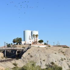
Castle Dome Landing, ghost town in Yuma County, Arizona, United States

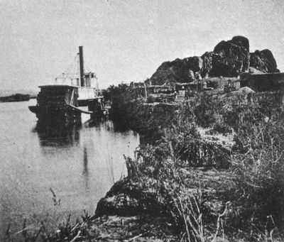
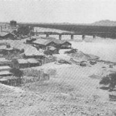
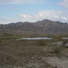
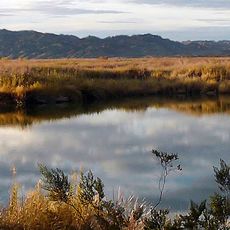
Castle Dome Landing was a settlement in Yuma County, Arizona, founded around 1863 as a transport center for mining products. The town developed as a trading hub along the Colorado River where miners and merchants gathered to store and ship ores.

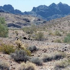
Jacob Snively discovered silver in the nearby mountains in 1864, establishing the first settlement at the site. The town reached its peak in the 1870s but declined as silver prices fell, and mining finally ceased in 1979 after World War II.

The name comes from the distinctive mountains nearby that resemble a castle fortress. This was a meeting place for miners and traders who gathered to transport ore and conduct business along the Colorado River.

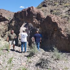
The original site is underwater, so the museum with restored buildings is located on land where visitors can walk through on foot. Comfortable shoes and water are important since the visit is mostly outdoors and the terrain can be warm and dry.

The museum holds the world's largest silver-galena bar and original Levi's jeans over 100 years old, showing the long human connection to the place. These rare artifacts give visitors a direct link to the people who lived here more than a century ago.

The community of curious travelers

AroundUs brings together thousands of curated places, local tips, and hidden gems, enriched daily by 60,000 contributors worldwide.

Start exploring
Location
Inception
1869
Elevation above the sea
62 m
GPS coordinates
32.96500,-114.46400
Latest update
December 18, 2025 21:57
Around this place
Ocean To Ocean Bridge
United States of America

Ocean To Ocean Bridge

29.9 km
McPhaul Suspension Bridge
United States of America

McPhaul Suspension Bridge

23.3 km
Yuma Crossing
United States of America

Yuma Crossing

29.9 km
Picacho State Recreation Area
United States of America

Picacho State Recreation Area

15.1 km
Imperial National Wildlife Refuge
United States of America

Imperial National Wildlife Refuge

25.3 km
Little Picacho Wilderness
United States of America

Little Picacho Wilderness

10.2 km
Imperial Reservoir
United States of America

Imperial Reservoir

9.1 km
Mission Puerto de Purísima Concepción
United States of America

Mission Puerto de Purísima Concepción

29.7 km
United States of America

Picacho Peak Wilderness

25.8 km
Trigo Mountains Wilderness
United States of America

Trigo Mountains Wilderness

28.2 km
Arturos Bridge
United States of America

Arturos Bridge

17.6 km
United States of America

Imperial National Wildlife Refuge

8.7 km
United States of America

Senator Wash Reservoir

6.3 km
United States of America

Bear Canyon Bluff

19.6 km
Southern Pacific Railroad Yuma Bridge
United States of America

Southern Pacific Railroad Yuma Bridge

29.9 km
United States of America

1930's Colorado River Work Boat

15.5 km
United States of America

Lower Mill

14.4 km
United States of America

Upper Mill Site

14.3 km
United States of America

Cobra Gunship Helicopter Display

15.8 km
United States of America

Natural Arch

28.8 km
United States of America

Dragon's Nest

28.3 km
United States of America

Valley of the Names

22.9 km

Ampitheater

15.6 km
United States of America

Scenic viewpoint

21.1 km
United States of America

Upper Dock

15.8 km
United States of America

Donald Duck Overlook

18.9 km
United States of America

Bear Canyon Falls

20.1 km
United States of America

Carrizo Falls

21.9 km
Show the full map
Reviews
Share your experience

No review yet

Discussions
Start a discussion...

No discussion yet

« Castle Dome Landing - ghost town in Yuma County, Arizona, United States » is provided by Around Us (aroundus.com). Images and texts are derived from Wikimedia project under a Creative Commons license. You are allowed to copy, distribute, and modify copies of this page, under the conditions set by the license, as long as this note is clearly visible.

Discover hidden gems everywhere you go!

From secret cafés to breathtaking viewpoints, skip the crowded tourist spots and find places that match your style. Our app makes it easy with voice search, smart filtering, route optimization, and insider tips from travelers worldwide. Download now for the complete mobile experience.

Around Us App Screenshot

A unique approach to discovering new places

Le Figaro

All the places worth exploring

France Info

A tailor-made excursion in just a few clicks

20 Minutes

Around Us
Travel Guide & Maps
Download

Send to your phone

QR Code
1

Open the camera app on your mobile.

2

Point at the QR code with your camera. A notification will appear.

3

Tap the notification to open the link.