Chest opened
+${chestReward.xp} XP
Explorer
NOUVEAU ×${chestReward.collectible.quantity}
tapez pour fermer
Chest locked

Open chests in the app

Around Us is built for your phone — chests unlock when you walk, explore and capture nearby places.

Enable Location

We need your location to show you interesting places around you

Discover nearby places

Find interesting locations and hidden gems around you

Precise directions

Get accurate directions and distances to places

Your location is never shared with other users. It's only used when you tap the location button.

Agua Fria River

Log in to your account

Start exploring — it's free

Trusted by 72,986 travelers worldwide

Continue with Google
Continue with Apple
or

We will send you a code to connect

By continuing, you accept our Terms and Conditions and our Privacy Policy

Check your inbox

We've sent a pincode in your inbox. Please enter the code below.

Agua Fria River
Discussion Reviews 1 Photos
8.7k Popularity

Agua Fria River, River system in central Arizona, United States.

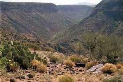
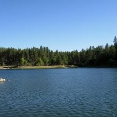
The Agua Fria River is a river system in central Arizona that flows southward from higher elevations through canyon landscapes. The water eventually reaches a large reservoir situated north of Phoenix in the region.

The river served as a water source for irrigation and farming activities in the early 1900s before modern water management systems were developed. These changes transformed how water from the system was used across the region.

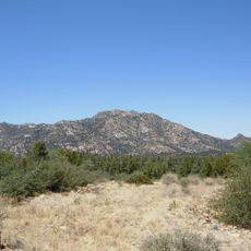
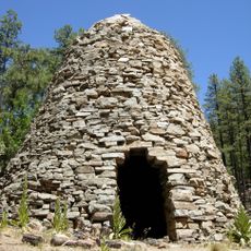
The river corridor contains numerous archaeological sites within the Agua Fria National Monument, where evidence of long-term habitation is visible to visitors. These places tell the story of how people lived in this landscape over centuries.

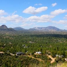
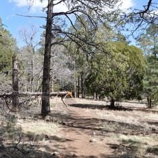
Visitors can access the river through hiking trails, though some routes cross challenging terrain. It is important to prepare for variable conditions and bring appropriate footwear and plenty of water.

The river shows dramatic changes in water flow depending on the season and rainfall, with some sections running dry while others carry flowing water. These natural variations are a defining feature of the landscape.

The community of curious travelers

AroundUs brings together thousands of curated places, local tips, and hidden gems, enriched daily by 60,000 contributors worldwide.

Start exploring
Location
GPS coordinates
34.61670,-112.39880
Latest update
December 10, 2025 16:01
Around this place
Fort Whipple
United States of America

Fort Whipple

8.8 km
Mingus Mountain
United States of America

Mingus Mountain

26.3 km
Granite Mountain
United States of America

Granite Mountain

16.5 km
Sharlot Hall Museum
United States of America

Sharlot Hall Museum

10.8 km
Goldwater Lake
United States of America

Goldwater Lake

13.9 km
Arizona Pioneers' Home
United States of America

Arizona Pioneers' Home

11.2 km
United States of America

Granite Basin Lake

13.8 km
Walker Charcoal Kiln
United States of America

Walker Charcoal Kiln

17.8 km
Bucky O'Neill Monument
United States of America

Bucky O'Neill Monument

10.6 km
Yavapai County Courthouse
United States of America

Yavapai County Courthouse

10.6 km
Hassayampa Inn
United States of America

Hassayampa Inn

10.4 km
Prescott Observatory
United States of America

Prescott Observatory

14.3 km
Prescott Public Library
United States of America

Prescott Public Library

10.6 km
Smoki Museum
United States of America

Smoki Museum

9.8 km
Prescott Elks Theater and Performing Arts Center
United States of America

Prescott Elks Theater and Performing Arts Center

10.5 km
Woodchute Wilderness
United States of America

Woodchute Wilderness

25.1 km
Sacred Heart Catholic Church and Rectory
United States of America

Sacred Heart Catholic Church and Rectory

10.2 km
Iron Turbine Windmill
United States of America

Iron Turbine Windmill

10.8 km
United States Post Office and Courthouse–Prescott Main
United States of America

United States Post Office and Courthouse–Prescott Main

10.7 km
First Congregational Church and Parsonage
United States of America

First Congregational Church and Parsonage

10.4 km
Prescott Public Library
United States of America

Prescott Public Library

10.5 km
Brinkmeyer House
United States of America

Brinkmeyer House

11 km
Courthouse Plaza Historic District
United States of America

Courthouse Plaza Historic District

10.6 km
Sloan House
United States of America

Sloan House

10.3 km
Fredericks House
United States of America

Fredericks House

10.5 km
Clark House
United States of America

Clark House

10.2 km
Detwiler House
United States of America

Detwiler House

10 km
Spruce Mountain Lookout
United States of America

Spruce Mountain Lookout

17.1 km
Show the full map
Reviews
Share your experience

No review yet

Discussions
Start a discussion...

No discussion yet

« Agua Fria River - River system in central Arizona, United States » is provided by Around Us (aroundus.com). Images and texts are derived from Wikimedia project under a Creative Commons license. You are allowed to copy, distribute, and modify copies of this page, under the conditions set by the license, as long as this note is clearly visible.

Discover hidden gems everywhere you go!

From secret cafés to breathtaking viewpoints, skip the crowded tourist spots and find places that match your style. Our app makes it easy with voice search, smart filtering, route optimization, and insider tips from travelers worldwide. Download now for the complete mobile experience.

Around Us App Screenshot

A unique approach to discovering new places

Le Figaro

All the places worth exploring

France Info

A tailor-made excursion in just a few clicks

20 Minutes

Around Us
Travel Guide & Maps
Download

Send to your phone

QR Code
1

Open the camera app on your mobile.

2

Point at the QR code with your camera. A notification will appear.

3

Tap the notification to open the link.