Terlingua

Log in to your account

AroundUs is a community-driven map of interesting places, built by curious explorers like you. It grows with every review, story, and photo you share.
Connect to save your favorite spots, contribute locations, and create personalized routes.
By continuing, you accept our Terms and Conditions and our Privacy Policy
Add to collection
Map
Suggest a change
Share

Terlingua, Ghost town in Brewster County, Texas, United States.

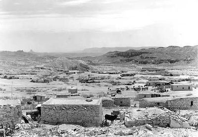
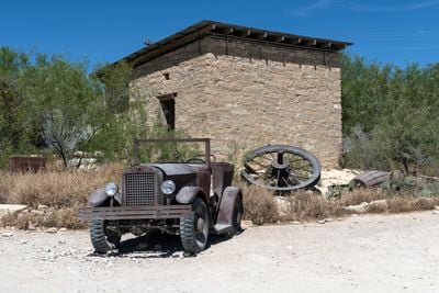
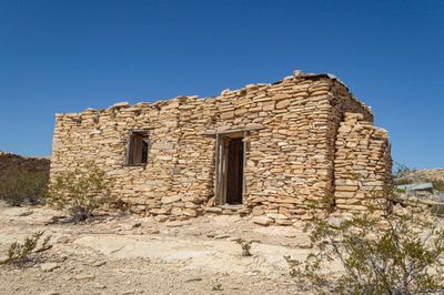
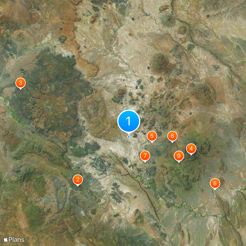
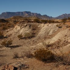
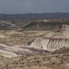
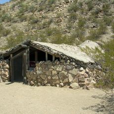
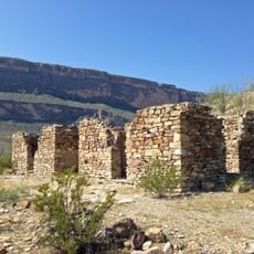
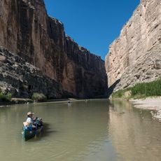
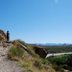
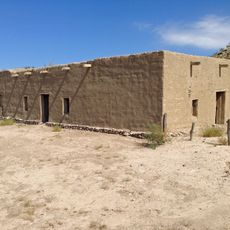
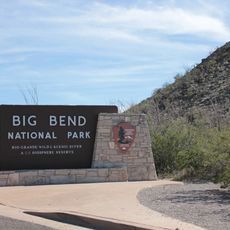
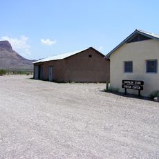
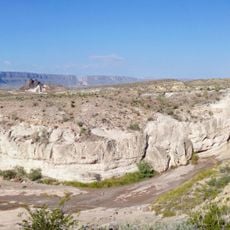
Terlingua is a ghost town in Brewster County, Texas, situated between Big Bend National Park and Big Bend Ranch State Park. The settlement consists of adobe ruins, trading company structures, and offers views of mountain ranges.

The discovery of mercury in the 1880s transformed the area into a mining town with one thousand residents. The Chisos Mining Company filed for bankruptcy in 1942, leading to the decline of the settlement.

The first chili championship began in 1967 and grew into an annual November gathering that brings over ten thousand people to this desert settlement. During the event, the ghost town becomes a lively meeting point with music and stalls.

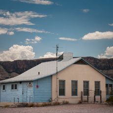
The Starlight Theatre Restaurant and Bar, art galleries, and the Terlingua Trading Company offer services for visitors exploring the desert settlement. Arriving by car is recommended, as there are no public transport options.

The cemetery, established in 1903, contains wooden crosses marking graves of miners who died in accidents and during the flu epidemic. Many burial sites are decorated with personal items and handwritten messages.

Location: Brewster County

Elevation above the sea: 764 m

GPS coordinates: 29.32167,-103.61611

Latest update: December 12, 2025 17:59

Photos
Hidden places in Texas

Texas combines landscapes that barely resemble each other. The west spreads out in deserts and sand dunes, while the east is marked by swamps and dense forests. Between these extremes lie limestone cliffs, natural springs, and waterfalls that bubble up from the ground. The size of the state allows...

Around this place
Cañón de Santa Elena Flora and Fauna Protection Area
Mexico

Cañón de Santa Elena Flora and Fauna Protection Area

33.9 km
Big Bend Ranch State Park
United States of America

Big Bend Ranch State Park

57.1 km
Emory Peak
United States of America

Emory Peak

31.4 km
Aguja Formation
Mexico

Aguja Formation

11.5 km
Javelina Formation
United States of America

Javelina Formation

21.1 km
Luna Jacal
United States of America

Luna Jacal

14.3 km
Mariscal Mine
United States of America

Mariscal Mine

48.7 km
Homer Wilson Ranch
United States of America

Homer Wilson Ranch

27 km
Persimmon Gap
United States of America

Persimmon Gap

57.9 km
Rancho Estelle
United States of America

Rancho Estelle

19 km
Santa Elena Canyon
United States of America

Santa Elena Canyon

17.4 km
Sotol Vista Overlook
United States of America

Sotol Vista Overlook

26.1 km
Santa Elena Canyon Trail
United States of America

Santa Elena Canyon Trail

17.2 km
Panther Junction Visitor Center
United States of America

Panther Junction Visitor Center

39.8 km
Panther Junction Mission 66 Historic District
United States of America

Panther Junction Mission 66 Historic District

39.8 km
Castolon Historic District
United States of America

Castolon Historic District

23.1 km
Castolon Ranger Station
United States of America

Castolon Ranger Station

23.2 km
Persimmon Gap Entrance Sign
United States of America

Persimmon Gap Entrance Sign

59 km
Chisos Basin Visitor Center
United States of America

Chisos Basin Visitor Center

31.2 km
Dugout Wells
United States of America

Dugout Wells

47 km
Camel Experiment Exhibit
United States of America

Camel Experiment Exhibit

56.8 km
Starlight Theatre
United States of America

Starlight Theatre

4.8 km
Castolon Store
United States of America

Castolon Store

23.1 km
Alvino House
United States of America

Alvino House

23.1 km
Persimmon Gap Entrance Station
United States of America

Persimmon Gap Entrance Station

57.2 km
Homer Wilson Ranch Overlook
United States of America

Homer Wilson Ranch Overlook

26.7 km
Maverick Entrance Sign
United States of America

Maverick Entrance Sign

10.8 km
Recreation Building
United States of America

Recreation Building

23.1 km
Show the full map
Reviews

Visited this place? Tap the stars to rate it and share your experience / photos with the community! Try now! You can cancel it anytime.

« Terlingua - Ghost town in Brewster County, Texas, United States » is provided by Around Us (aroundus.com). Images and texts are derived from Wikimedia project under a Creative Commons license. You are allowed to copy, distribute, and modify copies of this page, under the conditions set by the license, as long as this note is clearly visible.

Discover hidden gems everywhere you go!

From secret cafés to breathtaking viewpoints, skip the crowded tourist spots and find places that match your style. Our app makes it easy with voice search, smart filtering, route optimization, and insider tips from travelers worldwide. Download now for the complete mobile experience.

Around Us App Screenshot

A unique approach to discovering new places

Le Figaro

All the places worth exploring

France Info

A tailor-made excursion in just a few clicks

20 Minutes