Enable Location

We need your location to show you interesting places around you

Discover nearby places

Find interesting locations and hidden gems around you

Precise directions

Get accurate directions and distances to places

Your location is never shared with other users. It's only used when you tap the location button.

Log in to your account

Start exploring — it's free

Trusted by 65,779 travelers worldwide

Continue with Google
Continue with Apple
or

We will send you a code to connect

By continuing, you accept our Terms and Conditions and our Privacy Policy

Check your inbox

We've sent a pincode in your inbox. Please enter the code below.

Pima Canyon
Discussion Reviews Photo
3k Popularity

Pima Canyon, Desert canyon in Santa Catalina Mountains, Arizona

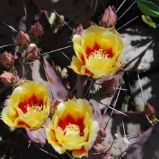
Pima Canyon is a desert canyon in the Santa Catalina Mountains just north of Tucson, Arizona, accessible via a marked trail from a dedicated trailhead. The path winds through Sonoran Desert terrain, passing several vegetation zones before reaching an old dam structure near the upper end of the trail.

The canyon was used by indigenous peoples for many generations as a passage and a source of food and water, long before European settlers arrived in the region. The old dam structure visible on the trail dates from a later period, when the valley was put to new uses by ranchers and early settlers.

The canyon sits within the traditional territory of the Tohono O'odham people, who have a long connection to this land. Petroglyphs and other traces of that presence can still be seen along the trail today.

The trailhead is reached from Oracle Road and Magee Road, where a parking area with basic facilities is available. Bringing enough water is important, as the terrain becomes steep and shade is rare along most of the route.

Part of the canyon closes to visitors each year during the lambing season of the Sonoran Desert bighorn sheep, a restriction that is rare for a hiking area of this type. This seasonal closure protects one of the few remaining populations of these animals near Tucson.

The community of curious travelers

AroundUs brings together thousands of curated places, local tips, and hidden gems, enriched daily by 60,000 contributors worldwide.

Start exploring
Location
GPS coordinates
32.21000,-110.92000
Latest update
March 3, 2026 13:52
Around this place
Arizona Stadium
United States of America

Arizona Stadium

3.4 km
United States of America

Bear Down

3.7 km
Tucson Botanical Gardens
United States of America

Tucson Botanical Gardens

1.4 km
Steward Observatory
United States of America

Steward Observatory

3.8 km
Reid Park Zoo
United States of America

Reid Park Zoo

135 m
Old Main, University of Arizona
United States of America

Old Main, University of Arizona

3.9 km
Rialto Theatre
United States of America

Rialto Theatre

4.6 km
Arizona State Museum
United States of America

Arizona State Museum

4.2 km
University of Arizona Museum of Art
United States of America

University of Arizona Museum of Art

4.4 km
University of Arizona College of Optical Sciences
United States of America

University of Arizona College of Optical Sciences

3.5 km
Centennial Hall
United States of America

Centennial Hall

4.1 km
Loft Cinema
United States of America

Loft Cinema

2.9 km
Bear Down Gym
United States of America

Bear Down Gym

3.7 km
University of Arizona Poetry Center
United States of America

University of Arizona Poetry Center

4.1 km
Santa Cruz Catholic Church
United States of America

Santa Cruz Catholic Church

4.6 km
Mosque Tucson
United States of America

Mosque Tucson

4.5 km
Armory Park Historic Residential District
United States of America

Armory Park Historic Residential District

4.4 km
University of Arizona Campus Historic District
United States of America

University of Arizona Campus Historic District

4 km
Ball-Paylore House
United States of America

Ball-Paylore House

4.3 km
Flandrau Science Center and Planetarium
United States of America

Flandrau Science Center and Planetarium

3.6 km
Catalina American Baptist Church
United States of America

Catalina American Baptist Church

4.2 km
Rincon Heights Historic District
United States of America

Rincon Heights Historic District

3.1 km
Blenman-Elm Historic District
United States of America

Blenman-Elm Historic District

4 km
Colonia Solana Residential Historic District
United States of America

Colonia Solana Residential Historic District

904 m
Ignite Sign Art Museum
United States of America

Ignite Sign Art Museum

2.1 km
Saint Joseph church in Tucson
United States of America

Saint Joseph church in Tucson

4.4 km
Saint Cyril of Alexandria church in Tucson
United States of America

Saint Cyril of Alexandria church in Tucson

4.2 km
Saints-Peter-and-Paul church of Tucson
United States of America

Saints-Peter-and-Paul church of Tucson

3.7 km
Show the full map
Reviews
Share your experience

No review yet

Discussions
Start a discussion...

No discussion yet

« Pima Canyon - Desert canyon in Santa Catalina Mountains, Arizona » is provided by Around Us (aroundus.com). Images and texts are derived from Wikimedia project under a Creative Commons license. You are allowed to copy, distribute, and modify copies of this page, under the conditions set by the license, as long as this note is clearly visible.

Discover hidden gems everywhere you go!

From secret cafés to breathtaking viewpoints, skip the crowded tourist spots and find places that match your style. Our app makes it easy with voice search, smart filtering, route optimization, and insider tips from travelers worldwide. Download now for the complete mobile experience.

Around Us App Screenshot

A unique approach to discovering new places

Le Figaro

All the places worth exploring

France Info

A tailor-made excursion in just a few clicks

20 Minutes

Around Us
Travel Guide & Maps
Download

Send to your phone

QR Code
1

Open the camera app on your mobile.

2

Point at the QR code with your camera. A notification will appear.

3

Tap the notification to open the link.