Enable Location

We need your location to show you interesting places around you

Discover nearby places

Find interesting locations and hidden gems around you

Precise directions

Get accurate directions and distances to places

Your location is never shared with other users. It's only used when you tap the location button.

Balmorhea State Park

Log in to your account

Start exploring — it's free

Trusted by 62,492 travelers worldwide

Continue with Google
Continue with Apple
or

We will send you a code to connect

By continuing, you accept our Terms and Conditions and our Privacy Policy

Check your inbox

We've sent a pincode in your inbox. Please enter the code below.

Balmorhea State Park

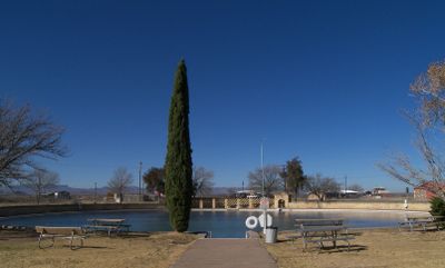
Balmorhea State Park, Natural spring swimming pool in Reeves County, US.

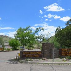
Balmorhea State Park is a natural park in Reeves County, West Texas, built around a natural spring. The swimming pool is fed by San Solomon Springs and stays between 22 and 24 degrees Celsius year-round.

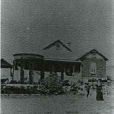
The Civilian Conservation Corps built the pool and San Solomon Courts between 1936 and 1941 as part of New Deal programs. Mexican settlers had already dug irrigation canals from the springs in the 19th century.

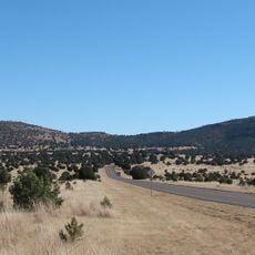
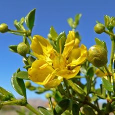
The springs were once called Mescalero Springs after the Apache groups who long used this water source in the Chihuahua Desert. Today families from across West Texas drive here to swim in one of the few permanent bodies of water in an otherwise dry region.

The park limits daily visitors to 900, so arrive early in the morning during busy periods. Divers and snorkelers find several areas in the pool with different depths, with the deepest section reaching about 8 meters (25 feet).

The spring releases between 83 and 106 million liters of water daily, so the pool never needs chlorine treatment. Some of the fish living in the pool are descendants of species that have been in these waters for thousands of years.

The community of curious travelers

AroundUs brings together thousands of curated places, local tips, and hidden gems, enriched daily by 60,000 contributors worldwide.

Start exploring
Location
GPS coordinates
30.94440,-103.78300
Latest update
December 20, 2025 12:22
Around this place
McDonald Observatory
United States of America

McDonald Observatory

38 km
Davis Mountains State Park
United States of America

Davis Mountains State Park

41.4 km
Hobby–Eberly Telescope
United States of America

Hobby–Eberly Telescope

36.7 km
Harlan J. Smith Telescope
United States of America

Harlan J. Smith Telescope

38 km
El Paisano Hotel
United States of America

El Paisano Hotel

74 km
The Holland Hotel
United States of America

The Holland Hotel

66.4 km
Otto Struve Telescope
United States of America

Otto Struve Telescope

38.1 km
Chihuahuan Desert Nature Center and Botanical Gardens
United States of America

Chihuahuan Desert Nature Center and Botanical Gardens

45.3 km
Presidio County Courthouse
United States of America

Presidio County Courthouse

73.9 km
Jeff Davis County Courthouse
United States of America

Jeff Davis County Courthouse

41 km
Henry M. and Annie V. Trueheart House
United States of America

Henry M. and Annie V. Trueheart House

41.2 km
Grierson-Sproul House
United States of America

Grierson-Sproul House

41.1 km
Hotel Limpia
United States of America

Hotel Limpia

41 km
Museum of the Big Bend
United States of America

Museum of the Big Bend

65.8 km
Rattlers and Reptiles
United States of America

Rattlers and Reptiles

39.5 km
Frank N. Bash Visitors Center
United States of America

Frank N. Bash Visitors Center

37.5 km
Palace Theater
United States of America

Palace Theater

73.8 km
Fort Davis
United States of America

Fort Davis

39.9 km
Rangra Theatres
United States of America

Rangra Theatres

66.3 km
Granada Theatre
United States of America

Granada Theatre

66.3 km
Brewster County Courthouse
United States of America

Brewster County Courthouse

66.3 km
Fort Davis National Historic Site Visitor Center
United States of America

Fort Davis National Historic Site Visitor Center

40 km
Fort Davis VLBA station
United States of America

Fort Davis VLBA station

37.8 km
Texas Theater
United States of America

Texas Theater

73.8 km
Fort Davis Quarters HB-14
United States of America

Fort Davis Quarters HB-14

39.7 km
Rebecca Gale Telescope Park Amphitheater
United States of America

Rebecca Gale Telescope Park Amphitheater

37.5 km
Fort Davis Magazine
United States of America

Fort Davis Magazine

39.9 km
Fort Davis Post Chapel
United States of America

Fort Davis Post Chapel

39.7 km
Show the full map
« Balmorhea State Park - Natural spring swimming pool in Reeves County, US » is provided by Around Us (aroundus.com). Images and texts are derived from Wikimedia project under a Creative Commons license. You are allowed to copy, distribute, and modify copies of this page, under the conditions set by the license, as long as this note is clearly visible.

Discover hidden gems everywhere you go!

From secret cafés to breathtaking viewpoints, skip the crowded tourist spots and find places that match your style. Our app makes it easy with voice search, smart filtering, route optimization, and insider tips from travelers worldwide. Download now for the complete mobile experience.

Around Us App Screenshot

A unique approach to discovering new places

Le Figaro

All the places worth exploring

France Info

A tailor-made excursion in just a few clicks

20 Minutes

Around Us
Travel Guide & Maps
Download

Send to your phone

QR Code
1

Open the camera app on your mobile.

2

Point at the QR code with your camera. A notification will appear.

3

Tap the notification to open the link.