Chest opened
+${chestReward.xp} XP
Explorer
NOUVEAU ×${chestReward.collectible.quantity}
tapez pour fermer
Chest locked

Open chests in the app

Around Us is built for your phone — chests unlock when you walk, explore and capture nearby places.

Enable Location

We need your location to show you interesting places around you

Discover nearby places

Find interesting locations and hidden gems around you

Precise directions

Get accurate directions and distances to places

Your location is never shared with other users. It's only used when you tap the location button.

Buchel County

Log in to your account

Start exploring — it's free

Trusted by 72,889 travelers worldwide

Continue with Google
Continue with Apple
or

We will send you a code to connect

By continuing, you accept our Terms and Conditions and our Privacy Policy

Check your inbox

We've sent a pincode in your inbox. Please enter the code below.

Discussion Reviews 1 Photos
1.4k Popularity

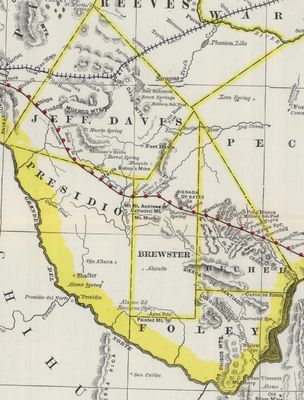
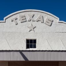
Buchel County, Former county in Texas, United States

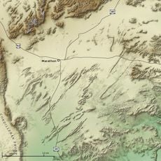
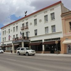
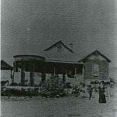
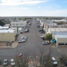
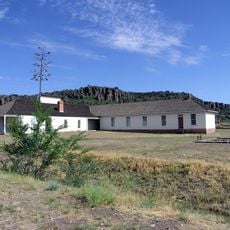
Buchel County was a former county occupying the northeastern area of present-day Brewster County in Texas, with Marathon serving as its county seat. The territory covered roughly what is now the eastern part of the Brewster County area.

The county was created in March 1887 when the Texas legislature divided Presidio County into separate parts. It remained active for about ten years before being dissolved in 1897.

The name comes from Augustus Buchel, a German military officer, reflecting German influence on early Texas settlement and development. This connection to German heritage shaped the region's identity during its time.

Historical records, documents, and maps from the county's period of operation are preserved in the Texas State Archives and available for research and genealogical study. These resources help visitors trace family connections and understand the region's development.

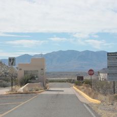
The 1890 census recorded around 300 residents, with most concentrated in Marathon, making it one of the smaller population centers of the era. This relatively small population reflects how sparsely settled the remote Big Bend region was during that time.

The community of curious travelers

AroundUs brings together thousands of curated places, local tips, and hidden gems, enriched daily by 60,000 contributors worldwide.

Start exploring
Location
Inception
1887
GPS coordinates
30.20000,-103.25000
Latest update
March 5, 2026 18:17
Around this place
Chinati Foundation
United States of America

Chinati Foundation

75.5 km
Marathon Uplift
United States of America

Marathon Uplift

1.1 km
El Paisano Hotel
United States of America

El Paisano Hotel

75.3 km
The Holland Hotel
United States of America

The Holland Hotel

43.4 km
Chihuahuan Desert Nature Center and Botanical Gardens
United States of America

Chihuahuan Desert Nature Center and Botanical Gardens

68 km
Presidio County Courthouse
United States of America

Presidio County Courthouse

75.3 km
Jeff Davis County Courthouse
United States of America

Jeff Davis County Courthouse

75.6 km
Persimmon Gap
United States of America

Persimmon Gap

59.7 km
Henry M. and Annie V. Trueheart House
United States of America

Henry M. and Annie V. Trueheart House

76.1 km
Gage Hotel
United States of America

Gage Hotel

849 m
Museum of the Big Bend
United States of America

Museum of the Big Bend

42.7 km
Central Marfa Historic District
United States of America

Central Marfa Historic District

75.2 km
Museum of Electronic Wonders @ FOOD SHARK with Snack Bar & Casita Bar
United States of America

Museum of Electronic Wonders @ FOOD SHARK with Snack Bar & Casita Bar

75.9 km
Marfa Lights Viewing Area
United States of America

Marfa Lights Viewing Area

61.4 km
Rattlers and Reptiles
United States of America

Rattlers and Reptiles

75.6 km
Persimmon Gap Entrance Sign
United States of America

Persimmon Gap Entrance Sign

58.5 km
Rangra Theatres
United States of America

Rangra Theatres

43.2 km
Granada Theatre
United States of America

Granada Theatre

43.1 km
Palace Theater
United States of America

Palace Theater

75.3 km
Fort Davis
United States of America

Fort Davis

76 km
Fort Davis National Historic Site Visitor Center
United States of America

Fort Davis National Historic Site Visitor Center

75.9 km
Brewster County Courthouse
United States of America

Brewster County Courthouse

43.4 km
Texas Theater
United States of America

Texas Theater

75.3 km
Fort Davis Enlisted Men's Barracks HB-21
United States of America

Fort Davis Enlisted Men's Barracks HB-21

75.9 km
Persimmon Gap Entrance Station
United States of America

Persimmon Gap Entrance Station

60.4 km
Fort Davis Quarters HB-14
United States of America

Fort Davis Quarters HB-14

76.1 km
Fort Davis Post Chapel
United States of America

Fort Davis Post Chapel

76 km
Fort Davis Officers' Row
United States of America

Fort Davis Officers' Row

76 km
Show the full map
Reviews
Share your experience

No review yet

Discussions
Start a discussion...

No discussion yet

« Buchel County - Former county in Texas, United States » is provided by Around Us (aroundus.com). Images and texts are derived from Wikimedia project under a Creative Commons license. You are allowed to copy, distribute, and modify copies of this page, under the conditions set by the license, as long as this note is clearly visible.

Discover hidden gems everywhere you go!

From secret cafés to breathtaking viewpoints, skip the crowded tourist spots and find places that match your style. Our app makes it easy with voice search, smart filtering, route optimization, and insider tips from travelers worldwide. Download now for the complete mobile experience.

Around Us App Screenshot

A unique approach to discovering new places

Le Figaro

All the places worth exploring

France Info

A tailor-made excursion in just a few clicks

20 Minutes

Around Us
Travel Guide & Maps
Download

Send to your phone

QR Code
1

Open the camera app on your mobile.

2

Point at the QR code with your camera. A notification will appear.

3

Tap the notification to open the link.