Chest opened
+${chestReward.xp} XP
Explorer
NOUVEAU ×${chestReward.collectible.quantity}
tapez pour fermer
Chest locked

Open chests in the app

Around Us is built for your phone — chests unlock when you walk, explore and capture nearby places.

Enable Location

We need your location to show you interesting places around you

Discover nearby places

Find interesting locations and hidden gems around you

Precise directions

Get accurate directions and distances to places

Your location is never shared with other users. It's only used when you tap the location button.

Hatch

Log in to your account

Start exploring — it's free

Trusted by 72,878 travelers worldwide

Continue with Google
Continue with Apple
or

We will send you a code to connect

By continuing, you accept our Terms and Conditions and our Privacy Policy

Check your inbox

We've sent a pincode in your inbox. Please enter the code below.

Discussion Reviews 2 Photos
29.2k Popularity

Hatch, Agricultural village in Doña Ana County, United States.

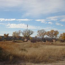
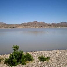
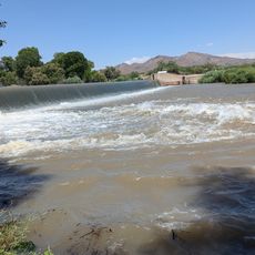
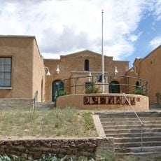
Hatch is a village in Doña Ana County, New Mexico, situated in a valley with mountain views and crisscrossed by irrigation channels. The landscape consists mainly of agricultural fields that follow the course of the Rio Grande.

The settlement began as Santa Barbara in 1851 and was renamed Hatch in 1875 to honor Indian fighter Edward Hatch, after the area experienced repeated hardship from Apache raids. The name change signaled a new era of relative stability and development.

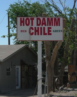
The community centers much of its life around chile pepper cultivation, with roasting and cooking traditions that shape local food culture and celebrations. Residents and visitors gather regularly to share meals featuring the distinctive local peppers.

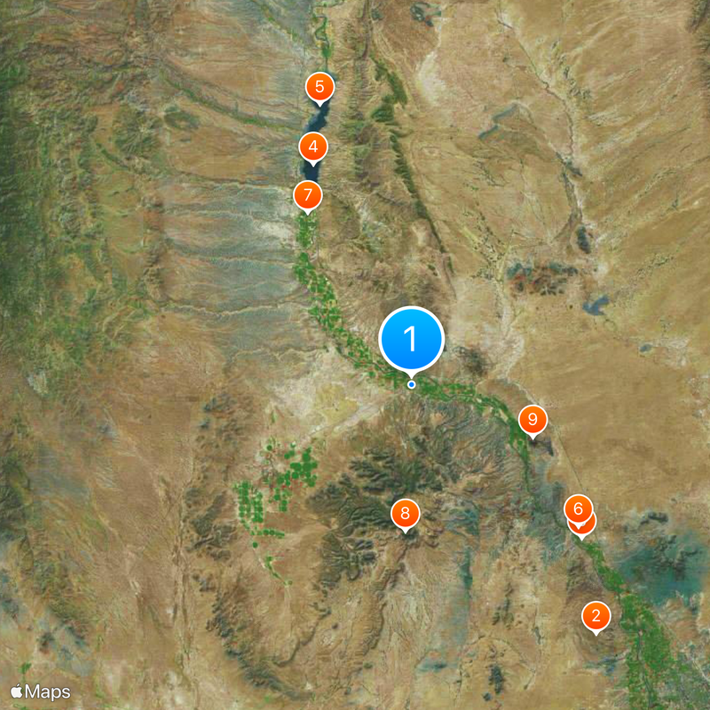
The village lies 40 miles north of Las Cruces on Interstate 25, making it convenient to reach by car from larger nearby cities. The flat terrain makes it easy to navigate on foot, though public transportation is limited.

The mineral-rich soil along the Rio Grande gives the local chiles a distinctive flavor that farmers have cultivated across many generations. Varieties grown here develop qualities that differ notably from those raised in other regions.

The community of curious travelers

AroundUs brings together thousands of curated places, local tips, and hidden gems, enriched daily by 60,000 contributors worldwide.

Start exploring
Location
Elevation above the sea
1,237 m
GPS coordinates
32.66472,-107.15861
Latest update
December 20, 2025 11:46
Around this place
Prehistoric Trackways National Monument
United States of America

Prehistoric Trackways National Monument

40.8 km
Fort Selden
United States of America

Fort Selden

30.2 km
Caballo Lake
United States of America

Caballo Lake

31.8 km
Caballo Lake State Park
United States of America

Caballo Lake State Park

38.8 km
United States of America

Leasburg Dam State Park

29 km
Percha Dam State Park
United States of America

Percha Dam State Park

26.4 km
United States of America

Blue Mesa Observatory

19.3 km
United States of America

San Diego Mountain

17.4 km
United States of America

Marijuana Tank

29.7 km
United States of America

Percha Diversion Dam

26.5 km
United States of America

Wetback Tank

33 km
United States of America

Cooke's Canyon

49.6 km
United States of America

Red Canyon

44.6 km
United States of America

Broad Canyon Wilderness

19 km
Rio Grande Bridge at Radium Springs
United States of America

Rio Grande Bridge at Radium Springs

29.5 km
George Tambling Miller and Ninette Stocker Miller House
United States of America

George Tambling Miller and Ninette Stocker Miller House

47.6 km
Hillsboro High School
United States of America

Hillsboro High School

47.6 km
United States of America

Cornelius Sullivan House

47.6 km
United States of America

Hatch Historical Marker

519 m
United States of America

Kight Flood Control Retarding Dam

15.7 km
United States of America

Sandia Gulch End

42.5 km
United States of America

Sandia Gulch Begin

43.7 km
United States of America

Lake Valley

38.6 km
United States of America

Palomas Gap

43.4 km
United States of America

Unknown Arch

40.2 km
United States of America

Work of art, sculpture

39.5 km
United States of America

Scenic viewpoint

24.4 km
United States of America

Branson Overlook

42.5 km
Show the full map
Reviews
Share your experience

No review yet

Discussions
Start a discussion...

No discussion yet

« Hatch - Agricultural village in Doña Ana County, United States » is provided by Around Us (aroundus.com). Images and texts are derived from Wikimedia project under a Creative Commons license. You are allowed to copy, distribute, and modify copies of this page, under the conditions set by the license, as long as this note is clearly visible.

Discover hidden gems everywhere you go!

From secret cafés to breathtaking viewpoints, skip the crowded tourist spots and find places that match your style. Our app makes it easy with voice search, smart filtering, route optimization, and insider tips from travelers worldwide. Download now for the complete mobile experience.

Around Us App Screenshot

A unique approach to discovering new places

Le Figaro

All the places worth exploring

France Info

A tailor-made excursion in just a few clicks

20 Minutes

Around Us
Travel Guide & Maps
Download

Send to your phone

QR Code
1

Open the camera app on your mobile.

2

Point at the QR code with your camera. A notification will appear.

3

Tap the notification to open the link.