Enable Location

We need your location to show you interesting places around you

Discover nearby places

Find interesting locations and hidden gems around you

Precise directions

Get accurate directions and distances to places

Your location is never shared with other users. It's only used when you tap the location button.

Oasis State Park

Log in to your account

Start exploring — it's free

Trusted by 62,057 travelers worldwide

Continue with Google
Continue with Apple
or

We will send you a code to connect

By continuing, you accept our Terms and Conditions and our Privacy Policy

Check your inbox

We've sent a pincode in your inbox. Please enter the code below.

Oasis State Park

Oasis State Park, State park in Roosevelt County, United States.

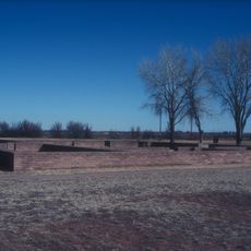
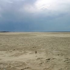
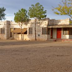
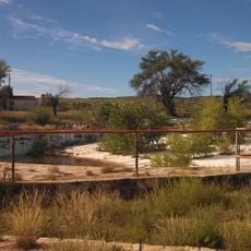
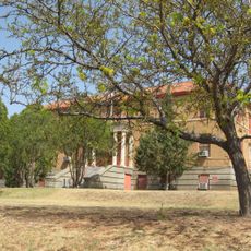
Oasis State Park sits north of Portales across 193 acres featuring sand dunes, cottonwood groves, and a three-acre fishing pond positioned at 4,100 feet elevation. The landscape includes camping areas, picnic grounds, and a visitor center distributed throughout the property.

New Mexico's State Parks Division established the park in 1961 to provide recreation for surrounding communities. This creation transformed the area into an organized recreational destination.

The park serves as a gathering place where local communities participate in fishing competitions and nature education events throughout the year. These activities connect visitors with the natural environment and each other.

The park offers RV sites with full hookups, tent camping areas, shower facilities, and scattered picnic spots throughout the grounds. Plan your visit during daylight hours and bring water for longer stays in the sun.

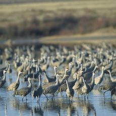
The fishing pond receives different fish species depending on the season, with rainbow trout stocked in winter and channel catfish in summer. More than 80 bird species have been recorded in the area, drawing birdwatchers year-round.

The community of curious travelers

AroundUs brings together thousands of curated places, local tips, and hidden gems, enriched daily by 60,000 contributors worldwide.

Start exploring
Location
Inception
1961
GPS coordinates
34.25780,-103.34900
Latest update
December 13, 2025 11:41
Around this place
Fort Sumner
United States of America

Fort Sumner

79.4 km
Caprock Escarpment
United States of America

Caprock Escarpment

98.1 km
Blue Swallow Motel
United States of America

Blue Swallow Motel

107.2 km
Tucumcari Mountain
United States of America

Tucumcari Mountain

102.7 km
Hotel Clovis
United States of America

Hotel Clovis

20.6 km
Blackwater Draw archaeological site
United States of America

Blackwater Draw archaeological site

3.2 km
Muleshoe National Wildlife Refuge
United States of America

Muleshoe National Wildlife Refuge

63.8 km
Grulla National Wildlife Refuge
United States of America

Grulla National Wildlife Refuge

31.7 km
Cactus Motor Lodge
United States of America

Cactus Motor Lodge

106.9 km
State Theater
United States of America

State Theater

20.9 km
First Methodist Church of Clovis
United States of America

First Methodist Church of Clovis

25.1 km
Metropolitan Park Bathhouse and Pool Historic District
United States of America

Metropolitan Park Bathhouse and Pool Historic District

107.1 km
Roosevelt County Courthouse
United States of America

Roosevelt County Courthouse

8.1 km
Midway Service Station
United States of America

Midway Service Station

60.5 km
De Baca County Courthouse
United States of America

De Baca County Courthouse

85.5 km
Lyceum Theatre
United States of America

Lyceum Theatre

20.8 km
1908 Clovis City Hall and Fire Station
United States of America

1908 Clovis City Hall and Fire Station

21 km
Curry County Courthouse
United States of America

Curry County Courthouse

21.1 km
Arch Hurley Conservancy District Office Building
United States of America

Arch Hurley Conservancy District Office Building

107.9 km
Bank of Portales
United States of America

Bank of Portales

8 km
Clovis Central Fire Station
United States of America

Clovis Central Fire Station

20.7 km
Administration Building
United States of America

Administration Building

8.8 km
Fort Sumner Railroad Bridge
United States of America

Fort Sumner Railroad Bridge

87.3 km
Fort Sumner Cemetery Wall and Entry
United States of America

Fort Sumner Cemetery Wall and Entry

84.4 km
Fort Sumner Community House
United States of America

Fort Sumner Community House

85.9 km
Deaf Smith County Historical Museum
United States of America

Deaf Smith County Historical Museum

107.2 km
Princess Theatre
United States of America

Princess Theatre

108 km
Carlile Theater
United States of America

Carlile Theater

100.6 km
Show the full map
« Oasis State Park - State park in Roosevelt County, United States » is provided by Around Us (aroundus.com). Images and texts are derived from Wikimedia project under a Creative Commons license. You are allowed to copy, distribute, and modify copies of this page, under the conditions set by the license, as long as this note is clearly visible.

Discover hidden gems everywhere you go!

From secret cafés to breathtaking viewpoints, skip the crowded tourist spots and find places that match your style. Our app makes it easy with voice search, smart filtering, route optimization, and insider tips from travelers worldwide. Download now for the complete mobile experience.

Around Us App Screenshot

A unique approach to discovering new places

Le Figaro

All the places worth exploring

France Info

A tailor-made excursion in just a few clicks

20 Minutes

Around Us
Travel Guide & Maps
Download

Send to your phone

QR Code
1

Open the camera app on your mobile.

2

Point at the QR code with your camera. A notification will appear.

3

Tap the notification to open the link.