Coatepeque, municipality of Quetzaltenango Department, Guatemala
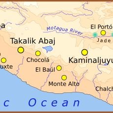
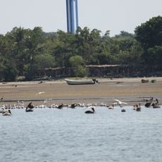
Coatepeque is a municipality in Quetzaltenango Department in Guatemala situated at approximately 500 meters (1,640 feet) above sea level with gently rolling terrain and scattered settlements. Rivers including the Suchiate, Naranjo, and Ocosito flow through the area, providing water for farming and daily use, while the warm climate averages around 26 degrees Celsius (79 degrees Fahrenheit).
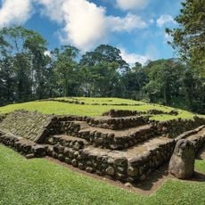
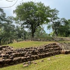
The municipality was officially established in 1770 when a local leader named Juan Bernardo organized his community and gave it the official name Santiago de Coatepeque. The name comes from a pre-Hispanic language and translates to Hill of the Snake, reflecting the area's ancient indigenous heritage.
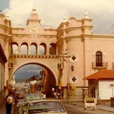
The town is known as the City of Gardenias, and flowering plants fill the streets and gardens throughout the community. Locals maintain this tradition as part of their identity, and the scent of blooms is noticeable when walking through the area.
The town is easy to walk through with paved streets in the center and open fields in the surrounding areas, allowing visitors to experience both the small urban core and the rural landscape. Plan visits for the dry season, as heavy rains occur frequently during rainy months and can make travel more difficult.
The name references ancient serpent symbolism and the earliest inhabitants worshiped a deity called Mixcoalt in this location. This deep spiritual connection to nature persists today in local stories and place names passed down through generations.
The community of curious travelers
AroundUs brings together thousands of curated places, local tips, and hidden gems, enriched daily by 60,000 contributors worldwide.