Quetzaltenango Department
Quetzaltenango Department, Administrative department in western Guatemala
Quetzaltenango Department is an administrative region in western Guatemala that encompasses highland terrain with multiple river systems flowing through it. The capital, also called Quetzaltenango, is the country's second-largest city and serves as the main regional hub.
The territory was part of the K'iche' Kingdom until Spanish forces under Pedro de Alvarado conquered it in the 16th century. This conquest redirected the region's political and social path for centuries to come.
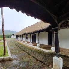
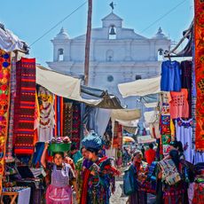
The area is home to K'iche' and Mam Maya communities alongside Spanish speakers, each group maintaining their own languages and ways of life throughout daily interactions. Walking through towns and villages, you notice these distinct traditions reflected in local dress, celebrations, and how people organize their communities.
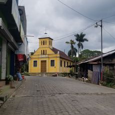
The region divides into 24 municipalities, so planning which areas to visit works best with some preparation ahead of time. The capital city offers good road connections and serves as a natural base for traveling throughout the area.
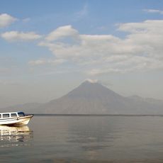
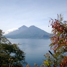
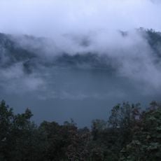
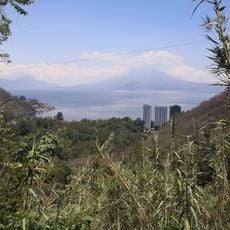
The region contains several active volcanoes including Cerro Quemado, Santa María, and Santiaguito that regularly reshape the landscape through eruptions. These geological features create an ever-changing natural environment that few visitors expect to encounter.
Location: Guatemala
Inception: September 16, 1845
Capital city: Quetzaltenango
Elevation above the sea: 2,333 m
Shares border with: Huehuetenango Department, Totonicapán Department, Sololá Department, Suchitepéquez Department, Retalhuleu Department, San Marcos Department
GPS coordinates: 14.84583,-91.51889
Latest update: December 7, 2025 20:41
Santa María
10.5 km
Takalik Abaj
32.3 km
Santiaguito
12.8 km
Almolonga
5.4 km
Volcán San Pedro
34.3 km
Volcán Tolimán
43.8 km
Xetulul
29.7 km
Pascual Abaj
44.7 km
Quetzaltenango Municipal Theatre
873 m
Chicabal
16.1 km
Chocolá
27.3 km
Estadio Mario Camposeco
469 m
Holy Spirit Cathedral, Quetzaltenango
1.4 km
Quetzaltenango Guatemala Temple
2.2 km
Holy Cross Cathedral, Santa Cruz del Quiché
44.8 km
Chapel of the Conqueress of the Immaculate Conception
7.5 km
Minerva
1.5 km
Santa María Hydroelectric Dam
8.4 km
Avalancha
29.8 km
Takalik Abaj
32.6 km
House of Justo Rufino Barrios
31.7 km
Chocolá, Suchitepéquez, Iglesia Católica
27 km
Canton Las Ruinas de Gumarkaaj
43.2 km
Chichicastenango Market
45.1 km
Mariposario Reserva De Atitlan
39.4 km
Fuentes Georginas Restaurant
11.4 km
Riviera de Atitlan
39.3 km
Fuentes Georginas
11.3 kmVisited this place? Tap the stars to rate it and share your experience / photos with the community! Try now! You can cancel it anytime.
Discover hidden gems everywhere you go!
From secret cafés to breathtaking viewpoints, skip the crowded tourist spots and find places that match your style. Our app makes it easy with voice search, smart filtering, route optimization, and insider tips from travelers worldwide. Download now for the complete mobile experience.
A unique approach to discovering new places❞
— Le Figaro
All the places worth exploring❞
— France Info
A tailor-made excursion in just a few clicks❞
— 20 Minutes