Enable Location

We need your location to show you interesting places around you

Discover nearby places

Find interesting locations and hidden gems around you

Precise directions

Get accurate directions and distances to places

Your location is never shared with other users. It's only used when you tap the location button.

Santiaguito

Log in to your account

Start exploring — it's free

Trusted by 62,159 travelers worldwide

Continue with Google
Continue with Apple
or

We will send you a code to connect

By continuing, you accept our Terms and Conditions and our Privacy Policy

Check your inbox

We've sent a pincode in your inbox. Please enter the code below.

Santiaguito

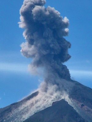
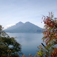
Santiaguito, Active lava dome complex in Quetzaltenango Department, Guatemala.

Santiaguito is an active lava dome complex in Quetzaltenango Department, Guatemala, made up of four separate domes: El Caliente, La Mitad, El Monje, and El Brujo. El Caliente shows the strongest activity right now, regularly sending out ash plumes and small pyroclastic flows, while the other domes remain mostly quiet and covered with thick vegetation.

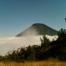
The complex started growing in 1922 after Santa María erupted violently in 1902, ejecting around 8 cubic kilometers of magma. Since then, the eruption has remained continuously active, building up the four domes over the decades that now form the massif.

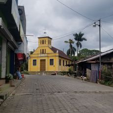
Indigenous communities in the region call the complex Gagxanul in the K'iche' language and weave its eruptions into their oral traditions. For people living in nearby villages, the occasional rumble and ashfall are part of daily life, so they have learned to adapt their farming activities around the constant presence of the active dome.

Visitors need to get permission from local authorities and hire certified guides to reach observation points where they can watch the small eruptions. The climb follows steep and sometimes loose trails, so sturdy footwear and good physical fitness are necessary.

The nearly continuous eruption activity for over 100 years ranks among the longest documented eruption sequences worldwide. Scientists often use the site to study volcanic processes in real time and improve forecasting models.

The community of curious travelers

AroundUs brings together thousands of curated places, local tips, and hidden gems, enriched daily by 60,000 contributors worldwide.

Start exploring
GPS coordinates
14.74187,-91.56898
Latest update
December 5, 2025 22:29
Photo spots in Guatemala

Guatemala offers photographers a mix of pre-Columbian sites, volcanic landscapes, and colonial buildings. The geography ranges from highland towns to rainforests and coastal areas along the Pacific and Caribbean. Ancient Maya temples stand alongside Spanish-era churches, while indigenous markets and...

« Santiaguito - Active lava dome complex in Quetzaltenango Department, Guatemala » is provided by Around Us (aroundus.com). Images and texts are derived from Wikimedia project under a Creative Commons license. You are allowed to copy, distribute, and modify copies of this page, under the conditions set by the license, as long as this note is clearly visible.

Discover hidden gems everywhere you go!

From secret cafés to breathtaking viewpoints, skip the crowded tourist spots and find places that match your style. Our app makes it easy with voice search, smart filtering, route optimization, and insider tips from travelers worldwide. Download now for the complete mobile experience.

Around Us App Screenshot

A unique approach to discovering new places

Le Figaro

All the places worth exploring

France Info

A tailor-made excursion in just a few clicks

20 Minutes

Around Us
Travel Guide & Maps
Download

Send to your phone

QR Code
1

Open the camera app on your mobile.

2

Point at the QR code with your camera. A notification will appear.

3

Tap the notification to open the link.