·

Enable Location

We need your location to show you interesting places around you

Discover nearby places

Find interesting locations and hidden gems around you

Precise directions

Get accurate directions and distances to places

Your location is never shared with other users. It's only used when you tap the location button.

Tecuamburro

Log in to your account

Start exploring — it's free

Trusted by 62,659 travelers worldwide

Continue with Google
Continue with Apple
or

We will send you a code to connect

By continuing, you accept our Terms and Conditions and our Privacy Policy

Check your inbox

We've sent a pincode in your inbox. Please enter the code below.

Tecuamburro

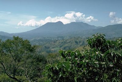
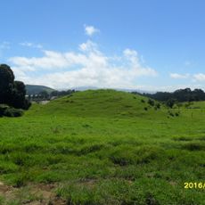
Tecuamburro, Volcanic summit in Santa Rosa, Guatemala.

Tecuamburro is a dormant volcano in Santa Rosa that rises to approximately 2000 meters. Its slopes are covered in dense forest of pine and cypress trees that extend from the lower areas to the higher elevations.

The volcano formed millions of years ago through volcanic processes and now lies dormant. Scientists began studying the area in the late 1980s to better understand its geothermal characteristics and potential.

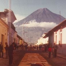
The mountain holds spiritual significance for local communities who have long ties to its slopes and seasonal rhythms. Visitors can observe how the landscape shapes the way people in surrounding villages organize their lives and work.

The hike to the summit takes roughly three hours and follows marked paths through the forest. Local guides are available in the nearby villages of Los Esclavos and Pueblo Nuevo Viñas for those who want assistance navigating the trail.

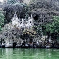
The mountain still has active fumaroles that release sulfuric gases and create striking yellow-green colors in nearby lake waters. These geothermal features are a visible reminder that volcanic forces still operate beneath the quiet surface.

The community of curious travelers

AroundUs brings together thousands of curated places, local tips, and hidden gems, enriched daily by 60,000 contributors worldwide.

Start exploring
GPS coordinates
14.15699,-90.40665
Latest update
December 10, 2025 16:21
« Tecuamburro - Volcanic summit in Santa Rosa, Guatemala » is provided by Around Us (aroundus.com). Images and texts are derived from Wikimedia project under a Creative Commons license. You are allowed to copy, distribute, and modify copies of this page, under the conditions set by the license, as long as this note is clearly visible.

Discover hidden gems everywhere you go!

From secret cafés to breathtaking viewpoints, skip the crowded tourist spots and find places that match your style. Our app makes it easy with voice search, smart filtering, route optimization, and insider tips from travelers worldwide. Download now for the complete mobile experience.

Around Us App Screenshot

A unique approach to discovering new places

Le Figaro

All the places worth exploring

France Info

A tailor-made excursion in just a few clicks

20 Minutes

Around Us
Travel Guide & Maps
Download

Send to your phone

QR Code
1

Open the camera app on your mobile.

2

Point at the QR code with your camera. A notification will appear.

3

Tap the notification to open the link.